The journey continues now solo from North Vancouver to the Yukon border.
In my last post, Marilyn and I toured the Sunshine Coast on our BMW f650GS. We’d been having some problems with a lithium battery I had put in before leaving, so as soon I was back in Vancouver, I headed over to High Road Vancouver and bought a glass mat battery. There was no way I was heading north into remote territory without a reliable battery.
While crossing the city, the most fortuitous thing happened: my phone fell out of its mount onto the road and broke. Why is this fortuitous, you ask? Well, because my phone was old and needed to be replaced. We’d noticed a huge difference between photos (the same photo) taken on my old Samsung Galaxy S5 and Marilyn’s new iPhone 11; the GPS often dropped the connection to the satellite (probably because I’d dropped it on my office floor); the screen sensitivity was failing and often didn’t respond to touches, which is really annoying when you are riding—in short, I’d developed a hate-on for the phone and just needed a good reason to replace it.
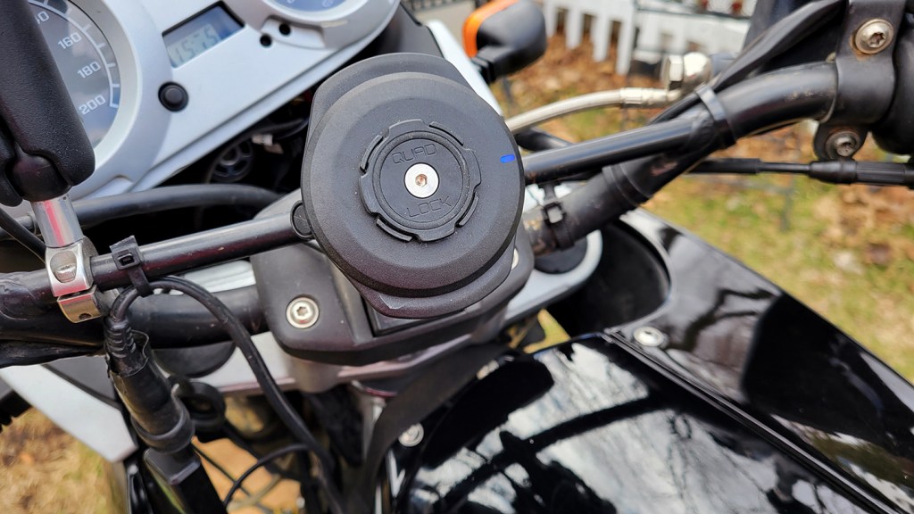
So before leaving North Van, I went to the Koodo store at Capilano Mall and upgraded to a Galaxy S21. Photos from this point on in my trip are much, much better. I had to pay a bit extra for the wireless charging, but finally I would be free and clear of the cords and charging issues on the bike. Okay, I didn’t have a wireless charger yet, but I’ve since picked up a Quadlock mount with vibration dampener and am never going back!
Marilyn flew back to Montreal and I suddenly found myself alone again. I love solo riding, but I loved touring with Marilyn more. This was—dare I say—a bit of a surprise to me; it would take a day or so to adjust. Her absence was felt all the more since the first day involved riding that same Sea to Sky Highway we’d ridden just the day before. But this time I didn’t stop in Whistler but blew past, all the way to Pemberton before taking a break.

Then the road got really interesting. Serj, a local ADV rider I’d met on the Sunshine Coast, had told me about this section of Highway 99 and it didn’t disappoint. Also known as the famous Duffy Lake Road, the small but well maintained mountain road weaves through the range with magnificent views of the valleys on each side. I passed a few recreation areas en route but had in mind to stay at the campground in Lillooet, only once I dropped down into the heat of the town, took one look at the parched and empty campground, I turned around and high-tailed it back up into the mountains.

BC has what they call “Recreation Areas,” which are unserviced sites for only $15 a night. They’re not full campgrounds but just a handful of sites on a loop off the road. You pick up an envelope at the entrance, drop your cash in it, tear off the portion that gets posted at your site, and deposit the money in a secure box. A park official comes by once in a while to check. These sites are a little rustic without running water (you have to pump it by hand, Waltons-style) and only drop toilets, but with a picnic table and fire pit, it’s a step up from wild camping (i.e. bivouacing). There’s also a sense of security with a few other campers nearby.

The next day I rode back down out of the mountains into the heat of Lilooet. Lilooet is apparently the jade capital of the world, so I stopped at The House of Jade Mineral Museum with the idea of picking up a gift. As it would turn out, the only gift I bought was for myself and it wasn’t jade. My eye was caught by a polished bit of tigers eye. I decided it would be a good-luck talisman for the rest of the tour and asked the owner to string it for me as a necklace that I could put under my gear.
“Do you know the particular properties of this stone?” I asked.
“No idea,” was his reply.
He was very knowledgeable about the local geology and geography, but clearly not interested in the energetic properties of crystals. As I write this, nine months later, I see on Wikipedia that “Roman soldiers wore engraved tigers eye to protect them in battle. It is still used as a stone of protection today.” My intuitions were correct.


As I and a few others browsed the store, the owner gave a sort of impromptu lecture on an unusual local geological landmark. About 45 minutes further along the 99 is Pavilion Lake, renown for sections of brilliant emerald water. The water gets its emerald colour from limestone, extremely uncommon in the Rocky Mountains, but apparently a mountain of it drifted up from California during the continental drift and attached. Sure enough, about 45 minutes down the road, I saw what he was referring to.

Soon I was on the 97, the Caribou Highway as its called here, blasting through place names like Williams Lake and Quesnel that I’d heard of when my son was tree-planting. While also planting, my niece and boyfriend had a bad experience wild camping near Prince George, and really, the only place I was nervous about for security reasons in all of Canada was PG, as the planters affectionately refer to it. So when an old friend from my undergrad days who was watching my progress on Facebook messaged with an offer to stay at her place just west of PG, I was doubly happy. Her husband also rides a GS, so we had a lot to talk about over dinner. Kristen and Dale live in a beautiful log cabin on a gorgeous piece of property. The last time I saw them was at their wedding near Whitby over twenty years ago, so it was a treat to see them again.

The next day I rode west along Highway 16, the Highway of Tears, as it’s called because so many murdered and missing indigenous women have disappeared while hitchhiking on this road. I passed billboards such as this one, and roadside shrines, and the miles laid down that day were pensive as I reflected on yet another layer of trauma inflicted on the indigenous peoples of Canada. I’d seen singular orange garments hanging from trees right across the country like a breadcrumb trail leading to a sordid history Canadians are only now truly beginning to recognize and accept, but now I was riding along a road that was tangibly a place of violence for many women. The contrast between my ultimate freedom on the bike and others’ lack of freedom in even the fundamental aspects of self-determination was poignant. And I couldn’t help also reflecting on the perpetrators of these crimes, and how damaged and deranged their own lives must be to do such heinous crimes. It was one of the more melancholy days on the bike.
Just south of Smithers, I decided to take another look at my bouncing front tire. The open roads in these parts allowed me to look down at the wheel as I was riding highway speeds. (Okay, maybe not a brilliant idea, but 6,000 kilometres of curiosity had gotten the better of me.) I noticed, in addition to the bounce I’d been feeling throughout the tour, that there was a definite wobble in the wheel. Aha! It’s not that the wheel is not balanced but that it’s not true! At least this is fixable, or so I thought.
I’ve trued up bicycle wheels before. It isn’t easy, and you have to be careful because you can easily make it worse, but I had a spoke wrench on me. However, with this much at stake, I thought maybe I’d have it done by a professional. As I came into Smithers, I saw a Yamaha dealership and pulled in there. They didn’t have a mechanic on duty but directed me over to Eyecandy Customs motorcycle repair and bikes. Sam took one look at my front rim and said it was bent. In fact, it was bent in two spots, probably from the two failed attempts to get up a particularly challenging rocky hill climb shortly before my departure in Montreal. He said there was nothing he could do about it. It wasn’t a matter of adjusting spokes; I’d need a new rim. Damn!
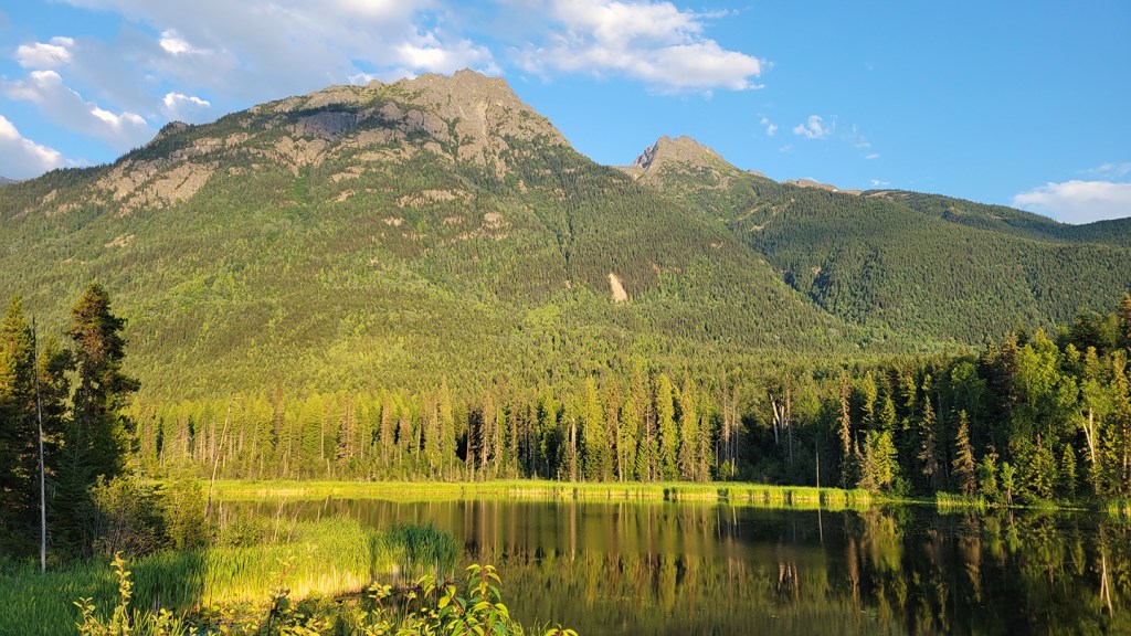
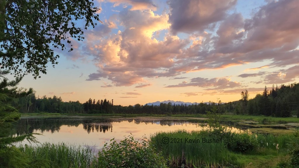
With that bit of good news adding to my day, I pulled in to Seeley Lake Provincial Park just east of Highway 37. The sunset there was the most beautiful I’ve ever experienced, so there really was a silver lining to this grey day.
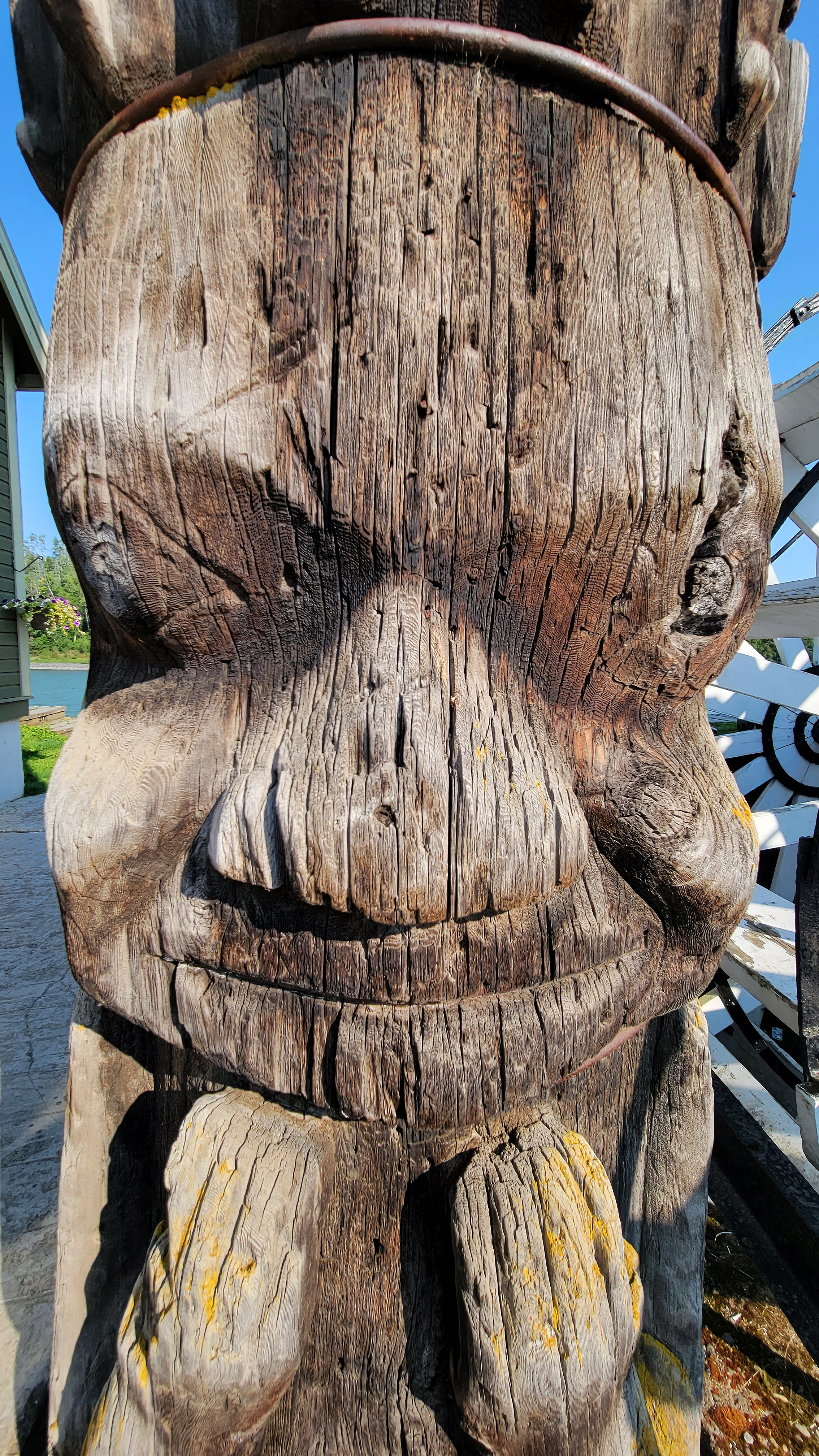
The next day was my big push north to the Yukon border up the Stewart-Cassiar Highway, but first I doubled back to Hazelton and the Ksan Historical Village because there are some totem poles there that Emily Carr had painted. It was getting late when I passed Hazelton the day before so I decided to do it this way. It meant that I arrived early and saw them in the rising sun.
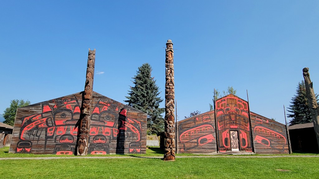
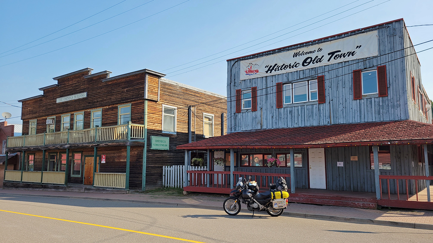
The poles were impressive, and the colour paintings on the dark wood of the longhouses striking. I wanted to explore more and was curious about the history of this place, but like my visit to Kay-Nah-Chi-Wah-Nung Historical Centre in northwest Ontario, everything was shut up due to Covid. I found myself strangely alone without a single soul in the historic village or adjacent town. Old Hazelton—quaint and picturesque, with a paddle boat at the water and old buildings with original exteriors—felt like a ghost town.


So I read the historic plaques, took some photos, then hopped on my bike and headed off. I had a big day of riding ahead of me so perhaps it was for the best.
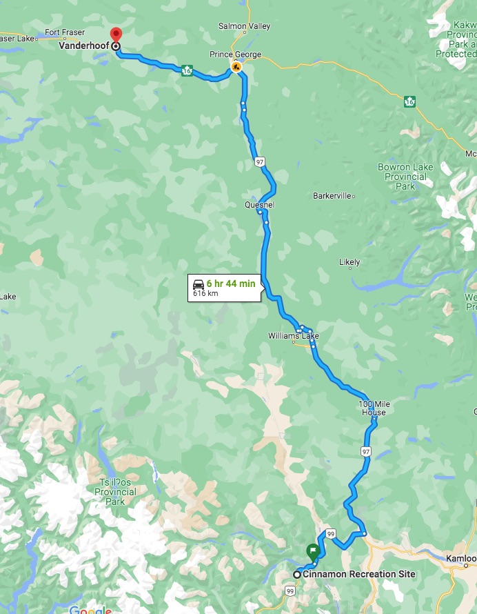
Soon I turned onto the 37. Now there are two ways to get to Yukon: the Stewart-Cassiar Highway (37) or the Alaska Highway (97). I took the 37 up and the 97 down. They are both pretty good for different reasons, but in terms of riding, the 37 is better.

Although tiring, I was happy to put on the kilometres, all 707 of them over nine hours with only a short break south of Dease Lake for fuel and food. I had to keep my eye out because there were a lot of bears on this road. You see a black dot up ahead and, sure enough, when you get up there, it’s a bear—in the ditch eating berries, crossing the road in front, or climbing the embankment on the other the side. I lost count how many I saw, thankfully all black bears. I even came across one dead on the shoulder, poor thing, half decayed, maggot infested, and stinking to high heaven in the heat.
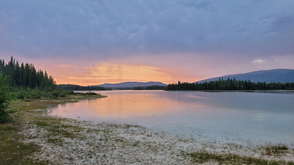
I was aiming for Boya Lake Provincial Park just south of the Yukon border and pulled in exhausted, late in the day. The entire campground was full except for one spot on the water, too small for anything but a motorcycle and tent. As I was pitching my tent, it started to rain and I didn’t have time to cook. Suddenly a man was there, offering me food. He said he does a lot of backcountry camping so I guess was understanding if not sympathetic, and he and his family were just pulling out in their RV and had some extra dinner. I was of course very appreciative of the gesture and the food. It was a delicious bean and pasta salad, which I ate in my tent during the downpour. When the rain stopped, I poked my head out to see this.
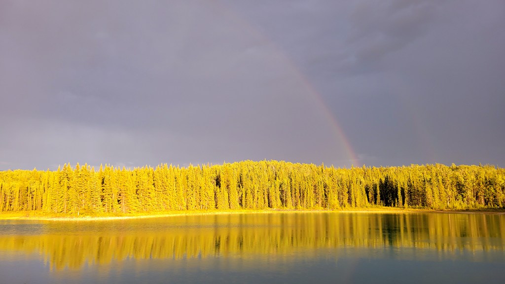
Luck and human kindness had shone on me again. It had been a long day of riding and I was tired but didn’t feel much like sleeping. This far north, the sun stays up well past midnight, so I just sat there at my picnic table and smoked my pipe and admired this sunset that lasted for hours. It just doesn’t get any better than this. Or so I thought.