Going Home

detour-sign

I left Katahdin Shadows Campground in central Maine after breakfast. I was looking forward to my ride along Highway 2 and to getting home and seeing my wife and dog. The trip had been full and exciting, but also exhausting, and I was ready to sleep in a bed.

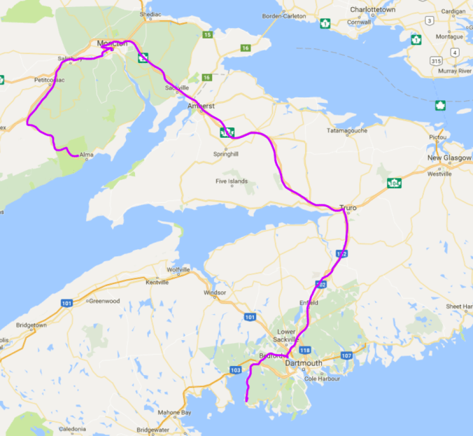
I came out on the 157 and headed down to Highway 2. I can’t remember what signage was at that T-junction but somehow I turned the wrong way. Looking at it on a map now, I can only imagine that the options were 2 North and 2 South, and I, naturally, took north. Only I was supposed to take south, which is counter-intuitive since I live in Canada and was south of the border. But because the 157 intersects the 2 at an odd angle, I think that must have been what deceived me.

After riding happily for an hour, I came to a split in the road, with 2 and 2A as the options. This doesn’t look right, I thought, and checking my GPS, discovered I was further from home than in the morning. Yes, I’d been going the wrong way; I had to go south first before I could go west. I’d lost the morning and my GPS was saying I was 12 hours from home! Damn!

Knowing I was now in a fix, I changed the settings on my GPS from “Avoid Highways” to “Fastest Route.” It promptly took me to the I95 and I bombed south for what seemed like an hour and a half until I came to Augusta, which I recognized from my ride down. I knew I was now near the section of Highway 2 that I wanted, but getting through Augusta to that road was not easy. If I hadn’t had that GPS, packed almost as an afterthought (thinking I could “easily” navigate by paper map in the US), I would have been in a bigger fix. Maine’s road system resembles a spider’s web, and getting from Point A to Point B involves passing through Points R, M, X, and C first. Clearly, the Romans did not make it out to Maine.

Now finally on a road that looked familiar, I stopped for lunch at a roadside general store that also contained a diner. Knowing I had a long way to go, I powered up with a cheeseburger and fries. Then it was the long ride back along Highway 2 west out of Maine, across New Hampshire, and into Vermont.

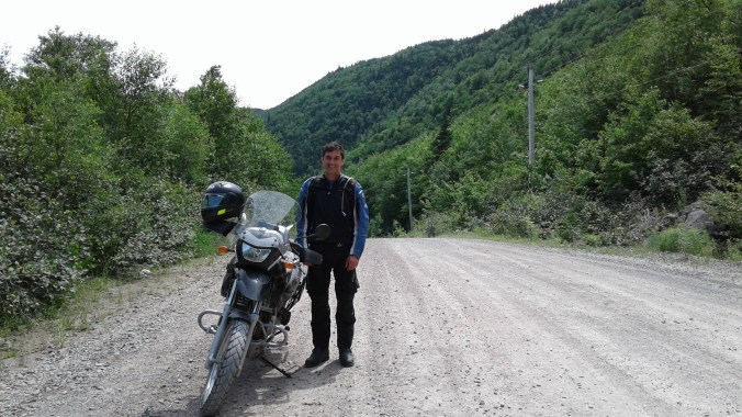
Riding for me is like running. When I ride or run, I’m very meditative. Perhaps some people would say I should give the road my full attention, but I’m still concentrating on the road even if part of my mind is wandering, reflecting, processing, purging. I’ve had some of my best ideas while running or riding. Perhaps that’s why I’ve never worn ear buds or installed a radio in my helmet; for me, that meditative quality, that state of mental calm and presence is part of what I find therapeutic in both activities.

And similarly to when I ride, when I pass by a section of road that I’ve run recently, because my thought was so present in the moment, I can remember exactly what I was thinking at a given place. It’s like each particular of that geography has a thought attached to it, like the mnemonic to remember a poem by heart in which you think of a very familiar place, say, a local park, and as you walk though that park in your imagination, you associate a line of poetry with a particular object, a specific tree or lamppost, for examples, so remembering the poem later becomes merely a walk in the park, so to speak.

I’m mentioning this now because, as I rode west along Highway 2, I was remembering my thoughts and feelings vividly from when I rode east that section of road 12 days prior. All the feelings of expectation and promise and adventure came back to me even though my trip was almost over. And I remember feeling, I admit, a little apprehensive as I ventured out on my first long trip, not knowing exactly how it would go, what kind of problems I would encounter, and if I’d be able to solve them. But it had gone well and I’d managed; in fact, I’d done better than managed. I had ridden over 5,000 kilometres and met some wonderful people, seen some beautiful places, and learnt some new skills on the bike. What had I been so apprehensive about? Rather than a sense of sadness for my trip coming to an end, I had an urge to get back on the road again as soon as possible. Realistically, that won’t be until next summer, but I was already starting to think of where I might visit next year.

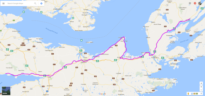
I turned north on the I91 that took me to the border at Stanstead, then I was on the familiar bumpy, pot-holed roads of Quebec. The 55 took me to the 10. The light was fading, and as I approached the Champlain Bridge the Montreal skyline rose up on the horizon. It was Saturday evening so the traffic was heavy, everyone driving in to town from the south shore. And then something else familiar: the winding tunnel of construction pylons lining the makeshift highway, lane-closures, douche-bags cutting in at the last moment at those lane closures, the ramp to the 20 Ouest unexpectedly closed, forcing me up the Decarie Expressway to loop around at Queen Mary (or was it higher?), then more lane closures on Decarie south, heavier, aggressive traffic, someone angrily leaning on a horn. It was all sadly too familiar.

I was pretty exhausted and now did have to devote all my attention to the chronically disrepaired and clogged roads of Montreal to get these last 20 kilometres home. I found it ironic that in the over 5000 kilometres I’d ridden the past two weeks, I never felt as unsafe as on those familiar roads so close to home. Once I was finally on the 20 Ouest after my detour and breathed a sigh of relief, some idiot cut across three lanes in front of me, passing a few feet from my front tire, his buddy close behind doing the same, getting off at the 13 probably to go to Laval. There are some things I love about this city, and some that I hate.

I always remind myself at the end of a long ride to concentrate right to the very end; I know it’s easy to lose your concentration and that’s when an accident can happen. But even knowing this and reminding myself in that final stretch of highway did not prevent a near accident on one of the last turns of the trip. As I came down the Des Sources ramp in 3rd, I went to shift into 2nd for the curve at the bottom of the ramp as I have done a hundred times, only when I shifted into 2nd, for some inexplicable reason, I forgot to pull in the clutch! What the hell?! The bike lurched and I immediately pulled the clutch and coasted. I found the bike in neutral and upshifted to 2nd, then took the curve, apologizing profusely to Bigbea. I can only think that these kinds of slips happen because you are already thinking of what you’re going to do when you get home. Another lesson learned: concentrate to the very end means to the very end. I think in the future I will associate the end with kickstand down, the signal that my brain can shut off now, or turn its attention elsewhere. Like my wife and dog that greeted me on the driveway. 😊

Day 12

Fundy Coastal Drive to Maine

Covered Bridge

If you want a good point of comparison between Nova Scotia and New Brunswick, just take a look at their tourism offices. The first time I passed through New Brunswick, I was fresh off the ferry and rode up the 172 and joined the Transcanada Highway (Route 1) at St. George. No sooner was I on the highway when I saw the ? sign indicating a tourism office. I decided to pull off and pick up a map. It was the 176 heading down towards Blacks Harbour. I rode for about a kilometre but it was early morning (in fact, I saw a few deer cross the road ahead of me in the mist) and I was sleepy and after a while I figured I must have missed it. So I turned around and headed back toward the highway, keeping a closer eye out for the office, only when I reached the highway again I realized I hadn’t missed it—it was just further from the highway than I’d expected. So back I went, down toward Blacks Harbour. Surely the tourism office isn’t this far from the highway, I kept thinking, but it was, and more, a good 5 kilometres at least, and when I got there, it was nothing more than a shed, really, with a girl not out of high school the single employee. She had some maps, and I was happy to take one, but she didn’t know much about them. “How long would it take me to ride the Fundy Coastal Trail?” I asked. “Hmm . . . I don’t know,” she replied, “but I’ve been to Moncton on the highway and it takes a few hours.” Gee thanks. I didn’t ask if she was the one driving.

Contrast this with when you cross the border into Nova Scotia. At the side of the highway is not only a ? sign but a lighthouse announcing the office. You can see it from the highway and the exit ramp takes you to the parking lot, which is huge, as is the modern building, with flags in front, and gardens, and picnic tables, areas to run your dog, poop bags for those dogs, and the lighthouse across the field, which you can tour at certain hours of the day. You walk in to the main building and no less than five employees are waiting behind a massive desk to answer your questions. And then there are the spotless bathrooms, and the wall of documents. I didn’t venture deeper into the tourism office but there are other rooms waiting to serve you. Nova Scotia knows where its bread and butter is.

So the first time I passed through New Brunswick, with less than reliable information, I did not ride the Fundy Coastal Drive. But heading back, I figured I’d do it no matter how long it took. I left Fundy National Park and headed up to Sussex for a second breakfast before doubling back to the 111 where the drive begins. It cuts diagonally down toward the coast and offers a pleasant if not inspiring ride through farmland and rolling hills, over a mountain range and, at one point, about 15 kilometres of unpaved gravel since, like everywhere, it seems, they are repaving. Good thing I have a dual sport bike. What would other riders do?

The trail is clearly marked and even includes some tourist attractions. At one point, I saw a sign indicating a covered bridge a short ways off the main road and decided to go check it out. If you’re a motorcyclist, you have to ride through a covered bridge at least once. In this case, it had to be twice because the road led to a dead-end so I turned around on the other side and experienced another century a second time.

Bridge Bracing

I didn’t take a lot of photos on this ride. I was acutely aware of how far I had to go and how ignorant I was of how long it would take me to get there, so paused only briefly, such as when I rounded this corner overlooking a beautiful bay.

Bayview

But really there is just the one road through New Brunswick and, as the saying goes, all roads lead to Route 1. A section of the Fundy Coastal Trail is Route 1, through and just west of Saint John. It’s not exactly the coast, nor a trail, but it gets you further west, if that’s where you’re headed. They are crazy about their ATVs in New Brunswick, and there will be several parked at the local Tim’s. I was eyeing the ATV trails that run parallel to the highway and, to my disbelief, cross the highway! One kid scooted in front of me as I nearly shit my pants; his buddy showed more prudence and waited until I passed. Perhaps it would have been safer if I’d taken that trail instead of the official one.

Soon I was at Saint Stephen and it was time to cross back into The United States. This meant no more data and no more Google Maps. Fortunately, I’d packed an old car GPS that would prove to be a huge help getting through Maine.

Maine. Before this trip, the word conjured associations with Stephen King, cedar shingle homes, charming coastal towns, and seafood. But now I realize that is just one part of Maine, namely, the coast. The interior is very different, and since I was cutting a B-line through to Montreal, the interior is where I was headed—in particular, Big Eddy Campground, somewhere on Golden Road. Draw a line between Saint Stephen and Montreal and Big Eddy will be on it, which is why I chose it when planning. The only problem was I didn’t really know where it was. It was in the middle of nowhere. It was in the Maine bush.

These parts are not very populated. You can ride on open, straight roads for hours. It’s a good place to see what your bike can do (which I didn’t do—fearing those state troopers of Smokey and the Bandit fame), or to learn clutchless shifting, which I did do. I’ve been upshifting for some time now using a technique I read about last winter in Lee Parks’ Total Control: High Performance Street Riding Techniques. You put a little upward pressure on the shifter and when you pull in the clutch the bike pops into gear. It’s a lot quicker and smoother than rolling off the throttle while pulling in the clutch, lifting up on the shifter, then rolling back on the throttle while letting out the clutch. In fact, with my adventure boots on, which feel like ski boots and are about as flexible, it’s pretty much necessary for me to do this to get from 1st to 2nd and avoid false neutrals. So while riding the empty straight roads of Maine, I got to thinking: what if I put that upward pressure on the shifter and rolled off the throttle but didn’t pull in the clutch? I don’t know if I’d read this somewhere or seen it on You Tube or if it was by pure genius but when I tried it, to my surprise, the bike popped into the next gear. It only works for upshifting and you have to be easy with the roll on otherwise the bike will lurch, but you can upshift in the blink of an eye this way. After some practice it feels like you are “flicking” the bike into the next gear with the throttle. (I have since seen conflicting videos on You Tube saying this is harmful/harmless to your gearbox, so do at your own risk. Perhaps a subject for a later blog?)

At one point, I came upon civilization. Actually, it was just some cars parked at the side of the road and lots of people gathered for some kind of event. I stopped to check it out and discovered it was a pow wow. I’ve never been to a pow wow so was curious. The women were doing a traditional dance where they kind of walk arm-in-arm in a circle to a simple double-beat. I found it interesting how easily you can see, even with such a simple dance, who has a sense of rhythm and who doesn’t. As I was standing alongside several others minding my own business a little girl, playing with her friends, suddenly pointed at me and asked “Who are you?” I felt like I was in a Hitchcock movie but I was actually just in Maine. I thought it was time to push on.

Soon I came to another attraction that looked like it was from another century. Willard’s Garage. It was a garage in the middle of nowhere that looked like it had been abandoned for 100 years. I pulled off and took a look around. Had I just slipped through a time hole like in The Twilight Zone and landed in a 1950’s gas station? There were cars from the mid 20th Century abandoned there, and what looked like the skeleton of a Model T, the first car ever mass produced. Then I looked inside the windows and there were more surprises there—old oil and other products, books, what looked like bookkeeping, was that tobacco?, and hot rods!—it was bizarre. But then, I was in Maine.

This slideshow requires JavaScript.

The folks in Maine like their ATVs even more than the folks in New Brunswick, so much so that they use them as their primary means of transportation. When I stopped for gas, along came two ATVs with four people in each, a canopy overhead, heading somewhere for their Sunday outing. And observing them, I have to say, I could see how someone like Trump could get into the Oval Office. These people seem to have a few  abiding values—freedom, independence, patriotism—held so strongly they become a guiding ideology, almost a religion. Anyone or anything that appears to challenge those values is deemed an outsider, an enemy. Is it coincidental that the fashion de rigeuer in these parts is combat camouflage?

I was so fascinated by this hillbilly culture I missed my turn and had to loop around to the 157. This turned out to be fortuitous because in doing so I happened upon Highway 2, my favourite highway and one I knew would take me to the Canadian border at Rouses Point the next day. I followed my GPS but I didn’t have an exact address. I did, however, have the name of the road, so took my best guess for the number and followed the directions. (Note to self: write down the full address of your destination before crossing into The States and losing data.) It took me to a dirt road that deteriorated into gravel, then loose shale. I ventured a few kilometres up Golden Road before realizing that it was not so golden and any campground further down that road is not one I want to stay at. I turned back and while topping up my gas I struck up a conversation with some guys who had just come from Golden Road. Yeah, they knew of Big Eddy Campground, but it turns out it is about 17 kilometres further along, and they got two punctures in their truck tires from the shale. I’m glad I turned back. With my back tire balding fast, I could easily have ended up with a slit tire.

I’d seen another campground earlier so decided to head back to it and hope they had a site. It was Katahdin Shadows Campround. By this time I was beginning to get a hate on for Maine. I pulled into another ubiquitous RV campground but didn’t care, was only happy they had a site because I was hot, hungry, and tired. The only thing I craved after such a long hot ride was a shower so I grabbed a change of clothes and headed to the main building. Unfortunately, for some reason, when I got there the power was out, but I was craving cleanliness so much I decided to shower in the semi-dark anyway. Then some guy in knee-length camo shorts and some cryptic heavy metal black T-shirt (the dress code for Maine) with his hairy gut sticking out the bottom waddled in behind me and proceeded to throw a wreaking, groaning dump in the stall next to my shower. That’s pretty much how I now feel about Maine.

That evening after dinner I decided to light a pipe and take a walk through the campground. These RV parks are popular everywhere now, but this one took the prize. They actually had named the lanes and one was called Paradise Hill, but was far from Dante’s Paradiso. The Maineiacs like to accessorize their RVs by stringing up LED lights, adding lawn ornaments, a roof, a deck, a bar, and firepit. Someone bombed past me on an ATV with a martini in his hand. Somewhere a baby was screaming relentlessly. As I was marvelling at this paradise, from out of the dark a voice asked “How’s she goin’?” I didn’t answer truthfully.

RV

Day 11

Peggy’s Cove to Fundy National Park

Day 10

At 120 km/hr., Bigbea is buzzing at 5000 rpm. It’s not meant for the Autobaun but the rolling twisties of Bavarian mountain roads. So I usually avoid the freeway. Of the 12 days during my tour, I only devoted myself to the big road twice—once to get through New Brunswick, and this day, because I had somewhere to be by early afternoon.

As I said in an earlier post, I miscalculated (i.e. did not calculate) the distance of my tour so was surprised when I needed to do an oil change en route. The BMW Motorrad (motorcycle) dealership in Nova Scotia has been converted to an auto dealership and services only cars. I think it was someone at advrider.com that suggested Adriaan’s Cycle Service in Moncton, and the comment was they are nice people, willing to chat about bikes. I liked the sound of that so made an appointment for Bigbea for Friday afternoon.

The shop is named after the woman in this mom and pop and son operation. Adriaan handles the phone and invoicing, and it was clear over the phone that she knows her business. “Do you have the filter?” she asked. I was puzzled, but she explained that many riders carry their preferred filter on tour for just such an occasion. When I asked if they carried synthetic oil, now she was puzzled. “You put synthetic in that bike?” She said they don’t carry any synthetic oil. I wasn’t about to launch into my rationale for synthetic over mineral but said that mineral was fine, I would change the oil again at the end of the season, and I’d be interested in hearing their argument against synthetic when there.

After I saw the lighthouse, I left Peggy’s Cove, went back to the campground, packed up, and headed off, following Googlemaps fastest route, which got me into Moncton shortly after 1:00. When I arrived at Adriaan’s, only Adriann was there. She said she knew I was coming because the men had seen me while trailering a bike that had broken down, I guess on the road I came in on. Their workshop was a sight to behold; it was clear this is an old shop that has seen some bikes.

Adriann's

Yes, that’s an R80 on the right, restored and it looked great. Outside were a couple of other 1980’s-era bikes, which turned out to be theirs. Soon pop arrived and when he heard I was in Cape Breton he got out a map—I don’t know how old—and showed me the routes they had taken. They’d ridden Highland Road too, and I suspect at a time when it was even more rugged than it is today. He’s been servicing bikes for over 60 years—20 years with BMW, over 40 with Honda, and if I’m not mistaken, all from this little garage. I knew Bigbea was in good hands so headed off to find some lunch.

When I returned, the son was just putting the crash guard back on and it was time to refill her. Adriann said synthetic would produce clutch slippage and I’d burn out my clutch. She told me about another customer who had been using synthetic and was surprised when they showed him his clutch, which was badly deteriorated and had to be replaced. Now I’d heard about clutch slippage and have discussed the synthetic versus mineral debate at length in a previous post. It’s a complex issue but Adriann simplified it for me: synthetic is too slippery. It seems that slipperiness is not the same as viscosity, which is how thick or thin an oil is, not how well it lubricates. At any rate, they didn’t have any synthetic so mineral it would be.

I also learnt how much oil to put in. There’s a range on the dip stick with a low, a high, and a middle mark. A parts guy at Motointernational had told me to keep it on the low side, that it was better low than high, but Adriann’s son explained that if it’s low, sometimes in hard riding while off-roading, the pick-up can miss and you can get air in the oil. He likes to put an extra .2 L from the middle mark and showed me where on the dipstick. They also discovered I was half a litre low on coolant. I like to do all my own service on the bike but was glad I paid for this one because I learnt some important things about the bike from people much more experienced than me. Sometimes all the reading and research you can do won’t replace experience.

Service

With the job done and the bike reloaded, I headed off toward Fundy National Park. I immediately noticed a difference in the bike. The clutch had been slipping! Perhaps only because I had been on it all day for the past eight days, I immediately noticed a subtle increase in power, as if I’d gained a few ponies. Sure, shifting was not as silky smooth as with the synthetic, but it was more definite, and I suspected I would get less of those annoying false neutrals I sometimes get when tired late into a ride. So for Bigbea here on in, it’s a good quality regular oil every 4,000 K.

The trip down to the park was short, and when I arrived, a sign at the gate said it was full. Good thing I’d made that reservation. It’s a popular campground. My site, however, was not so great. No wonder it was one of the last available. It was narrow, all gravel, and sloping downhill, which meant I had to back the bike downhill about 30 feet to the site.

Funday Campsite

I’d picked up some Talapia and garlic butter in Moncton and it fried up great in the pan. A little rice and even a caesar salad from a bag kit made the best meal I’d had all trip.

Fundy Meal

The only thing it needed was a beer, so I headed down after dinner into Alma and found The Holy Whale Brewery and this porter.

Porter

Next day, the Fundy Coastal Trail back into Maine.


Marine Drive to Peggy’s Cove

Lighthouse

I left Boylston Provincial Park early and headed south along Highway 16 that hugs the coast and curves west. Given how hot it was the day before, I did not make the same mistake but wore my water and dressed lightly. But this is Nova Scotia, after all, and you never know how to dress. In fact, mist hung along the coast and the air was cool, which on the bike is cold. I was freezing. I stopped in Canso for a coffee and to zip the liner into my jacket and change my gloves. I think I might even have turned the heated hand-grips on.

I doubled back along the 16 then turned left onto the 316 that took me west along the southern coast. The ride was magnificent, with inlets and bays on either side of the road.


This slideshow requires JavaScript.

Sections of Marine Drive carve inland through forested terrain as well, and I was keeping a watch for moose and deer. I took a break at the interpretation centre at Goldboro, where I struck up a conversation with a local who told me the local mine had been bought by a large company and was going to re-open. I can’t remember what kind of mine, but given the name, I guess it was gold. He wasn’t too happy about the prospect of massive trucks rolling past his house at all hours of the day.

Shortly after leaving Goldboro, I turned left onto the 211 and caught a ferry across the inlet. Ferry at Issacsville As I started the bike again when we shored, my gas light came on. I was surprised because I thought I had about another 90 km left in the tank, but then remembered I was off by 50 km. My bike doesn’t have a gas gauge, so I have to keep track of how much gas is left in the tank by using the trip odometer; every time I fill up, I reset it so I know where I’m at. At least, that’s what I always intend to do. For some reason, often I forget this crucial step in the filling process. I don’t know why; it just hasn’t become habit yet. And often there’s a distraction of some sort—the receipt doesn’t print, someone starts asking me questions about the bike, I’m dying to take a piss—and only remember after I’m back on the bike riding. Then I have to reset it while riding, which obviously isn’t ideal.

In this case, it was 50 km into my next segment before I remembered. I made a mental note to add 50 km onto whatever the odometer is reading, then promptly forgot . . . until the gas light came on 50 km “early.” Now I’m in the middle of nowhere running on reserve. I rode for a while but there were no signs that a town was near so I stopped to consult my phone/GPS. Not only was there no gas station, there was no cell service. I was beginning to worry. I had a litre extra on the back of the bike that was good for another 30 km. Then what? I guess start walking.

Just then a guy pulled out of a driveway in his truck. I waved him down and asked where the nearest gas station is. To my relief, I was close. I just had to go a little further, turn left at the T-junction onto Highway 7, and there are two in Sherbrooke. Boy, was I happy to pull into that first station; I’d dodged another gas scare. On this day, I abandoned my goal of finding a nice lunch spot and sat on a public bench at the gas station, de-stressing with my Lunch of Champions.

Lunch spot

The ride in the afternoon was along Highway 7. It really is, as Eat, Sleep, Ride describes, “twisties galore.” But now inland, it was hot, and it got hotter as I neared the end of Marine Drive in Dartmouth. I stopped in Lawrencetown to see the famous beach and, a little further on, the kite-surfers.

Lawrencetown

Kite Surfers

By the time I entered Cole Harbour, thinking of hockey, it was easily 30 degrees Celcius and who-knows-what on the humidex scale, probably upper 30s. Then I hit traffic. Ugh! It was rush hour so I decided to skirt Dartmouth and followed a route that looped over the top through Bedford on the 213 that took me to within 15 minutes of Peggy’s Cove at Wayside Campground.

I’d found Wayside online when I changed my plans at Baddeck and decided to visit Peggy’s Cove. The reviews said it was a campground run by the same family for generations and was very family-oriented. In fact, one reviewer had given it a bad review because his group had apparently been refused a site on the suspicion that they were there to party. (Is that a negative or positive review? I guess it depends on if you like peace and quiet at a campground.) At any rate, I wasn’t sure what to expect when I pulled up on my motorcycle. I was greeted at the office by several of said family members sitting on the porch. The manager was super friendly, and as I was filling out the paperwork, her son showed me a photo on his phone of a cousin’s BMW ADV bike (I think it was the 800GS) and told me a story of an aborted trip to Alaska. Seems I would not be refused a site for being a trouble-maker biker, and good thing too because I was hot and exhausted. The manager clearly knew a thing or two herself about bikes because she warned me about the rocky hill to get to some of the tent sites on the plateau.

Remembering my dismount mishap at Deer Island, I made sure to concentrate right until the kickstand is down. Not long after it was, another camper named Walter wandered over from his RV and handed me a cold can of beer. I’d say he must have read my mind, but his knowing my needs actually has a simpler explanation. Turns out he used to ride a Kawasaki KLR 650, so knows every biker’s first thought at the end of a long, hot ride. He was retired military from the Air Force, and he and his wife Barb summer in Nova Scotia.

The next day I woke up early (like, 6 a.m.), and although I planned to leave that day, I decided to drop everything and head to Peggy’s Cove after a quick breakfast. I have to admit, I wasn’t all that drawn to Peggy’s Cove, but thought I should check it out because it was such an iconic tourist spot. I envisioned busloads of tourists crawling over the rocks (if the sea doesn’t wash them off first) and tacky tourist shops filled with plastic replica lighthouses. Thankfully, that vision was entirely wrong! It’s actually a very pretty little fishing village that has been carefully preserved. I did manage to catch the lighthouse before the throngs, and the image above is my proof.

The rest of the village is almost as pretty.


This slideshow requires JavaScript.

The memorial to the passengers of Swissair Flight 111 is also tastefully done. It’s just on the other side of the cove in a quiet spot more suiting to reflection and remembrance. Two disks are placed on end and angled such that if you look down them, one points to Bayswater and the other out to the crash site on the horizon. The three geographical points, including Peggy’s Cove, form a triangle that was instrumental in the investigation as the area covering the debris field.

I’m sure the final moments of those unfortunate passengers were terrifying, but there are few prettier places to leave this Earth in bodily form. I’m glad I went to Peggy’s Cove. My prejudice of it and private campgrounds like Wayside were happily quashed.

Day 9

Next day, Bigbea gets an oil change in Moncton and we head to Fundy National Park.

Goodbye Cape Breton

Great Bras D'Or

Great Bras d’Or Lake overlooking Boularderie Island

One of the nice things about travelling solo is that you can play it by ear, so to speak. My wife likes to have a trip planned out before leaving home, with reservations for each night made weeks in advance. I decided to reserve when needed (i.e. weekends) and keep the week open and flexible. Yeah, the trade-off is that when the sun is setting and you don’t have a place yet to lay your head, it can be stressful.

I had planned to go from Baddeck to Meat Cove, a campground at the eastern tip of Cape Breton. It’s a pretty spectacular place and popular amongst bikers, if only to be able to boast about doing the dirt road required to get there. My wife and I were there with our dog a few years ago. The campsites are literally on the precipice of cliffs overlooking the ocean and we were worried our dog would make a false step and plummet to his death. But when we were there we realized that, as a border collie, he is in his element. Meat Cove is like the true highlands (not that I’ve ever been there)—rugged, raw, and a bit dangerous. Just the type of terrain to herd sheep.

But I digress. I did not return to Meat Cove this time. When I left Montreal, I had 3000 km before I needed an oil change. Surely enough, I thought, to get me there and back. Except it took 3000 km to get to Cape Breton so I started to look for a place that services BMWs. Turns out there are none in Nova Scotia, but a biker forum pointed me to a mom and pop operation in Moncton called Adriann’s, so I decided to start heading that way instead of further east. Besides, I’d already done the Cabot Trail, and going to Meat Cove and back would basically mean riding it again.

First I had to go to Sydney to the nearest Best Buy. The micro-USB cord I use to charge my phone off the bike when riding was acting up. Sydney is a port industry city and a fine place to pass through when picking up a phone cord but I wouldn’t want to live there. In fact, it appears that most places that were built on mining and are now transitioning to something else are not very nice. I picked up Highway 4, the same Old Highway 4 I took to get to Cape Breton, at Sydney and took it back to the causeway. It was hot and I had decided that morning to not use my fuel pack, which was a bad decision. A fuel pack is a 3-litre bag of water you carry on your back either under or over your jacket. There’s a tube you can tuck under the chin of your helmet to sip water all day. It’s great, but 3 litres of water starts to feel like 30 after a several hours, so in the interests of comfort, knowing I had a long day ahead, I packed it instead of wearing it and bundgied a Nalgene to my bags instead. I chose the wrong day to choose comfort over hydration. Lesson learned: I made a note to myself that the discomfort of carrying water is preferable to the pain of a 2-day headache, which is what happens when I get dehydrated. To make matters worse, I suffered my first sleeve bee sting. And the traffic was bad getting off the causeway because the trucks have to be weighed..

But once off, things improved. I turned left at the first junction onto the 344. This is the beginning of Marine Drive, 7 hours of twisties and the best motorcycle route in NS according to Eat, Sleep, Ride. By this time I was looking for a lunch spot, and I pride myself on finding good ones. Heading along the 344, I saw a sign for Port Shoreham Beach Provincial Park and decided to check it out. It led me to another magnificent lunch spot.

Beach

It also provided an opportunity finally to swim a bit in the ocean and cool off. There were even change rooms.

By this time it was getting on in the afternoon, so back at the parking lot, I asked someone if there was a campground nearby. Boy, did I luck out! She used to work for the tourism bureau and recommended “the most beautiful provincial campground in Nova Scotia,” just a little further along the 344 at Boylston. You climb and climb up from the road to a spectacular view of the bay.

Boyston PPSites are administered on an honour system at a whopping $21.60 a night tax included. They are grassy and private and quiet. If you’re ever in the area, be sure to stay at Boylston. She then proceeded to tell me where to find a micro-brewery pub with “the best fish and chips in the province.” If I hadn’t already been married, I might have proposed.

With my site chosen and the tent up, I rode into Guysborough to The Rare Bird. The terrace was open out back and it looked out onto the wharf where they have live music. A young man was playing an acoustic version of Green Day’s “Time of Your Life,” and I couldn’t help thinking, as I sipped my amber ale, I am having the time of my life.

Guysborough

Day 8

Next day: finishing Marine Drive and going to Peggy’s Cove.

Taking the High Road

Quarry

After riding the Cabot Trail, my plan was to stay in the area and explore a network of trails in the interior. My instructor, Emily, at S.M.A.R.T. Riding Adventures in Barrie had lived in Cape Breton for a few years and told me about them. Highland Road is a dirt road that joins the Cabot Trail near Wreck Cove and cuts across the island toward Cheticamp, opening up into a network of trails. There’s no one around for miles and there are no speed limits, little signage, and no asphalt. It’s an off-roader’s paradise.

But such riding should not be done alone. Fortunately, I spotted a 1200GS at the campground and struck up a conversation with the owner, Yannick. He is from Sherbrooke and was travelling with his wife and daughter with the bike in the back of their pick-up. It was a stroke of good luck! I don’t know whose second-language was worse but we managed. He decided to change his plans to ride the Cabot Trail that day in order to ride with me instead. His wife and daughter took a boat cruise in a tall-ship that was in port and Yannick and I headed off into the bush.

It took some sleuthing to find Highland Road and when we did, it was closed at the entrance due to some construction. Yannick used his Garmin Montana, an off-roading GPS that shows trails and topographical maps, to find a way around the construction and soon we were blasting along a gravel road . . . until we hit deep gravel. I almost lost the bike! We decided to stop and let air out of our tires. Looking up at the mountain before me and thinking of the recent near-accident, I have to admit, I was a little nervous about the riding ahead. But Yannick reminded me of a few basics that proved to be extremely helpful:

  • Don’t hesitate. If you hesitate and brake, you fall.
  • Braking off-road is opposite to on-road. Instead of 80/20 front/rear, it’s more like 20/80.

Once we headed off again, I immediately noticed a huge difference with the lower tire pressure. I no longer felt like I was riding on ball-bearings. The back end was squirmy, but the front held its line. I also found myself drawing on my training at S.M.A.R.T. earlier in the summer: peg-weighting to turn; squeeze the tank with your thighs; counterbalance on turns; feather the clutch (2 fingers) to regulate speed. But above all, I kept reminding myself of the rear braking lest muscle memory get the better of me.

By the time we made our first stop I was feeling more confident. Credit to Yannick for letting me go first and determine the pace. He took a lot of dust and stones for that! We discovered the reservoir for the area. There were some signs of warning, but thankfully everywhere was accessible. The network of trails was ours to explore.

Reservoir

We decided to take a side road that we thought led back to the reservoir; we were looking for a nice lunch spot. But the road narrowed and narrowed, and got gnarlier and gnarlier, until it was a single-track ATV trail that challenged even our GS’s. I was going super slow over these huge rocks and bumps, feathering the clutch in first gear, but I still hit the skid plate several times on large rocks that jutted from the earth. It led to a rocky hill climb that took us to the precipice of a quarry. This is why the instructors at S.M.A.R.T. had said you coast to the top of a hill: you don’t know what’s on the other side. In this case, it was a 100-foot drop!

We had found our lunch spot and photo-op.

Bigbea and meYannick

After lunch we had 37 kilometres of dirt road to cover to complete the loop back to the Cabot Trail. We were cruising at 80 km/hr but in the straights sometimes hit 100. The Metezler Tourances, which Yannick had too, were fine for this sort of riding. My confidence was growing but I reminded myself not to get over-confident and make a mistake. In some of the curves, at 60 km/hr., I swear the back end was sliding out. I was getting the hang of this! Then to make sure I didn’t get too cocky, Yannick blasted by me on his 1200GS, spitting stones and leaving me literally in his dust.

Still, I was doing what I’d been preparing to do for the past year and what had been my ultimate goal for this tour: off-roading in Cape Breton. The winter reading, the training with Jimmy Lewis at Dirt Daze, the full-day course with S.M.A.R.T., the practice at a local sand pit and, not insignificantly, the investment in off-road gear, all culminated in this day of off-roading. It was even more exciting than the Cabot Trail and I wrote that evening in my journal that this trip just gets better and better.

GSsBreak

Next up, the Marine Drive to Peggy’s Cove.

The Cabot Trail

Cabot Trail

Imagine the perfect motorcycling road. What would it look like? It would have lots of twisties, of course, and probably some hills too. Curving hills, climbs and descents, to make it extra challenging. It might even have some switchbacks. And for scenery, it might have mountains, or some water, like an ocean. Well, the Cabot Trail has all of these, which is why it’s on every rider’s bucket list. 360 kilometres of climbing, snaking twisties with mountains on one side and spectacular ocean views on the other. It was my destination for this trip and worth every one of the 1,739 kilometres it took to get there.

But I didn’t want to put all my eggs into one bucket, so to speak, so getting to the Cabot Trail was part of the fun. I left Deer Island at Lord’s Cove on the free ferry run by the New Brunswick provincial government and landed in L’Etete, NB. From there, I bombed through the drive-through province on the Transcanada and into Nova Scotia. I’d been reading Alistair MacLeod’s Island to get a sense of Cape Breton culture, and since almost every story has some reference to mining in it, I thought I should visit a mine. So my first stop in Nova Scotia was at Springhill, about 20 minutes past the border.

Springhill. The name is synonymous with disaster. There have been three major accidents at the mine: an explosion in 1891, another in 1956, and a bump in 1958. A bump is an earthquake that causes not the roofs of tunnels to collapse but the floors to rise up to the roofs. It results in overturned railway cars and crushed or trapped men. 75 men died in that last accident; 99 were rescued, including some who managed to stay alive for 8 1/2 days by drinking their urine before a rescue team broke through. The mine is now a museum; you can walk 400 feet into the shaft on a guided tour.

I found the tour moving, the place solemn, even sacred, and I didn’t take any photographs while underground; it just didn’t seem like something I ought to do. Besides, in this instance, a photo does not come close to reproducing the feeling of being down there. If you’re interested, there is always Wikipedia, which covers the three disasters well, with photos of the mine.

In a regular 8 1/2 hour shift, each miner had to extract and load 10 tonnes of coal. The coal is extracted largely by hand, with hand tools like a manual auger. The miner would press a steel plate strapped onto his sternum against the butt of the auger and turn, boring into the wall of stone in front of him. I’ve used a power auger to dig down into earth, and it’s hard enough, even with the advantage of leaning your weight into a softer substance. But to have to press into a wall of stone in front of you and turn by hand is almost unimaginable, and to do that for 8 1/2 hours is inhuman. Each miner has a lunch bucket and flask of water, both steel to prevent rats from eating the lunch, although they would still chew through the cork, dip their tail into the neck of the water jug, and get water that way. (Obviously no concern about double-dipping for them.) Despite these threats, the rats were appreciated by the men, and in fact were helpful in warning of disaster. On the day of the bump, the rats vacated the mine. Many of the experienced miners did not show up for work that day, but many younger ones did.

Given these working conditions, it’s not surprising that the first legalized trade union in Canada was formed in Springhill. I did take photos of the memorial in the centre of town, and a plaque commemorating the surreptitious meeting that established the union.

PWA


Miners Memorial

Those four tall memorials behind contain the names of “others who have lost their lives in individual accidents.” So while so much attention is placed on the three disasters, there were hundreds of other men who died in single incidents during a workday. Many men lost their lives from runaway railway cars; you’d have to jump out of the way or be crushed, and it was extremely dark down there. In fact, the guide turned out the lights for a few moments and it was unnerving. To be trapped down there in the dark would be horrific. He also showed the actual lighting conditions of the miners (the museum had added extra lighting for tourists), pre- and post-20th Century. Pre-century lighting was so poor you basically could only see the small section of wall in front of you on which you were working, nothing more. I’m glad I did this tour; it’s ironic that the most surprising and memorable moment of my trip was off the bike, down in that mine.

After that experience, the sensation of being on the bike was all the more liberating. Up in the sunshine, I sped to my next destination, which was 5 Islands RV and Campground. I say sped but, thanks to Googlemaps, which does not discern between a dirt or paved road, 16 kilometres of Highway 2 taking me there was gravel. But the view, once there, was worth every one of them.

5Islands Camp

If you look closely at the people beside me (in the centre of the photo), you’ll see a motorcycle parked behind that boat. I struck up a conversation with these nice people, a young couple travelling with their son. They live the other side of the bay, directly across that body of water, and told me of a nice route to get to Cape Breton. You go into Truro, then head to Bible Hill, where you can pick up Highway 4 (aka Old Highway 4) which snakes back and forth across the Transcanada Highway and is a lovely ride! I split off at the 245 instead of going through Antigonish and rode a section of the Sunrise Trail up to Cape George.

Cape George
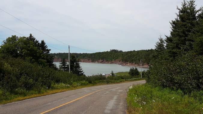
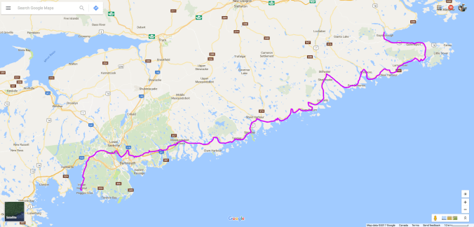
I’m not sure why it’s called the Sunrise Trail since it faces northwest, not east, but it’s pretty nonetheless. At one point, just west of Arisaig, I saw a dirt road leading off from the 245 and decided to go exploring. This is what I love about adventure riding and my bike—the ability to get off the asphalt when curiosity beckons. A short ride in led to a perfect lunch spot overlooking the ocean, complete with a picnic table to prepare my sandwich. Sunshine Coast Lunchspot

Like I said, with motorcycling, it’s not the destination but getting there that is the fun. But finally, I did cross the causeway and found my way to Baddeck Cabot Trail Campgound.

Baddeck Camp
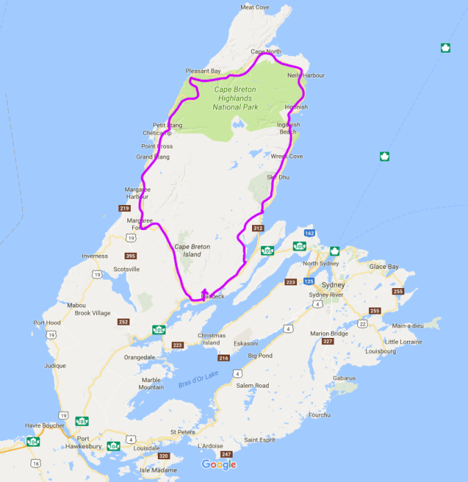
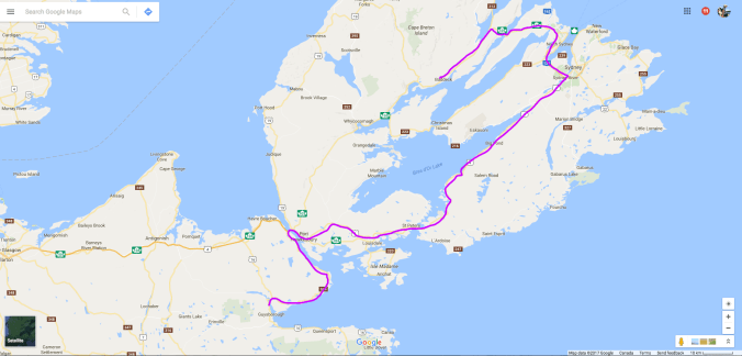
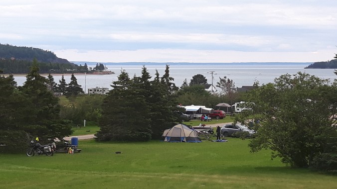
I love this campground! My wife and I stayed here when we vacationed in Cape Breton two years ago, and she found it, so I can’t take any credit. It’s a very well run campground with wooded sites, clean washrooms, friendly service, a heated pool (nice after a long day of riding), free showers and, a personal favourite of mine, a campers’ lounge. I have to admit, I didn’t take to the lounge right away; it has a TV and seemed like what one tries to escape by camping. But this time round I was forced to sit there to charge my phone, and found it a pleasant place to write or read, especially on the evening it rained. I decided to stay an extra night at Baddeck.

The next day was it, the Cabot Trail. Now whether to ride it clockwise or counter-clockwise is a matter of some online debate, but to me it’s a no-brainer: doing it counter-clockwise means you have the ocean views, and hence the lookouts, on your right side. Doing it the other way would involve crossing traffic every time you want to pull off or continue. And there are some spectacular lookouts you don’t want to miss.CT Lookout

CT Lookout2

But I have to admit, I didn’t stop at many. To me, they seemed like a distraction to why I had come all that way, and stopping every 15 minutes would prevent me from finding a rhythm on the road. So I rode. Yes, it’s only 360 kilometres and will take you only an afternoon, but it’s pretty intense riding, requiring your full concentration if you are, like me, not interested in cruising. For me, part of the fun is challenging myself to really ride a road properly—not dangerously, I always leave 20% buffer—but on a piece of road like this, you don’t want to be poking along like on a Sunday drive. So yes, that involved some passing too on this two-lane road.

It’s a clinic in riding, and by the end of the day I felt a lot more adept at cornering and passing. Do any repetitive skill for a day and you will get it down. I remember learning to canoe properly. One day in the stern and you learn the J-stroke and the Power-stroke. One day in the bow and you are a pretty good navigator of nautical maps. The same for riding. Now I know why it’s so important to fully brake before a sharp turn. If you go into it at the speed you think you can take it, you don’t have any buffer should you have misjudged. But by braking into a corner, you can determine your speed through the turn using the throttle, not the brake, which might have disastrous consequences. And by accelerating through the turn, the torque of the bike is pressing the rear tire into the road, increasing traction and preventing lowsides.

I also discovered that my little pony really pulls! There were of course other bikes on the road and it kept up with anything out there. Okay, it doesn’t have the acceleration of a bigger bike, but its smaller weight more than compensates on a piece of twisty road like this. It climbed those switchbacks effortlessly, had no heating issues despite, I later discovered, being half a quart low on coolant, and gripped the road through those corners. I always knew my bike was easy to ride; the Cabot Trail showed me it’s also very capable.

Finally through Chéticamp, I decided it was time to give both of us a rest. I pulled off at a rest site with a huge mountain lurking over us. The photo does not convey the dimensions and perspective. CT Lunchspot

As you can see, I left the panniers and top bags at camp. This is another reason why I decided to stay an extra night at Baddeck, so I could ride unencumbered. With the switchbacks and challenging section of road behind me, I took a slower pace to complete the loop and returned to camp mid-afternoon. The pool was just the thing after a such an intense, hot ride.

The Cabot Trail was everything I thought it would be. I’m glad I was riding alone and could do it at my pace. I have to add that there was a fair bit of road work happening across the top section, but thankfully it was a section of relatively straight road so was more of an annoyance than a major detraction from the ride. And I guess such an important road for Nova Scotia’s tourism does need to be well maintained. But if you’re not comfortable riding in those grooves or at all on gravel, check highway conditions before you decide to go. But just make sure you do go sometime because it’s a ride not to be missed.

Next up, off-roading in Cape Breton.

Day 4

Day 5

Day 6