The Prairies

I blast through Manitoba but savour Saskatchewan.

Many thanks to my talented and skilled wife, Marilyn Gillespie, for the retouching of all images used.

Of all the geographical regions in Canada, I was most excited to experience the Prairies. That probably sounds strange to many. Before leaving on this trip, I’d heard others say that prairie roads are flat and straight and mind-numbingly boring. But the Prairies were not only the one Canadian region I hadn’t yet visited in my lifetime, but they are also Big Sky Country, and I’m a Gemini, an air sign, so I like the sky. No wonder I’m also a flight enthusiast.

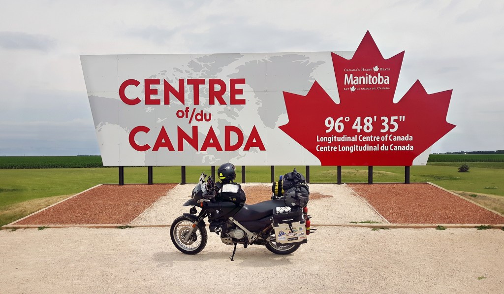
Provincial Covid restrictions meant I couldn’t stop in Manitoba except for food and gas, and with that in mind, I didn’t even stop in Kenora on my way out for the requisite photo-op with Husky the Muskie. That would have to wait for the return leg of my tour. I hit the highway, brought the bike up to 120 km/hr, activated my Kaoko throttle lock, and didn’t stop for hours on end. It’s not the Prairies that are mind-numbing, but the super-slab highway.

I discovered a few favourite positions on the bike to cover these miles. My favourite and go-to position was right hand on the throttle and left elbow on the tank bag. This “lean-in” look not only made me look distinguished on the bike but also saved my back as well as cut down on wind noise. There was also left hand on the left grip and right arm anywhere but on the throttle, usually dangling down by my side. Even with my throttle lock, I developed tingling in my right hand from the hours of vibration transmitted up through the handlebars, and this position gave it some relief. It’s not just the mind that goes numb on a big thumper with adventure tires. And when my legs needed a stretch, there was the Harley cruiser position. I would lift my legs up and rest them on the little Giant Loop Possibles Pouches strapped horizontally to my crash bars. Those bags became my highway pegs. 6 hours of 5000-rpm riding is not really touring but moving the bike from Point A to Point B, which was exactly the intent of Manitoba’s Covid restrictions.

Halfway to my destination.

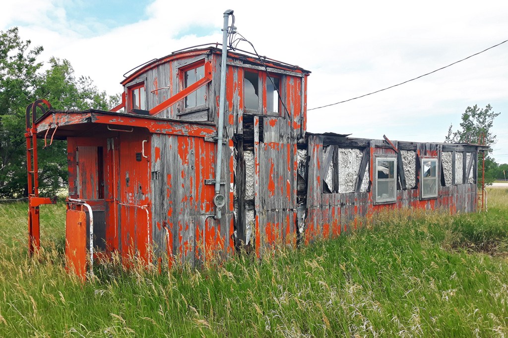
The only relief came at Winnipeg on the ring-road, Highway 101. For some reason, my GPS decided that, enough was enough, and it would mercifully divert me, 3/4-way through the ring, off onto Highway 221 and then the 26. What a difference the secondary highway makes! It meant a few stretches of gravel road, but the tank-slapper I received on one section (a result of my bent rim, I would discover later) was preferable to another kilometre of the Trans Canada. I was closer to the land and passing through small towns with history. On one “roadside break,” I discovered this old caboose and wandered back through a field to find more quintessential prairie artifacts.

Shortly before Poplar Point, I noticed a sign stating something like “Celebrating 100 Years of Hockey” and then a historical marker. I naturally had to go explore and arrived at this historic hockey rink.

Soon I was routed back onto the Trans Canada and the rest of the day was more of the same. The only thing that made it bearable was knowing there would be a TV and bed waiting for me just over the Saskatchewan border; I had decided to take a hotel room in Moosomin—a rare luxury when I travel. After a long hot day of highway riding, a cool shower, hamburger, and more mind-numbing TV in bed would be just the thing.

En route to the beer store.

The only time my bike burns oil is at high revs, so after the kind of day of riding it had been, I thought I should check it. Unfortunately, checking the oil level on this bike is not as simple as letting it settle in the sump and pulling the dipstick. That’s because the crafty German engineers gave it a dry sump system, so oil level is a product of a) amount of oil in the bike [duh!], b) temperature of oil, c) ambient temperature, d) temperature of engine, e) altitude, f) lunar cycle, and g) bike’s direction relative to True North. It was hot, and the engine was hot, and so was the oil, so I let the bike sit for a bit while I checked in at the hotel. That only took a few minutes, but when I checked the level, it was missing about 3/4 of a quart! Yipes! I thought that was a lot, and a bit concerning, but I added it nonetheless from the quart I was carrying.

The next morning at my first rest stop I checked it again and now it was high—really high. Damn! I guess the bike did not burn as much oil as I’d thought, or perhaps I waited too long before checking it at the hotel. Guessing aside, I knew I had to get oil out of it now or risk damaging the seals. What was there to do but parking-lot maintenance. Out came the tools and off came the body panels. I was at a gas station with adjoining convenience store, so I ransacked the washroom for paper towels and dug an empty windshield washer fluid container out of a garbage bin, then drained some oil out of the upper holding tank. I did my best guess and took out about half a quart. The level was now within range and I put everything back on the bike and rode on in search of somewhere to deposit the used oil. Fortunately, in these parts, the ubiquitous Co-op gas stations have oil drop-off containers.

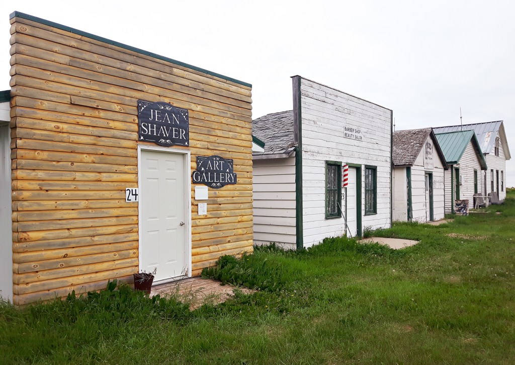
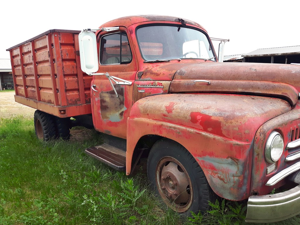
Now I was ready to ride, and what a ride it was! I was headed to Grasslands National Park (East Block entrance) and my GPS routed me along Highway 13, which is a different world from the Trans Canada. What a joy finally to be seeing some of Saskatchewan. While passing through Ogema along the 13 I saw a sign for Deep South Pioneer Museum. Always curious to learn something about the history of the places I’m riding through, I decided to take a look. Of course it was closed for the usual reason, but I was able to walk through the grounds and check out some pretty old machines.

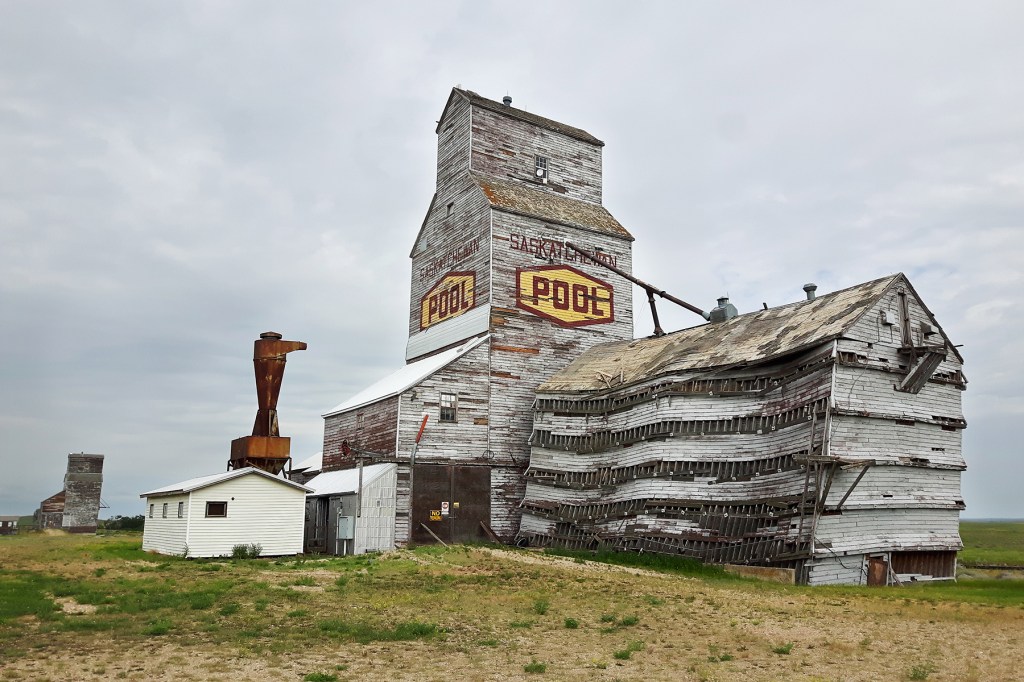
Further west along the 13 I saw a sign for Horizon, and from the little bit of research I’d done, I knew there were some dilapidated grain elevators there so decided to make a detour. When driving back out to the 13, I passed this quaint little chapel. They are everywhere in Saskatchewan—spartan clapboard churches that are very different from the heavy stone exteriors and ornate architecture of Quebec churches. I could suggest that’s indicative of the difference between prairie folk and Quebecers . . . but won’t.

So tempted to give this a nudge.

The riding got better once I turned south onto 36 and even better on the 18. By now it was the golden hour, and the twisty road rose and dipped over the amber, grassy hills. Who says Saskatchewan is flat? It seemed like I had the road to myself except for mule deer that scurried away across the barren fields and a coyote that froze and glared as I passed. Was I in heaven? No, actually just in southwest Saskatchewan. I fell in love with this region. It was one of the discoveries of the entire tour and I’m looking forward to going back as soon as I have the chance.

The only thing I didn’t like about Saskatchewan was the gravel used on their secondary roads. They use small brown stones similar in shape, size, and rolling behaviour as marbles. It’s fine as long as you stay in the tire tracks, but if you get into the deeper stuff that collects between those tracks, you are in for a treat. I didn’t have the best tires for this stuff, and it didn’t help that my front wheel had a wobble, so there were a few times when I thought I was going down. In such cases, the old adage “If in doubt, throttle out” was not going to help me. And with the bike fully loaded, getting my weight back did not lighten the front end one bit. I found I just had to clutch in, coast, let the bike go where it wants to go, and hope for the best.

When I arrived at the park, I mentioned my dislike of those stones to the young lady at registration.

“Yeah, I know what you mean,” she said. “When I first moved here, I ended up in the ditch.”

“Oh, you ride too?” I asked.

“No, it was in my car.”

Riding down to the campground in the valley.

But don’t let me put you off visiting the park. It is very remote, as you can see from the photo above, and you get the sensation of what it must have felt like to travel by wagon across the prairies. You are completely exposed, and I could hear the coyotes yelping in the distance at night. The wind is fierce and relentless, so cooking is a challenge, but the badlands are spectacular, especially at sunset. There is a 20 kilometre single-lane loop along the top and I was lucky enough to do it at sunset. It doesn’t get any better than that.

The Badlands at sunset.

The next morning I decided to head on over to the other side of the park. I’d heard that the west entrance at Val Marie is very different so worth a stop. Now what do you do when road signs point one way and Google Maps tells you another? It’s not that I have an abiding faith in modern technology, but I decided to follow my GPS because it showed a route through the park, and I thought it would be much more interesting than going back out to the 13 and riding asphalt.

Crossing the park by dirt. It looks easy enough.

The road looked pretty doable at first and I enjoyed the true adventure riding. Four stags crossed the road in front of me and, one by one, in what seemed slow-motion, leapt the bordering fence and headed majestically across the open countryside. That kind of sighting was the reward, but the cost was more of the infamous gravel and, then worse, sand—deep sand. It’s not fun riding a fully loaded bike through sand, but I was committed now, and to make matters worse, my fuel light was on and I didn’t think I had enough gas to get me back out the other way, even if I wanted to bail. I pursued on and the sand in the valleys turned to two-track dirt on the hills. The road deteriorated further, I was told to turn off that “road,” and I found myself facing a gate. Like I said, adventure riding is about facing each challenge as you encounter it. Now I was in the middle of a vast, remote park; I hadn’t seen a soul in about an hour of riding; I was almost out of gas; and I was facing a closed gate.

I got off the bike and untied the gate, which thankfully wasn’t locked. I swung it open, rode through, stopped, closed and tied it again, then rode on. But as I pulled away, I heard a terrible grating, scratching sound like metal on metal. I’d ridden through barbed wire! Someone had strung barbed wire across the road on the other side of the gate! Clearly I was not where I was supposed to be but had no choice now but to continue. I untangled myself and the bike from the wire and rode on, half expecting to hear gunshots. It was lucky I hadn’t received a puncture from the barbs.

Just when things couldn’t have looked worse, my GPS announced, “In 8 kilometres, turn left.” Ugh! But it’s always darkest before the dawn, and just when I thought I was riding myself into serious trouble, there was another chapel in the middle of nowhere—a good sign—and then the road got better and resembled more a road, and before I knew it I was back out on the 18 again. It was asphalt from here on.

I popped out at McCord and filled up at the local gas station there. Across the street were these old pumps next to a local museum which was . . . well, you know.

There is a Visitor Information Centre at the West Block and I learned some interesting information about the region. For example, I discovered that they get an average annual rainfall of only 30-35 cm, half of it in the summer in thunderstorms in June and July, and about a third in snowfall. This really is a desert climate! I also discovered that rattlesnakes are common and that you can hike up the nearby Eagle Butte. Normally those two clauses would be incompatible but I had adventure riding boots on so decided to do it, just for the view. A sign at the trailhead said the buzzing sound you often hear along the trail are rattlesnakes, but the grasshoppers in this region make a similar buzzing sound by slapping their wings together in flight, just to mess with you. The whole experience—climbing a desert mountain mid-summer wearing adventure boots amid rattlesnakes and flying, buzzing insects—is highly recommended. Once at the top, the view was worth it all, but not captured very well by the camera.

From the summit of Eagle Butte, looking west.

By now it was mid-morning. I wanted to stay and explore this fascinating geography some more but still had seven hours of riding to get to my destination, Calgary. Marilyn had reserved an AirBNB for us and I was looking forward to seeing her and sleeping in a bed. I hit the highway again and before long I was at the provincial border.

Goodbye Prairies. Hello Rockies.

Now I had a few days to rest the body, do laundry, eat and drink well, and socialize with friends and family before we would hit the road together on the next leg of the trip.

Northwest Ontario

I leave Chutes Provincial Park and ride along the north shore of Lake Superior into Lake of the Woods.

You don’t realize how big Ontario is until you have to drive it. The people I know who’ve driven across Canada say getting through Ontario feels like half the journey. It’s made long in part by having to circumnavigate Lake Superior, but seriously, what better obstacle could there be? I’ve written about my love for the geography north of gichi-gami, aka The Great Sea, and in that article I said “you could drive from Sault Ste. Marie to Thunder Bay in eight hours, but why would you?” Well, if you had to be in Calgary in five days, that’s why.

I’ve driven in the car Highway 17 to Thunder Bay with my wife, and I’ve ridden on the bike Highway 11 as far as Kapuskasing, but this would be my first time riding the beautiful 17 on the bike. That was a large part of the reason for my smile upon waking at Chutes Provincial Park that morning: I knew the ride that lay ahead of me for the day.

Whether you have time to stop and savour the landscape or are on a tight timeline, the ride is amazing. The weather was cooperating and the bike was running great so I put on the miles and made it all the way to Pukaskwa National Park in time to set up camp, eat, and stroll the shoreline before losing the light.

Looking at views once painted by The Group of Seven

Upon leaving the park the next morning, I saw a sign indicating that there was a National Historic Site nearby, so naturally I followed the signs to The Pic, an important Aboriginal meeting place for thousands of years and the site of an important trading post during the height of the fur trade.

Today there is little evidence, aside from this marker, of the historical importance of this place.

I continued west, but was soon diverted by another sign marking Ausable Falls and Gorge.

Pretty spectacular view just off Highway 17 west of Terrace Bay at the head of Lake Superior

There’s a convenient parking lot right off the highway, and the short little hike down to the lookout makes a good rest stop. Best of all, there is no charge to get a view worth a million bucks.

Looking south out to the Slate Islands on the horizon

Okay, now it was time to avoid the distractions and pound out the miles. There are a number of spectacular lookouts along the north shore but I sadly had to blow past most of them or I’d never get to my destination just west of Thunder Bay by evening. It was hot, like 30+C (~90 F), and I was glad I’d purchased the Klim Marrakesh jacket specifically for the tour and days like this. It vents a ton of air, and my fuel pack meant I had plenty of water to keep me hydrated.

Still, I pulled off on one of the lookouts just to take a break in the heat and ran into two other riders, about my age, it seemed, maybe a little older, heading east on sport tourers. They had travelled from Victoria and said the heat bubble followed them for the first several days of their trip and was pretty unbearable. Their red, puffy faces showed the aftereffects, and I was glad I missed the worst of that. I experienced it on TV newscasts from the comfort of my air-conditioned living room. I would ride in heat the entire trip, but nothing like they experienced.

The heat got worse, and the stretch from Nipigon to Thunder Bay seemed endless! All I had on my mind was finding the first Tim Horton’s and getting a large Ice Cap, which I did. As I was standing outside savouring it (the A/C dining area still closed due to Covid), a Harley pulled in riding two-up. He was struggling in the heat to back his bike into a parking spot, so asked his wife to dismount first to make it easier. I thought, “He’s tired.” Turns out he’d been on the road since 4:30 a.m. and this was his first stop since leaving Sudbury. And I thought I was in a hurry.

“That was some heat coming down through those hills,” he said. And then, before I had slurped the last of my drink, they were back on the road again, apparently to Regina.

I thankfully had another small errand to run, happy to be in A/C for a little longer. I stopped in to the local grocery store to pick up something for my hosts that night who live in the Shebandowan area just west of Thunder Bay on Highway 11. This is a lovely cottage area with its own network of lakes. Marilyn and I stayed with her cousin last summer and did some water skiing there, which left me stiff for days but was exhilarating. This time there was none of that; I was happy to relax, see familiar faces, and meet more extended family.

The next morning I continued west along Highway 11 toward International Falls. The evening before, in conversation with a fellow biker, I was told that “the road is straight and remote, and you might be tempted to see what your bike can do, but be careful because OPP are along there.” I now saw what he meant so “sped responsibly.” I really couldn’t afford a whopping fine let alone having my licence suspended.

Somebody has a warped sense of humour

I was excited to experience Lake of the Woods, which I had never visited before but had only read about in researching an article on The Northwest Loop. But first I decided to explore Kay-Nah-Chi-Wah-Nung, or Manitou Mounds, another ancient Aboriginal meeting place of national significance that contains “the records of 8000+ years of recurring use or habitation” and “the largest group of burial mounds and associated village sites in Canada” (https://manitoumounds.com/history-culture/). It was about forty minutes out of my way but I decided to pay the price to learn first-hand about ancient Indigenous history and culture. Only once I had paid the price, not only in time but kilometres of dirt road, the only thing I learned was that it was . . . you guessed it, closed due to Covid. Nothing on the website indicated that, which would have been nice. (I could hear my wife’s voice in my head saying “You should have phoned first,” which is probably true and would have saved me the frustration.)

Now I was in the mood to see what my bike can do. I’ve never had it pinned and have always wondered. Okay, the bike was fully loaded, but it still hit 160 km/hr in a tuck, which is pretty good for a 650 that is 16 years old with over 100,000 kilometres. As luck would have it, soon after that little test, I passed an OPP sitting at the side of the road. Sometimes you get lucky.

Highway 71 lived up to its reputation, winding up through a mixture of forest and wetlands as it skirts the eastern border of Lake of the Woods. My wife who grew up in Winnipeg has talked about this region using similar tones that Torontonians use to talk about the Muskokas. It’s beautiful cottage country, for sure, and its remote location has saved it from the more obnoxious development that has altered the Muskoka region during my lifetime. The road north of Nestor Falls is twisty and hilly with views of lakes and wetland. I stopped at The Narrows Gift Shop and took a browse (I’m always on the prowl for pannier stickers). Beside is The Lazy Loon Restaurant. Okay, there’s some kitsch development here too, with fake inuksuks, fake totem poles, and mini-putt, but I forgave it all because THEY HAD ICE CREAM!

The final leg of the day and my ride across Ontario took me into Anicinabe RV Park and Campground in Kenora just as a thunderstorm broke. It had been a long, hot day, and the cooling rain was welcome relief. As it would turn out, it was one of only three showers I would experience in my six weeks on the road.

One of the last spots at Anicinabe Campground near the Manitoba border.

Have you been to any of these places? Drop a comment below. I love to hear from my readers.

Next up: Prevented from stopping in Manitoba due to Covid restrictions, I ride across in one day and spend the night in Moosomin, SK.

Guelph to Chutes Provincial Park

After a few days visiting family in Guelph, I start out on July 1, Canada Day.

With my sisters and brother-in-law. //Photo credit: Sue Bushell

After the stressful days of preparing the bike and packing, I was happy to have a few days to unwind with family before setting off. As the day of departure approached, so did the expected trepidation of leaving my comfort zone. The main thing that I was concerned about was finding accommodations as I headed across the country. In order to keep my schedule flexible, I don’t like making reservations, and I’d heard that campgrounds were full as people flock to the great outdoors post-lockdown. I had visions of struggling in the fading light to find a safe and affordable spot to stop each night.

Final tinkering, delaying, before leaving Guelph. //photo credit: Sue Bushell

There were other concerns too, but here’s the thing I’ve discovered from doing these trips: once I’m on the road, all anxiety and concern dissolve as I face each challenge in turn. A trip of almost 20,000 kilometres breaks down into a series of distinct tasks in the moment: “Okay, now I have to get to that road . . . now I have to find gas . . . now I have to solve this mechanical issue . . . now find a campground,” etc. You deal with one thing at a time, and it’s not actually all that stressful.

The immediate concern as I left Guelph was a bounce in my front wheel. I’d had the balancing double-checked by BMW before leaving Montreal and they said it was fine, but I could still feel vibration at 110-120 km/hr—annoyingly right in my cruising speed. I pulled into Two Wheel Motorsport off Highway 6 to see if they had any ideas.

“What tire pressure are you running?” someone there asked.

“About 31 psi,” I replied. The normal pressure on the front is 28.5 but I was fully loaded. He thought it was a little high and to drop it a pound or two. Unfortunately, that didn’t fix the problem which, I would find out much later in the trip, was actually a bent rim. [Note to self: don’t attempt any rocky hill climbs just before leaving on a major tour.]

I continued north on Highway 6 and started zig-zagging my way toward the 400. It was warm and sunny, the countryside north of Guelph is beautiful, and aside from the wheel issue, the bike was running great. It was sinking in that I was finally doing this—what I had been thinking of doing for years.

As I was passing along Highway 26, I spotted a MiG 17 mounted at the side of the road. I pulled a U-turn—the first of many on the tour—and turned into the Edenvale Aerodrome. There, I saw not only the Mikoyan-Gurevich MiG-17 but a Canadair CT-114 Tutor used by the RCAF Snowbirds. It was July 1st, Canada Day, and the museum was closed, but little did I know that the only replica Avro Arrow is now housed at Edenvale. A return visit and tour is definitely in the near future.

MiG 17 and CT-144 Tutor at Edenvale Aerodrome in Stayner, Ontario.

Yes, I’m an aviation as well as motorcycle enthusiast. It seems I’m not alone in being passionate about both. I figure that’s because riding is about as close to flying as you can get without actually leaving the ground. When riding, you get the sensation of wind and speed and the pull of all three planes in each sweeping turn. In fact, I’m so crazy about flight that I’ve written a collection of poems about it, due to be published by DC Books next spring. Invisible Sea is a collection on the theme of flight, especially early human flight, with the title poem a long serial poem examining aerodynamics. Details on the launch and availability to follow.

After stretching my legs and having a snack, I pressed on, up the 400, through Sudbury, and over the top of Georgian Bay. Now I was in familiar territory from my Northern Ontario adventures. I would have loved to detour down the 6 from Espanola to Manitoulin Island, one of my favourite places to visit, but with 3,000 kilometres still to cover in 6 days, I had to keep heading west. (I was supposed to meet my wife in Calgary on the 7th, and I know better than to keep her waiting.)

As I was passing through Massey, about 30K west of Espanola, I spotted a sign for Chutes Provincial Park. It was about the right time of day to start looking for a campsite, and I was pleased with the distance I’d covered. I pulled in late afternoon, hoping they had a site. This was my first real test and what I had been most stressed about.

“I’m hoping you have a campsite for tonight,” I said to the young lady in the kiosk. “I don’t have a reservation.”

“We’re full,” she replied, and then, “Let me check with the Warden.”

In a minute he showed up, and it turned out there was a spot for me. This would not be the last time on the tour that I would literally get the last spot in the campground.

I set up camp, had a quick dinner, then went for a walk around the campground. I figured with a name like Chutes Prov. Park, there had to be some waterfalls somewhere. The park contains the Seven Sisters Rapids and a hiking trail that follows the river.

Seven Sisters Rapids at Chutes Provincial Park

I followed the trail and it led me to a lookout at the base of the falls just as the sun was beginning to drop below the trees in the west.

That night I slept in my tent like a king, and in the morning, when I woke, I had that uncanny experience whereby for a moment or two you don’t know where you are and what you are doing. When the answers to those questions finally came to me, lying in my sleeping bag, I just smiled.

Route Day 1