Everyone tours The Cabot Trail on the east coast, but the west coast has its own charm.
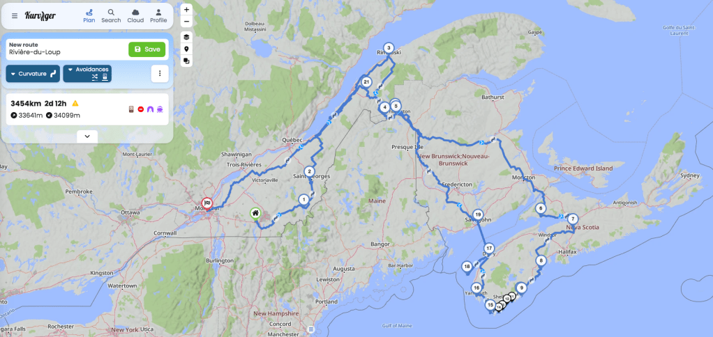
After riding the TQT (Trans Quebec Trail) from Magog to Rimouski, I’d had enough of dirt roads and boreal forest and decided on a change of pace. I contacted my good friend in Nova Scotia to see if she was up for a visit. Sharon and I met as undergrads at Western University, so long ago the university was then called The University of Western Ontario, and we’d kept in touch through the years. She’s one of my oldest and dearest friends and I don’t see her enough, so I spontaneously reached out. Thankfully, my timing was good; she’d just finished her teaching duties for the summer and her schedule was clear. I decided I’d nip down to central Nova Scotia for a short visit, then ride The Lighthouse Route that follows the NS western coastline from Halifax through Lunenburg, Liverpool, Kejimkujik National Park Seaside, Yarmouth, and around to Digby. Then I figured I’d cross The Bay of Fundy on the ferry and start making my way back to Montreal. Where the first week was remote solitary dirt and gravel riding through forest, the second would be asphalt, ocean, lighthouses, cafes, bookstores, and microbreweries.
Google said Sharon was only 7 hours from Rimouski by highway, but I wasn’t in a hurry so thought I’d ride mostly dirt roads down. In fact, I could still follow the TQT south out of Rimouski and then follow my nose. It brought me to the northern gate of a large nature reserve (ZEC) standing between me and New Brunswick. I write “gate” but there was no actual barrier, just a small building that you stop at to buy your permit. There is a small fee to enter these reserves. I’m not sure why, but this is Quebec and there’s usually a fee attached to most things. No doubt the money goes toward maintenance of the building that houses the staff member whose job it is to collect the fee.
The man inside started to fill out the paperwork for my fee. I noticed that he was a two-finger typist so I guess a certain typing speed was not a requirement for his job. We got to the point where he collects the fee and I caught something about “trois cent kilomètres,” which caused me some concern. (He didn’t speak any English so obviously that was not a requirement either for the job.) A few questions of inquiry and I discovered that, yes, it was over 300 hundred kilometres through the reserve. (This man was now earning his wages.) I wasn’t expecting that and hadn’t filled my extra fuel bladder and didn’t know if I had enough gas to get through. He also said it wasn’t advisable to ride through alone because there are a lot of moose and not many people in the reserve. With that, I wished the man adieu and decided to find another way down to Nova Scotia.
I rode back out to the main road and plugged Sharon’s address into Google but with the option to “Avoid Highways.” I figured if I couldn’t ride dirt, I at least didn’t have to ride highways. Google did pretty well and in fact found me some interesting dirt to ride.
However, once I got into New Brunswick, Google did less well. I think some of the NB backroads aren’t mapped in Google using anything but satellite imagery because I soon found myself on an ATV trail that looked pretty gnarly. Yes, it wasn’t highway, but it also wasn’t a road. Fortunately there was a sign indicating I needed a permit (yes, another fee) to ride it, and given that I was fully loaded and alone, I decided to back out of that one too. It wasn’t easy getting to Nova Scotia. Clearly I couldn’t ride through the drive-through province without using highways.
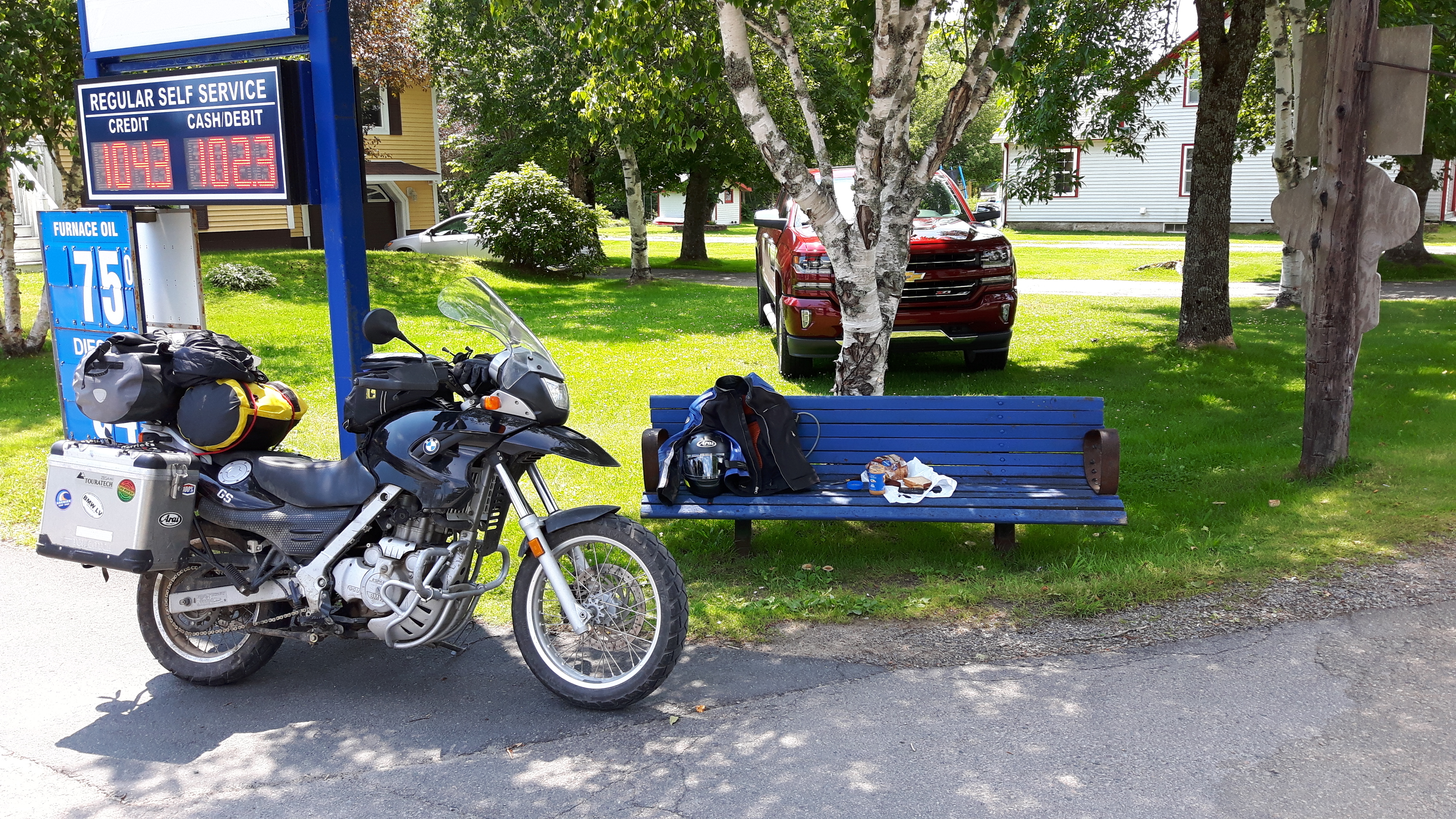
Now I was somewhere in New Brunswick and getting low on fuel. I didn’t have cell service so couldn’t look up the nearest gas station so I went old-school and asked a man who was cutting his grass. (Thankfully, there was a house.) He said to continue until I reached the St. John’s River and then turn left and that would take me into Edmundston. Phew! Every tour requires at least one fuel scare.
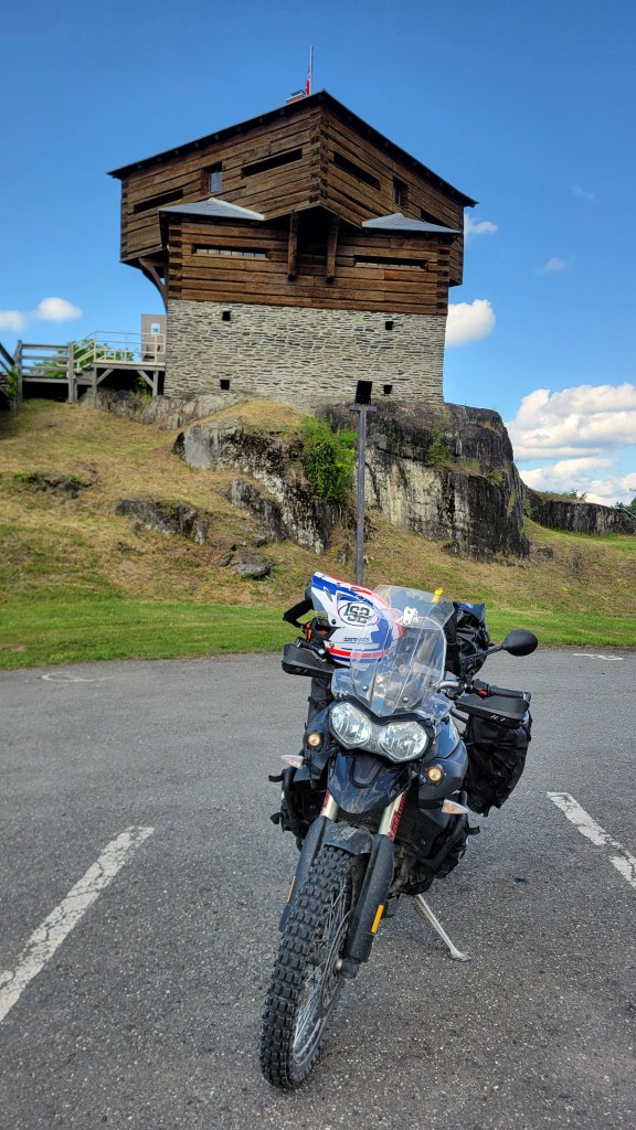
Soon I was not only fueled up but also at a tourist information centre, which in Edmundston is housed in an old military block house on the St. John’s River.
And before long, I was set up for the night at Parc Provincial de la République, which is nowhere near as revolutionary as its name suggests.
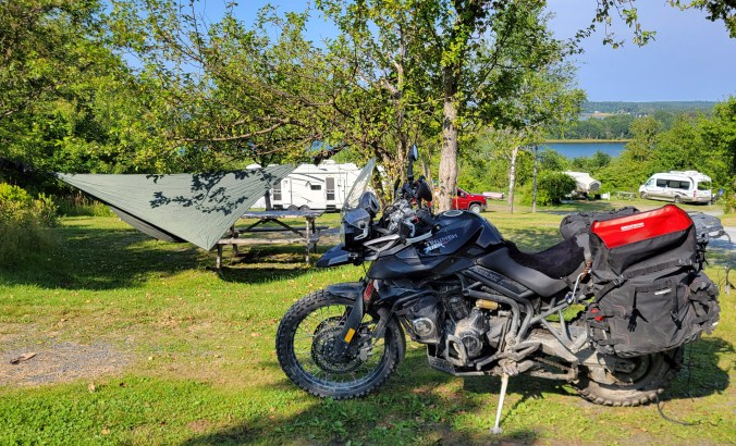
The next day there was no avoiding it: 5+ hours on the Trans Canada Highway south and then east, cutting through bush with moose fence on either side, a 120 km/h asphalt corridor that numbs the mind and body but gets you into Nova Scotia, where you can drop down a gear and start to smell the ocean. I had in mind to camp at 5 Islands Provincial Park, which I missed the last time through by accidentally staying at 5 Islands RV Park (very different), only once I got there after a long, exhausting, boring day in the saddle, I was told they didn’t have a site. The Not Since Moses race was that weekend in which participants run along the muddy beach at low tide. Sounds like fun but unfortunately it meant the campground was full. With some advice from park staff and a phone call, I found a site just 30 minutes west along the shore in Glooscap Campground in Parrsboro. I was now right on the shore of Minas Basin with Sharon just a short ride away on the other side of Cobequid Bay.

The next day, while circumnavigating the bay, I came across this roadside sign, which seemed apropos since I wouldn’t have been in Nova Scotia if it weren’t for what was happening in The United States.
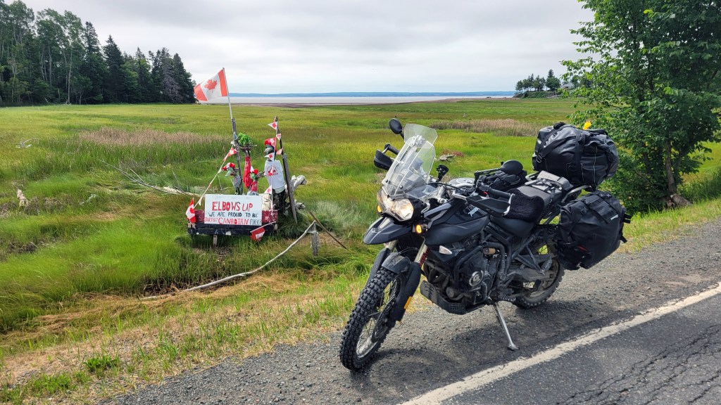
“Elbows Up” is a reference to hockey, Canada’s official national winter sport. It refers to a style of play by Mr. Hockey, Gordie Howe, who used his elbows to defend himself against larger attacking players. It has become a rallying cry for Canadians against Trump’s punishing tariffs and threats of annexation. The date indicated on the sign is when Canada officially became a nation, comparable to 1776 for Americans.
As a Canadian, I’ve watched with a kind of dispassionate curiosity the political events and discourse happening south of the border, but lately the conflict and tensions have crossed the border and become more personal and threatening. I normally don’t like to get political in this blog because it’s one of those topics one is supposed to avoid at the dinner table so perhaps should be avoided in this public conversation as well. Let me preface the following comments by saying that I’m in agreement with some of Trump’s policies and recognize that the Democratic Party seems to have abandoned the working class and adopted a politic based more on race and identity than pragmatic economics. I’m not a fan of open borders, despite understanding why many people might want to flee difficult situations in their home countries. I don’t think mass unregulated immigration is viable long-term. And while I’m not an anti-vaxxer, I’m curious to see what Robert Kennedy Jr. is going to do with health care reform and food and drug safety in The States.
However, Make America Great Again cannot involve violating international law and annexing sovereign countries and continents. It should not involve turning a friend and ally into an enemy and opponent by breaking trade agreements with unreasonable tariffs designed to crush industries that have served both countries very well since 1989, when the US-Canada Free Trade Agreement (FTA) was first signed by President Reagan and Prime Minister Mulrooney (superseded by NAFTA). If President Trump wants to change the nature of the US-Can trade agreement, there are mechanisms built into the agreement for that. But Trump wields tariffs like a club, threatening to use them according to his whims when he even hears something he doesn’t like. That is not a viable economic strategy for developing stable trade and investment relations.
In 1969, then Canadian Prime Minister Pierre Elliot Trudeau said that living next to America is like “sleeping with an elephant. No matter how friendly or even tempered is the beast . . . one is affected by every twitch and grunt.” And currently the beast is far from friendly. How does a relatively small country like Canada deal with a unfriendly United States? I think the answer can be found in one of our oldest stories, Jack and the Beanstalk, a story that is perhaps 30,000 years old. Jack knows he cannot survive on his own against the giant, so he enlists the help of the giant’s wife, who feeds him and hides him when the giant returns. Perhaps she too is afraid of the giant. This is exactly what Prime Minister Carney has suggested in his recent speech at the World Economic Forum in Davos—for middle-sized countries to cooperate and form alliances to protect themselves against hostile superpowers. That speech has clearly angered Trump because, as I write this, he’s threatening a 100% tariff on all Canadian goods, although his motives for this latest threat are unclear.
But back to Elbows Up for a moment, while we are still stopped at the side of the road. I miss riding in The United States and hope these political tensions are resolved soon. I plan to tour in my upcoming retirement not only the eastern seaboard but also The Continental Divide, including Utah, and the Pacific Coast Highway, among other destinations. I haven’t yet seen The Grand Canyon, or the Bonneville Salt Flats, or ridden The Great Smokey Mountains or The Outer Banks. So please, my American readers, don’t take it personally that I’ve decided to participate in the tourism boycott for now. It is a price that we are both paying for President Trump’s decisions. I feel it’s just something I ought to do while President Trump is being disrespectful. In every single course outline I present to my students, there is a sentence at the end of the section on class rules: “Mutual respect is the basis of all relationships.” Referring to Canada as the 51st state and our Prime Minister as its governor is not being respectful.
Feel free to comment below on what I’ve said above, but if I may extend the analogy of the classroom a little further, another of my class rules is that any and all comments are valid as long as they remain respectful in both tone and content.
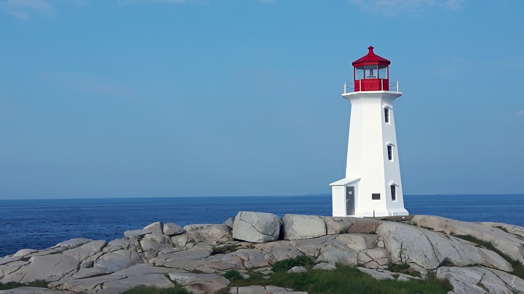
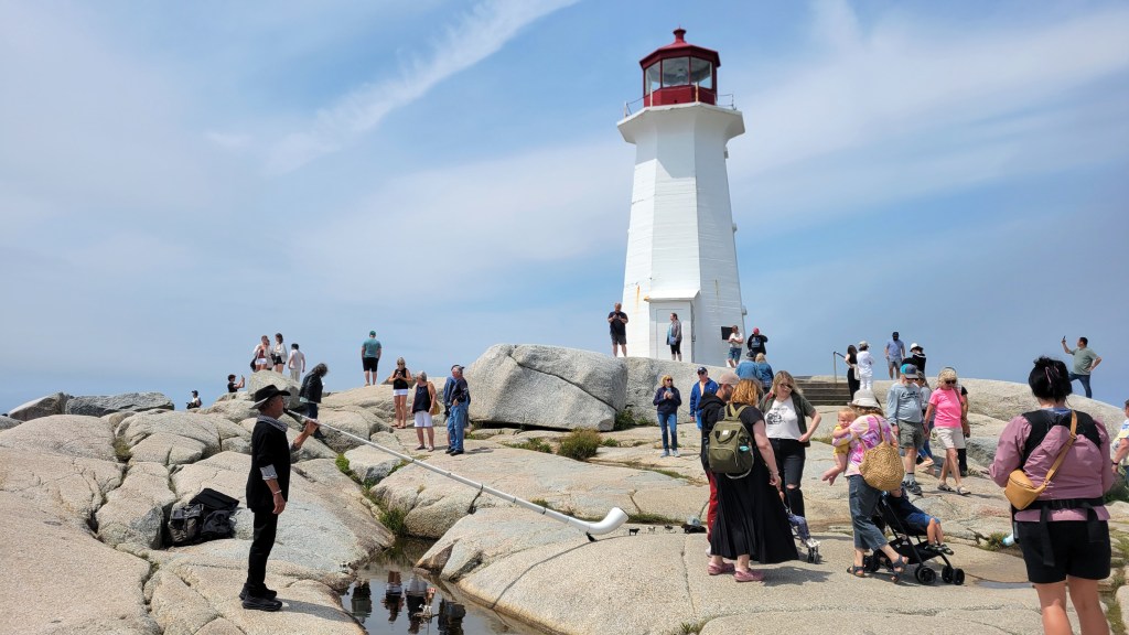
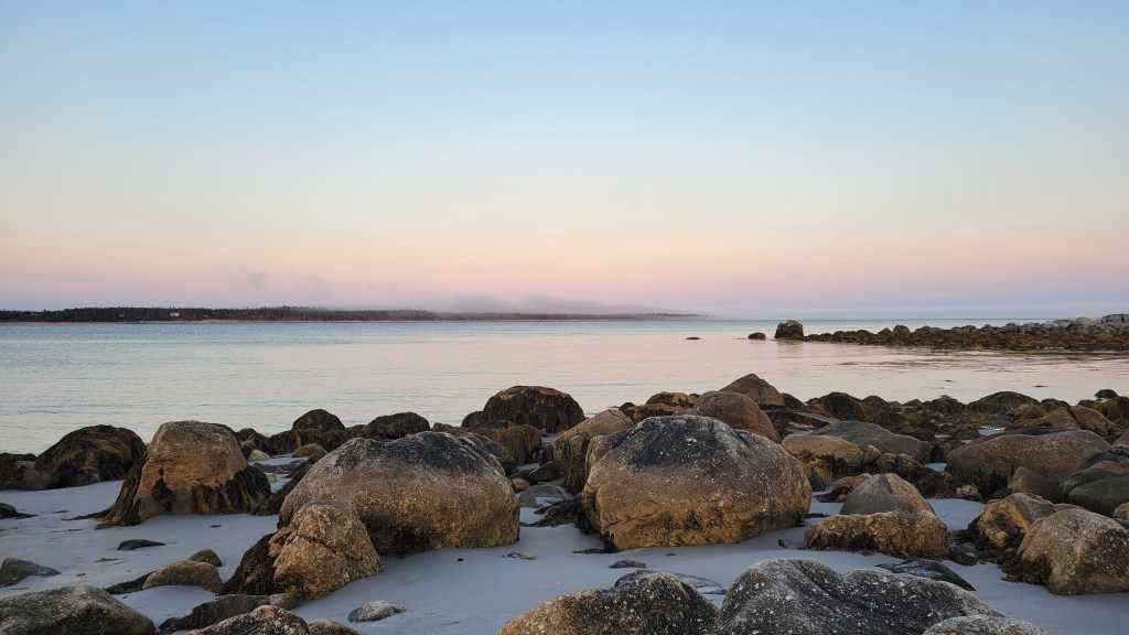
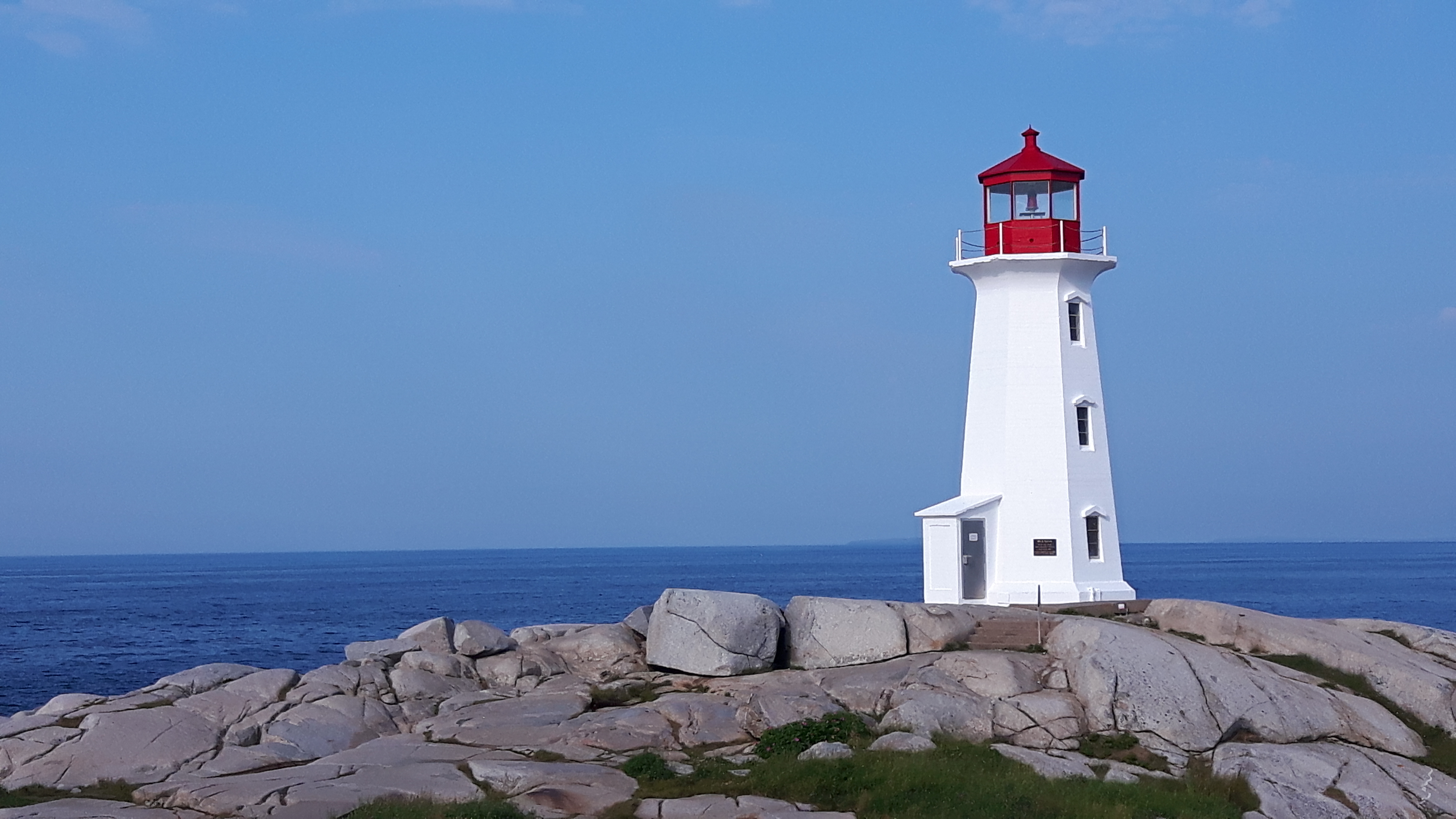
After a few days of rest, conversation, campfires, and catching up with Sharon, I loaded up the bike again and headed south, skirting Halifax and picking up the 333 that took me to my first lighthouse, Peggy’s Cove. The first time I visited Peggy’s Cove, I camped about 15 minutes away at Wayside Campground and was able to get down to the lighthouse at dawn to take the photo above (banner image). This time it was later in the morning and it looked very different.
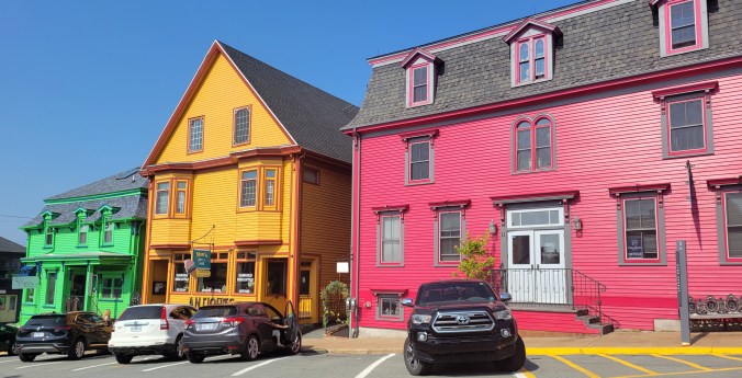
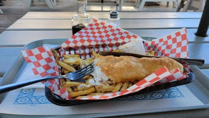
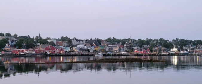
My tour now was not solitary, and unfortunately, I got more of the same once I reached my destination for the day, Lunenburg. I set up my hammock at the campground, then walked down into town for a pint and some fish & chips.
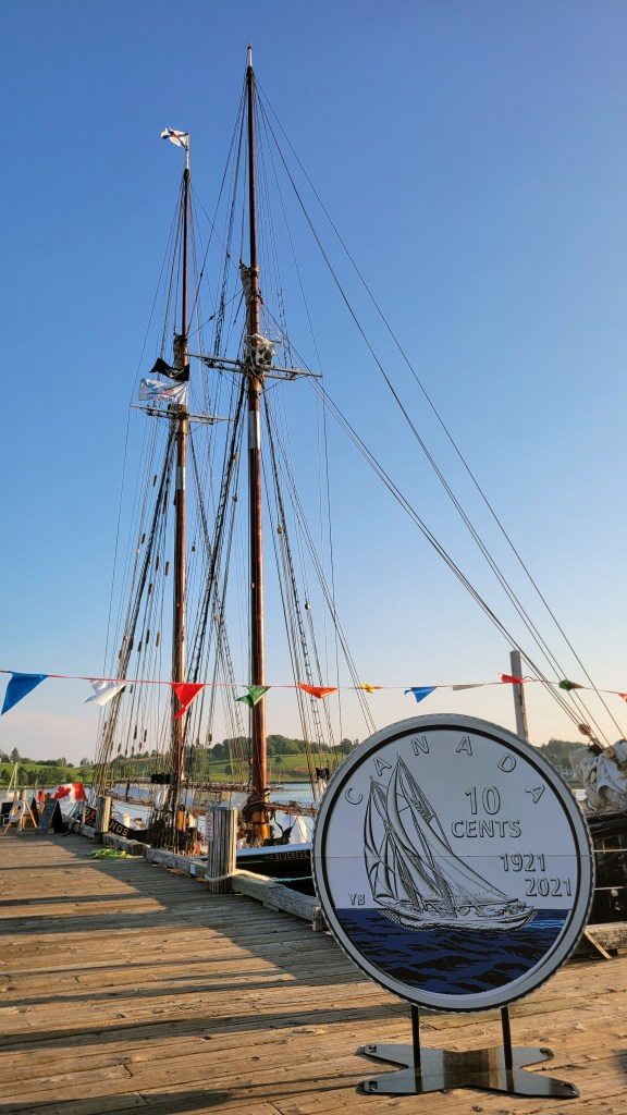
After dinner, I got an ice cream and walked down to the dock to see Bluenose II.
The last time I was here was with Marilyn. In fact, we’ve visited Lunenburg a couple of times and now, alone, I experienced another kind of loneliness from the previous week as everywhere I went her absence was all the more poignant, exacerbated ironically by the streets and restaurants teeming with tourists.
I decided to wander over to the other side of the bay where it was quieter and provided a peaceful view of the harbour at dusk. The next day I was strangely happy to pack up and continue west along the coastline, out from the crowds and into the more remote side of the province.
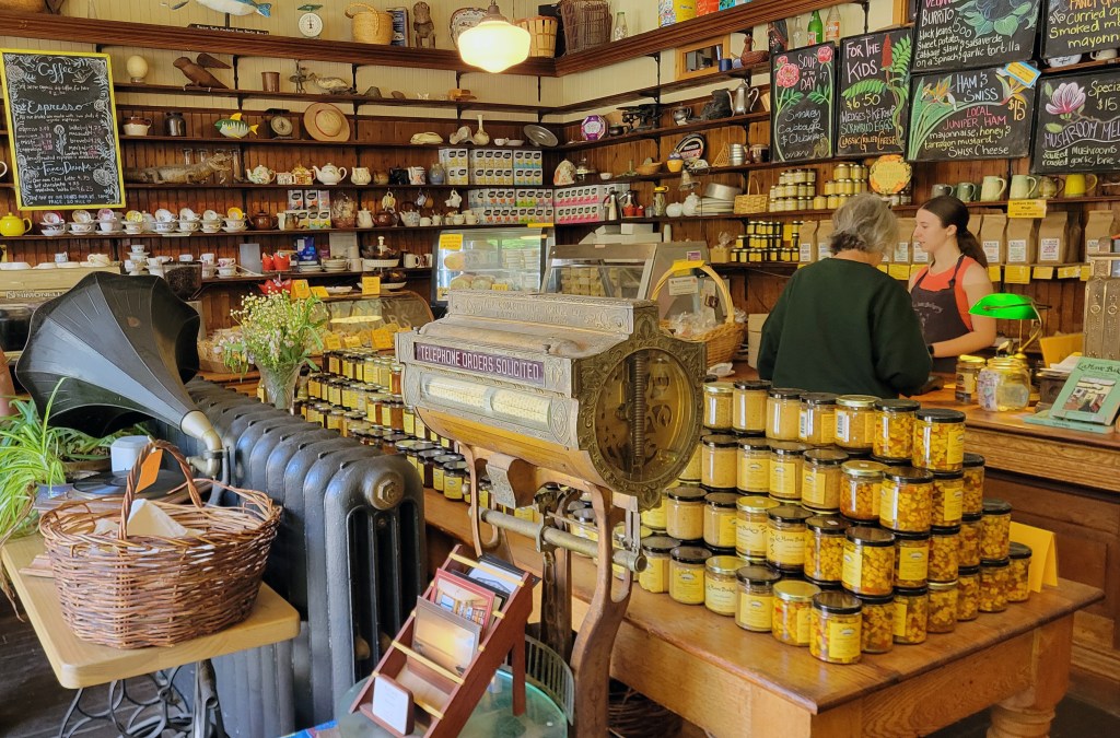
My first stop was LaHave Bakery, just off the ferry that takes you across the LaHave River. One of my favourite things while touring is stopping at a bakery for a midday snack and coffee, and it doesn’t get any better than the LaHave Bakery. They have not only delicious baked goods and coffee but also an adjoining bookstore and a dock out back where you can sit while you enjoy your treats.
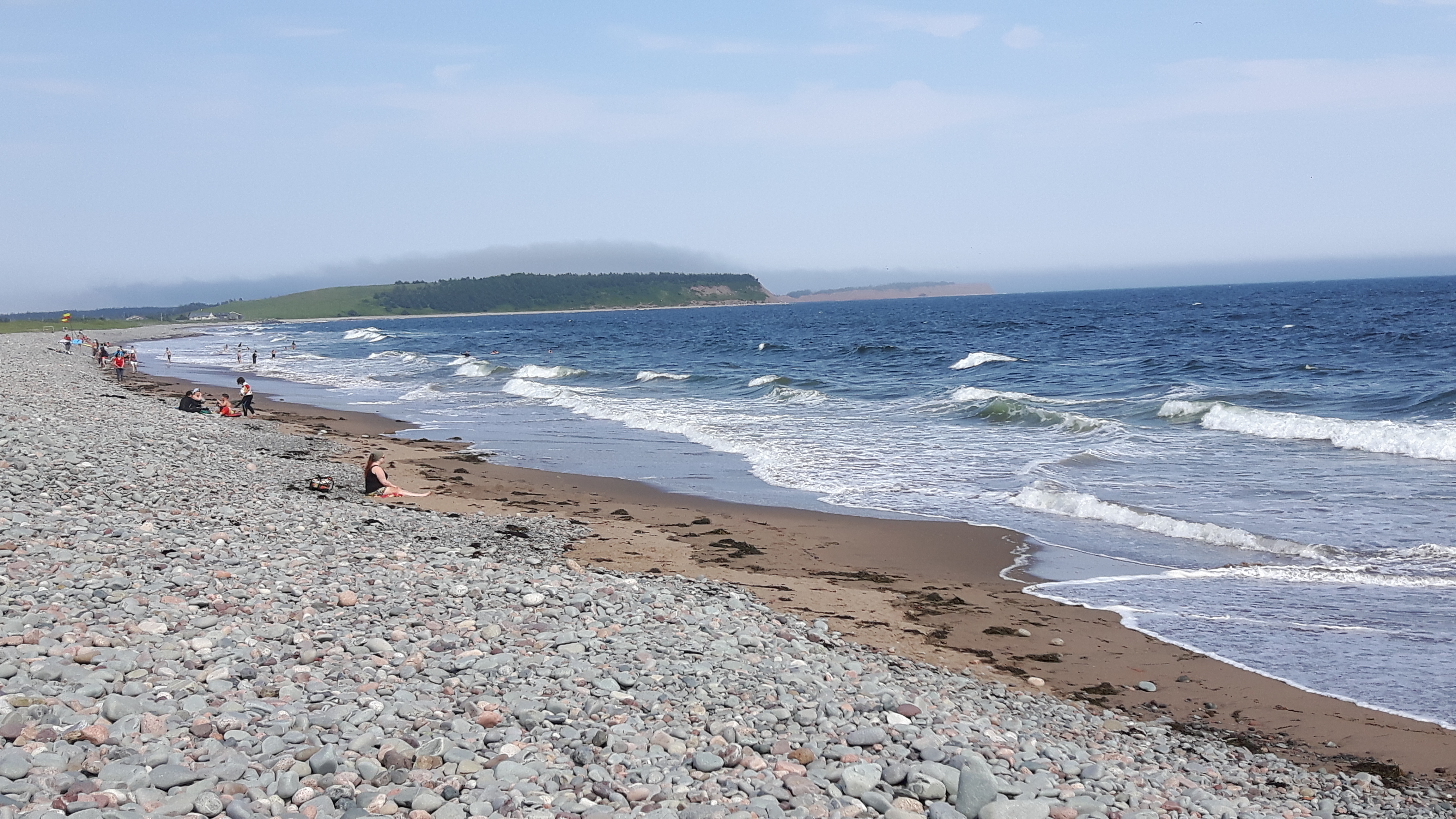
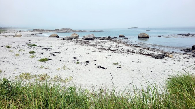
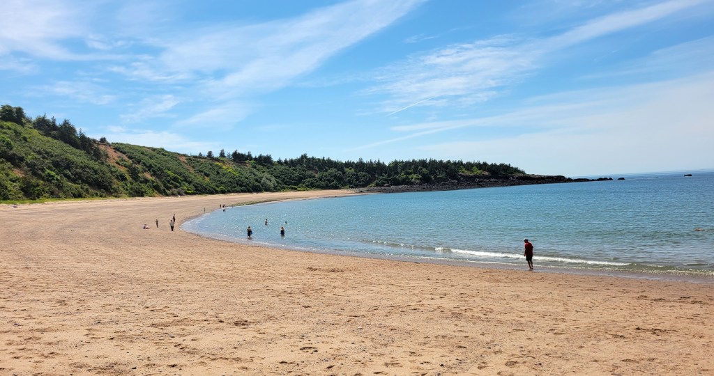
After, I continued along the 331, dropping down onto secondary roads that hug the shoreline of the peninsulas as I headed west to Kejimkujik National Park Seaside. Don’t ask me how to say it (or spell it, for that matter), but it’s on the southern shore about halfway between Lunenburg and Yarmouth. You can’t camp there so I went to Thomas Raddall Provincial Park just on the other side of the bay and set up there. As soon as I’d strung the hammock and made my way down to the beach, I knew I would stay here for a few days.
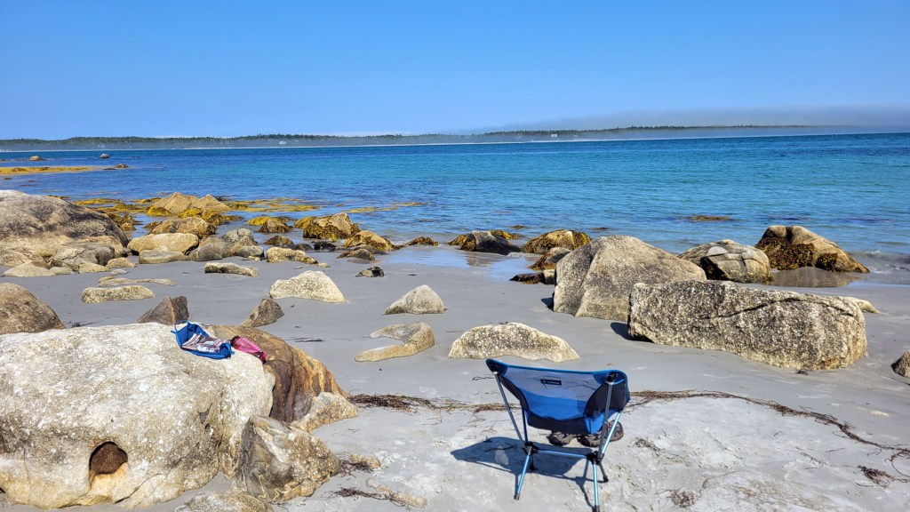
I went for a swim and read for a bit, then hopped on the bike and rode over to the park, only by the time I got there it was getting late, the parking lot was completely empty, and I knew I was all alone in this large, remote park. You have to walk a narrow trail to get to the beach from the parking lot and signs at the trailhead indicated the presence of bears. I’d left my bear spray back at camp, and when I saw signs of bear activity on the trail, I decided not to risk it but return the following day better prepared. Sometimes you just have to listen to your gut.
I’ve written in an earlier post about how, at my age (62), I’m trying to take some days off the bike while touring. Rest days, recovery days, sightseeing days—call them what you will, they are helpful and needed and ensure I slow down a bit and don’t ride past attractions in the quest to cover miles. Kejimkujik was the perfect place to spend a day and in many ways felt like the highlight of the tour.
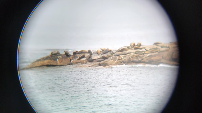
And speaking of rest, the last time I was here with Marilyn, I was so exhausted that I fell asleep sitting up on a rock at the shoreline, much to Marilyn’s chagrin, who found it a photographer’s paradise. At least that’s her memory of our visit, but in truth I was just “resting my eyes.” This time I was well rested and hiked the trail, then found a viewpoint to sit and take in the sights and sounds of the ocean. Seals were in the bay in front and a bunch were bathing on a nearby island, which I was able to see through my monocular and photograph by putting it to the lens on my phone.
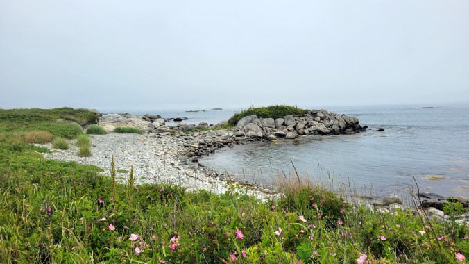
While hiking the shoreline trail, I rounded a corner and saw a bear up ahead, but it skedaddled into the bush when it saw me. Kejimkujuk Seaside really is a special place. If you are a nature lover, make sure it’s on your destination list.
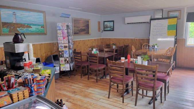
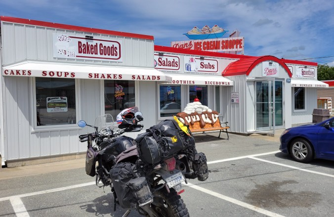
The next day I continued along the shore toward Yarmouth. I found this quaint mom and pop diner for breakfast in Bayman (Highway 3), and later in the heat of the afternoon, a classic ice cream parlour in Barrington Passage. It was a different kind of tour from first week but I was enjoying the comforts.
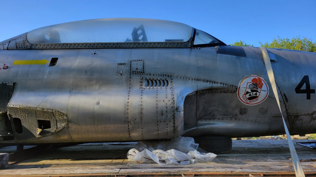
I stopped at the Canadian Tire in Yarmouth to get some oil for the bike, then rode inland to Castle Lake Campground. It was a campground unlike any other I’ve stayed at—the biggest, for sure, with lots of heavy equipment and construction going on, and some unusual artifacts, like a dismantled McDonnell CF-101B Voodoo sitting on a flatbed. I’m not sure what they plan to do with it. At any rate, I was happy for the site because everything else was full.
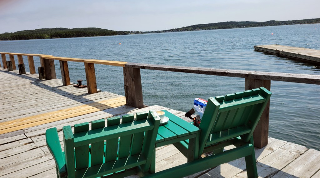
The next morning I was treated to one of those peaceful moments that make camping for me preferable to a cheap room.
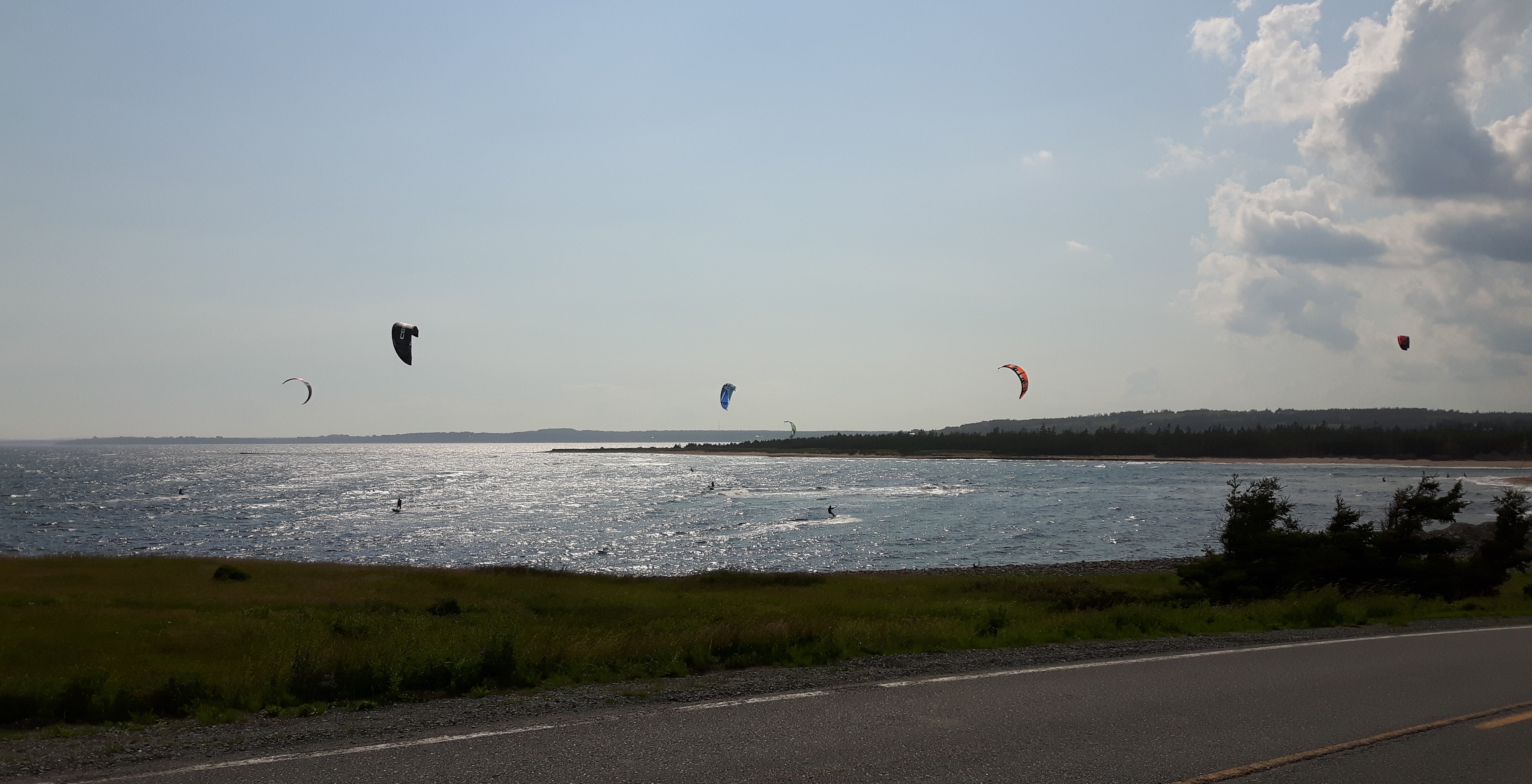
I was now getting near the end of my loop. I rode into Digby and bought my ferry ticket for passage the following day. Then I had the day to spend so I decided to ride the Digby spit. It’s very different from The Cabot Trail, but special too in its own way. Where The Cabot Trail is spectacular and exciting, the Digby spit is quiet and peaceful, but not without some interesting attractions.
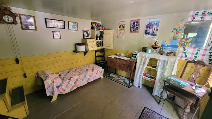
I stopped at the reconstruction of folk artist Maud Lewis‘s home. If you haven’t seen the movie Maudie (2016) starring Sally Hawkins and Ethan Hawke, it’s worth a look. Someone who as a boy knew Maud has built a pretty good reconstruction of her tiny home (the original is in the Art Gallery of Nova Scotia). I have to admit that I don’t understand the artistic merit of folk art, but I can appreciate a good story, and the story of a young destitute woman with numerous physical challenges finding love and artistic success in rural Nova Scotia is a good one and exemplifies much that is right about Canada.
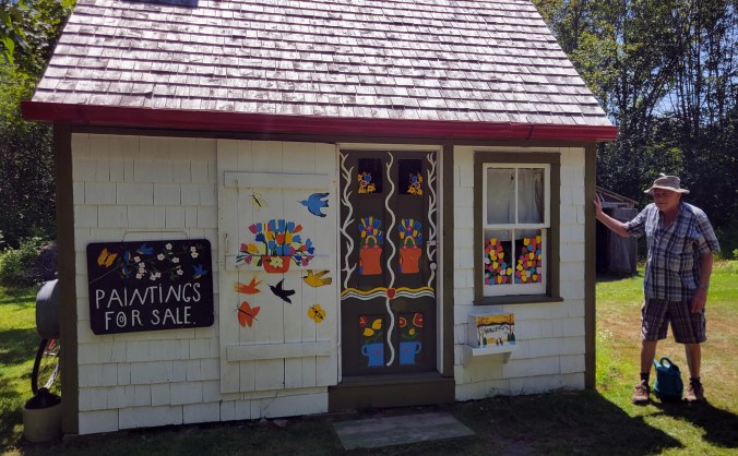
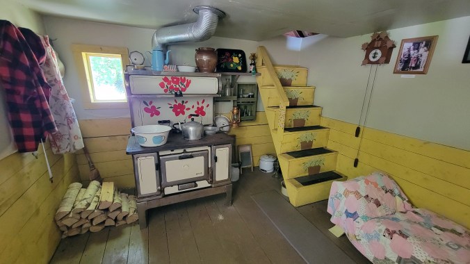
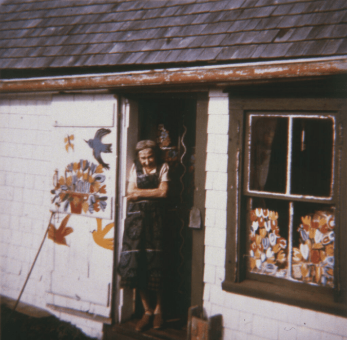
Murray Ross told a few stories from memory about Maud, including that she soaked her paintbrushes in turpentine and the terrible fumes in the little house likely contributed to her lung ailments later in life.
A little further along the spit, I pulled off at the appropriately-named Sandy Cove.
The Digby spit is comprised of several islands. There are free short ferries rides that take you to the outer islands. If you have the time, keep going because there are some interesting attractions further along.
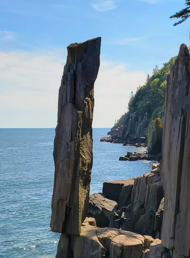
Shortly after getting off the first ferry, look for the sign for Balancing Rock. You have to survive a very buggy hike along a trail to the shore to see it, but it’s pretty neat. (Pro tip: wear your helmet with visor down on the hike.)
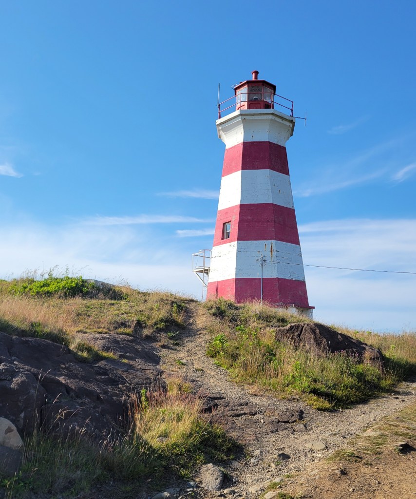
Keep your eye out for whales. Finally, if you make it that far, Brier Island not only has ice cream but also a lighthouse out on the point.
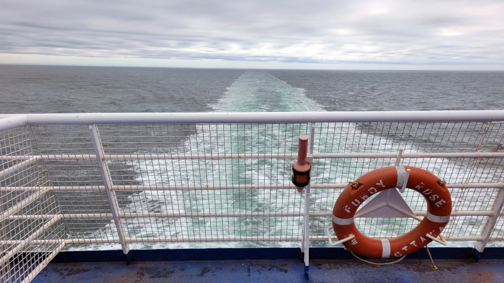
I’d never made it out to the furthest island before, and doing so this time felt like the end of the road for this tour. The next day I caught the ferry across The Bay of Fundy and started heading home, stopping at my buddy Mark’s place again in Rivière du Loup for the night before pushing on to Montreal.
Reflecting on the tour now, midwinter, I have to admit that the planned tour changed pretty dramatically, from an ambitious solo off-road ride across two major provinces, to three weeks on the TQT, to one week on the TQT and one in rural Nova Scotia. Some of that downgrading was from a lack of confidence in my bike, some from a lack of confidence in myself. When I had a stupid tip-over turning around on Mark’s driveway, I discovered that I could barely get the Tiger back up again on my own. My back is not what it used to be, and my confidence took a hit.
I’m working on getting my mojo back. I’ve been working really hard this winter on my strength and fitness to prepare my body for the kind of retirement I want to have, and moving to a bike 150 lb. lighter with Honda reliability will give me confidence again to explore on my own. That includes plans for some epic tours, but I’ll leave that for a future post. For now, I’m looking forward to buying the Honda 300 Rally in the spring and having some fun with the boys on the trails next summer.
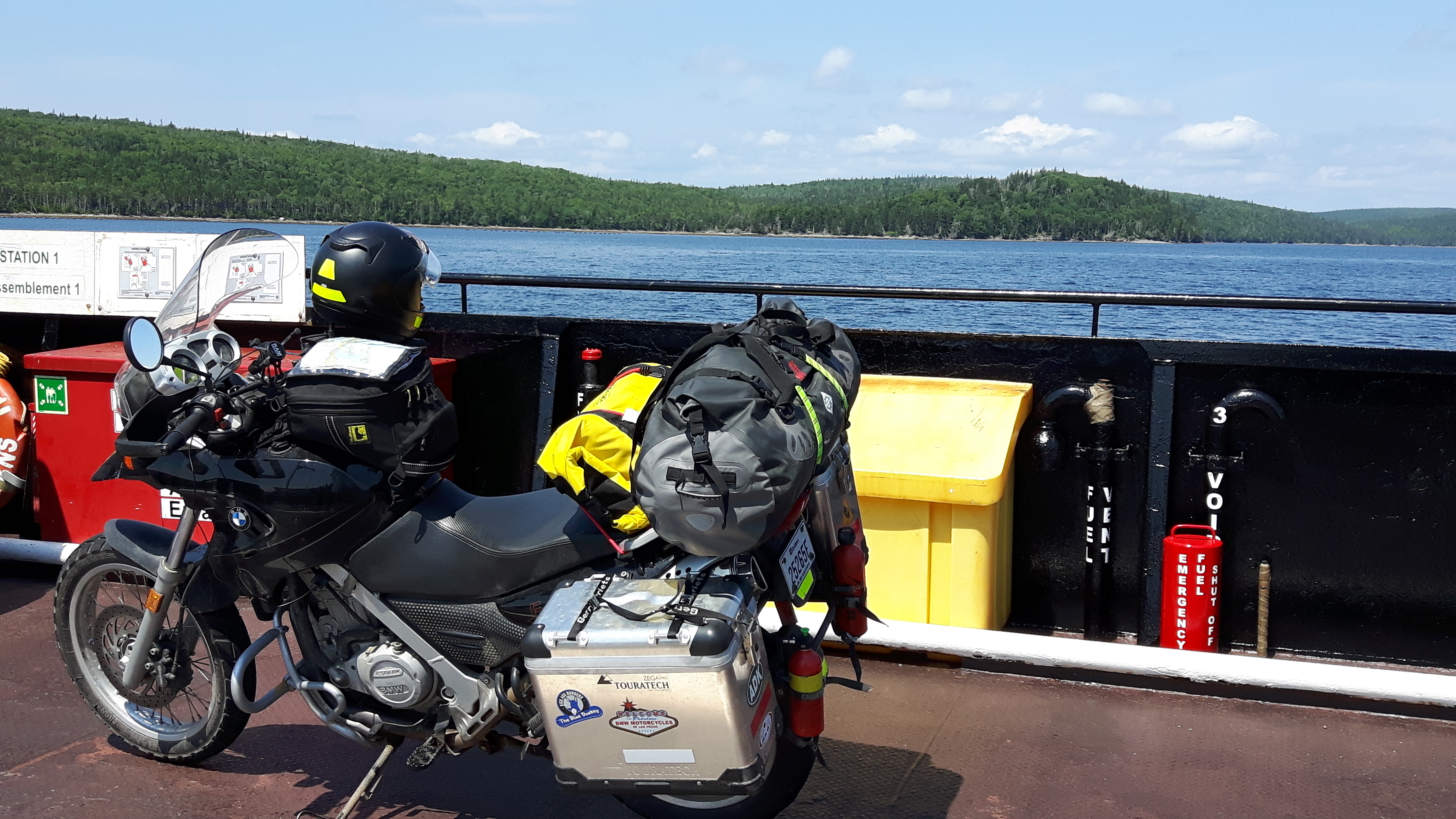 As I started the bike again when we shored, my gas light came on. I was surprised because I thought I had about another 90 km left in the tank, but then remembered I was off by 50 km. My bike doesn’t have a gas gauge, so I have to keep track of how much gas is left in the tank by using the trip odometer; every time I fill up, I reset it so I know where I’m at. At least, that’s what I always intend to do. For some reason, often I forget this crucial step in the filling process. I don’t know why; it just hasn’t become habit yet. And often there’s a distraction of some sort—the receipt doesn’t print, someone starts asking me questions about the bike, I’m dying to take a piss—and only remember after I’m back on the bike riding. Then I have to reset it while riding, which obviously isn’t ideal.