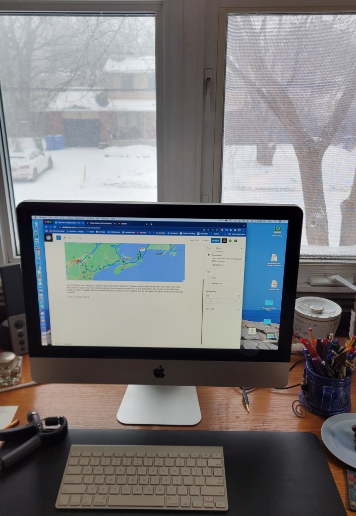
Sketching out the next big adventure

As I write this, we’re having yet another major snowfall in Montreal. It’s been a particularly snowy winter and after a few mild days, some of us got lured into thinking spring is just around the corner. But as I sit looking out the window of my 2nd-storey study, it’s hard to imagine that the Montreal Motorcycle Show is next weekend and we can legally be back on the road in less than a month.
Still, I must continue making travel plans in a kind of blind faith in the power of nature. If I put on my cheap Dollar Store shades, all that white outside becomes a shade of green, and I can almost imagine it being June and setting off. With this trip, there are some reservations that have to be made, like booking the ferry on and off Newfoundland, so I have started to map out a rough outline of our planned exploration of the Canadian east coast. This will be the book-end tour of the west coast trip of 2021.
Learn from your mistakes
I’m trying to keep in mind what I learnt from that last one, specifically, sometimes less is more. That’s what I keep telling my students, anyway, who think they are clarifying their thesis statements by adding clause after clause. The last trip was spent too much on the Superslab in my need to cover distance in the time I had. I don’t want to make the same mistake so am trying to be realistic in what we can see in the time we have away from the dog and our jobs. Marilyn, the domestic accountant, likes to remind me about our budget too.
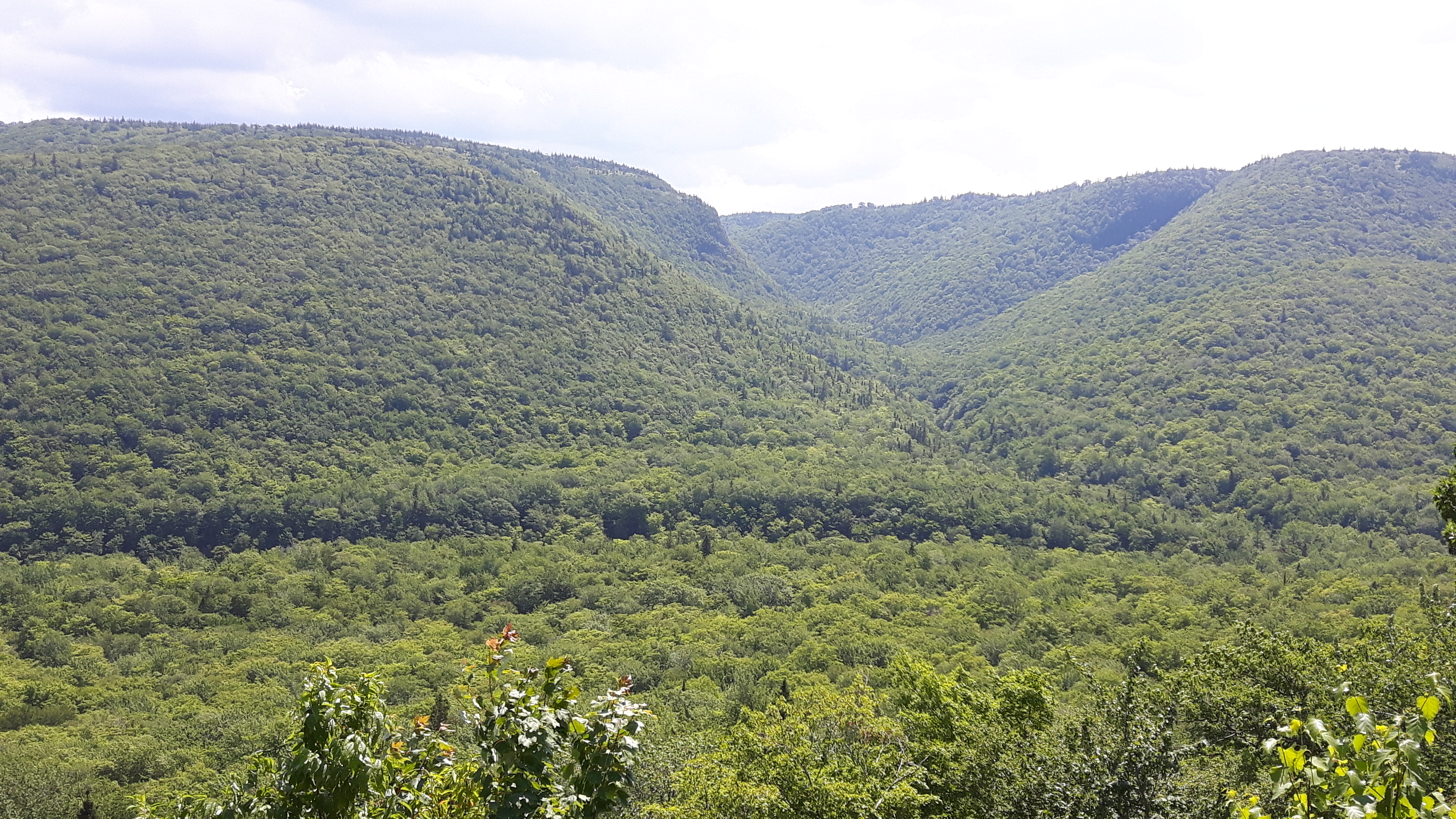
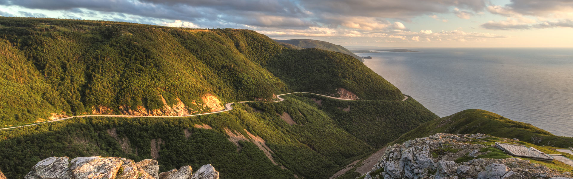
My first route planned included The Cabot Trail. It seems sacrilegious not to “do” The Cabot Trail if you are anywhere within 150 kilometres of it on a motorbike, and we will be passing through Cape Breton en route to Sydney, NS, where one catches the ferry to get to Newfoundland. But my practical wife reminded me that we have been to Nova Scotia several times and both ridden (at least, I did) and driven The Cabot Trail and maybe we should devote that time to Newfoundland and perhaps Prince Edward Island, which we haven’t visited. This is a classic case of idealism (i.e. “we can do it all”) versus realism (“we are only human”) so we’ll see in the coming months which ideology wins.

Gaspésie, PEI, Nova Scotia, Newfoundland
What we do agree on is that we’d like to ride the coast of the Gaspé Peninsula, or as they like to call it here in Québec, La Gaspésie. I’ve driven that before and it’s spectacular. Marilyn hasn’t seen the Roche Percé, and like the Butchart Gardens we visited on Vancouver Island, we will make a stop at the Reford Gardens in Matane, QC. Forillon National Park at the tip of the peninsula is pretty special too.
Another decision we have is whether or not to visit Prince Edward Island. Our Insight Guides book suggests a three-day 250-kilometre road trip that includes Charlottetown, Argyle Shore Provincial Park, Brackley Beach, and the West Point Lighthouse near Cedar Dunes Provincial Park. Hopefully, those provincial parks offer camping. Technically, I’ve been to PEI, but I was too young to remember much. If we can’t work it in this summer, we will definitely get out there next. Aside from NWT and Nunavut, PEI and Newfoundland are the only provinces or territories I haven’t visited, so I’m hoping we can devote a few days to get a taste of the island.
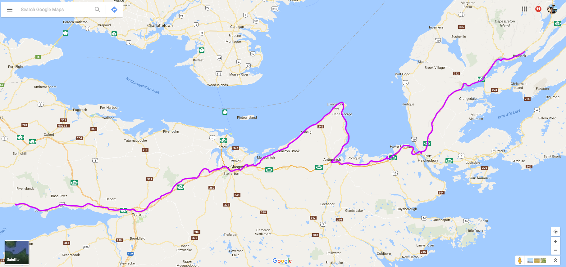
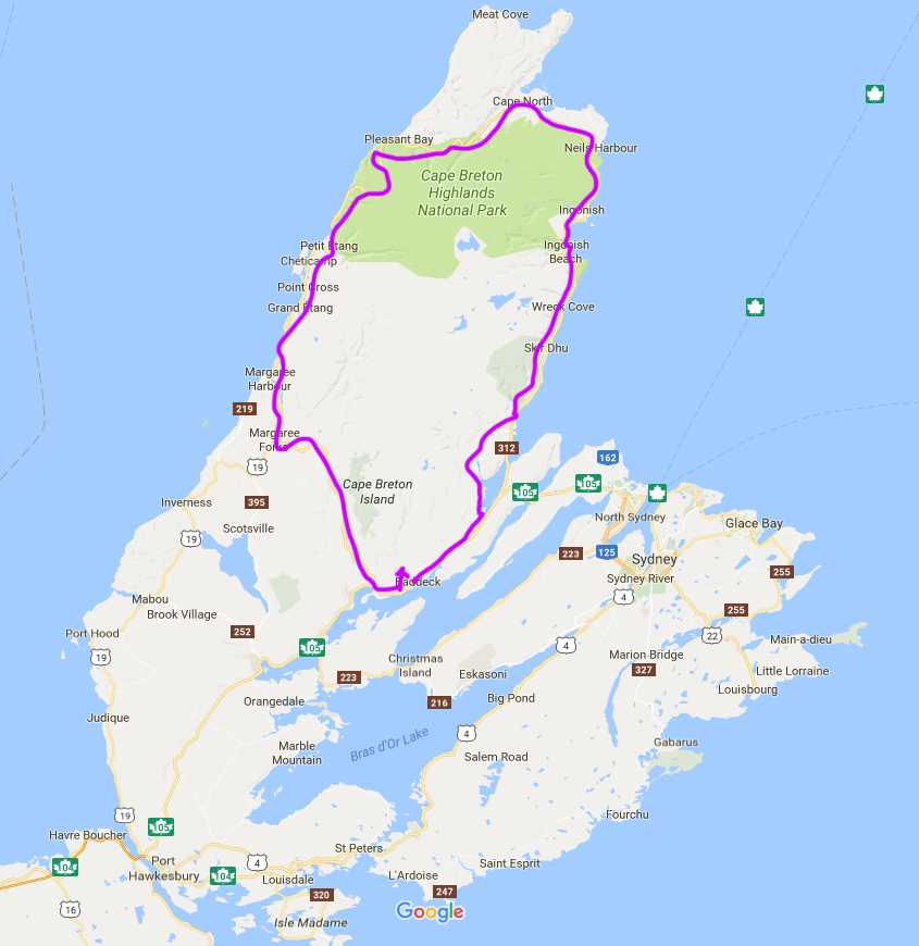
Should we take the day or night ferry to Newfoundland? There are pros and cons of each, as I see it. A day crossing might be time wasted, just looking out for 7+ hours over endless water. I know there might be the opportunity to do some whale watching, but I’m sure we’ll be doing some of that once on the island. A night crossing is more expensive if you buy a cabin and try to get some sleep. On the other hand, the cabin isn’t any more expensive than a motel room, which we’d have to get soon after landing from a day passage. I’m leaning toward a night crossing. I’ve never experienced sleeping on a boat like my parents did when they immigrated on the Queen Elizabeth II and I think it would be novel. If we cross during the day, we will camp at a favourite campground in Baddeck in order to get to the ferry in the morning; if we cross at night, there might be time to ride The Cabot Trail or stay at Meat Cove, which is an amazing campground off The Cabot Trail right at the eastern tip of Cape Breton Island.
If you’ve visited Newfoundland, what did you do and why? I’m open to advice. There is a growing sense of urgency to decide, especially if we want a cabin as they sell out early, so decisions have to be made soon.
Neither Marilyn nor I has visited Newfoundland before, so this is going to be a treat. Again, we can’t do it all, and we’ve decided to focus on the west coast. Gros Morne National Park is a bucket list item. Then we will continue up the coast on what’s called The Viking Trail because I like history and am interested in seeing the Viking settlement at L’Anse aux Meadows. Then we will cross the island to Saint John’s because, well, you can’t visit Newfoundland without strolling around Saint John’s, including “hydrating” at a pub on Water Street before climbing Signal Hill. I’ve heard and read about these places and look forward to exploring them in person.
Finally, we have to decide whether we have time to ride The Irish Loop, a 325 kilometre loop along the coastline south of Saint John’s. The name is intriguing since we both have some Irish blood. And anything along a shoreline is bound to please me on the bike. Our guidebook suggests 2-3 days for this, so it really depends on if we can fit it all in.
Maine, New Hampshire, Vermont
Currently, the plan is for Marilyn to fly out of Saint John’s back to Montreal like she did from Vancouver when we were out west, and I’ll continue on solo. And I’m pretty sure I’ll come back via The United States instead of my initial plan to return via Labrador and the north shore. Like the caribou during their migration, I’m detouring to avoid bugs. Besides, the riding through Maine and New Hampshire will be more interesting than through Labrador. I recently purchased a subscription to Rever, which classifies roads on a colour coding system, and there’s a cluster of G1 (Best) roads in the White Mountains of NH that is calling my name.

I might saunter my way back along the coast, checking out Bar Harbour and a few other places before cutting diagonally north-west through the White Mountains. Without the deadline of ferry crossings, this will be the unplanned, unscheduled segment of the trip, which is generally how I like to tour. Maybe I’ll stay an extra night in New Hampshire so I can ride those primo roads unladen with gear.
This trip is going to take me about three weeks—two weeks with Marilyn, and about a week solo to get back. After a short rest in which I’ll service the bike and change my tires to something more dirt-oriented, I’ll head off again, this time to ride some BDRs. It’s going to be a full and exciting summer on a new bike, and I’ll have lots to write about so click Follow if you want to follow along.

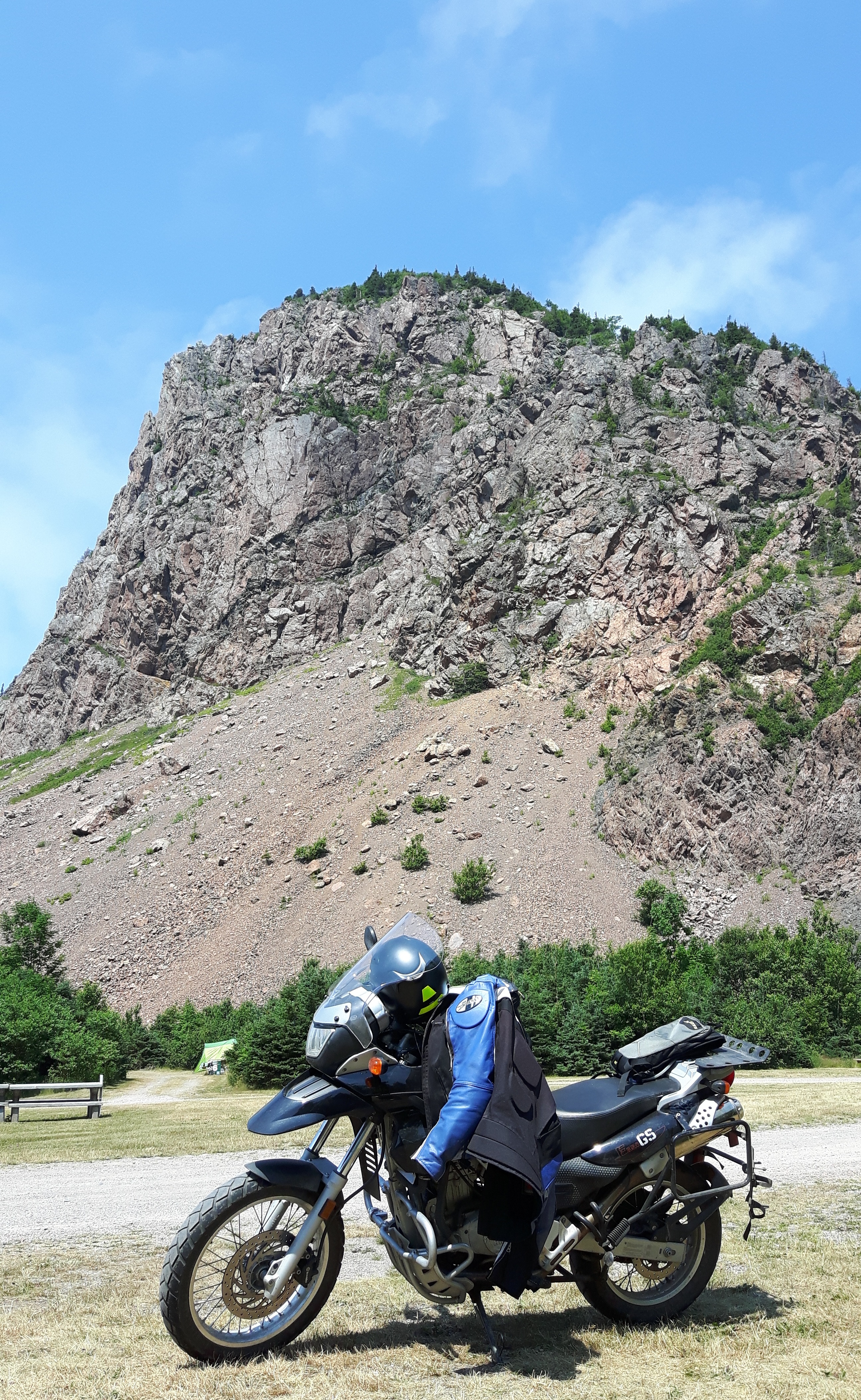
 I’m not sure why it’s called the Sunrise Trail since it faces northwest, not east, but it’s pretty nonetheless. At one point, just west of Arisaig, I saw a dirt road leading off from the 245 and decided to go exploring. This is what I love about adventure riding and my bike—the ability to get off the asphalt when curiosity beckons. A short ride in led to a perfect lunch spot overlooking the ocean, complete with a picnic table to prepare my sandwich.
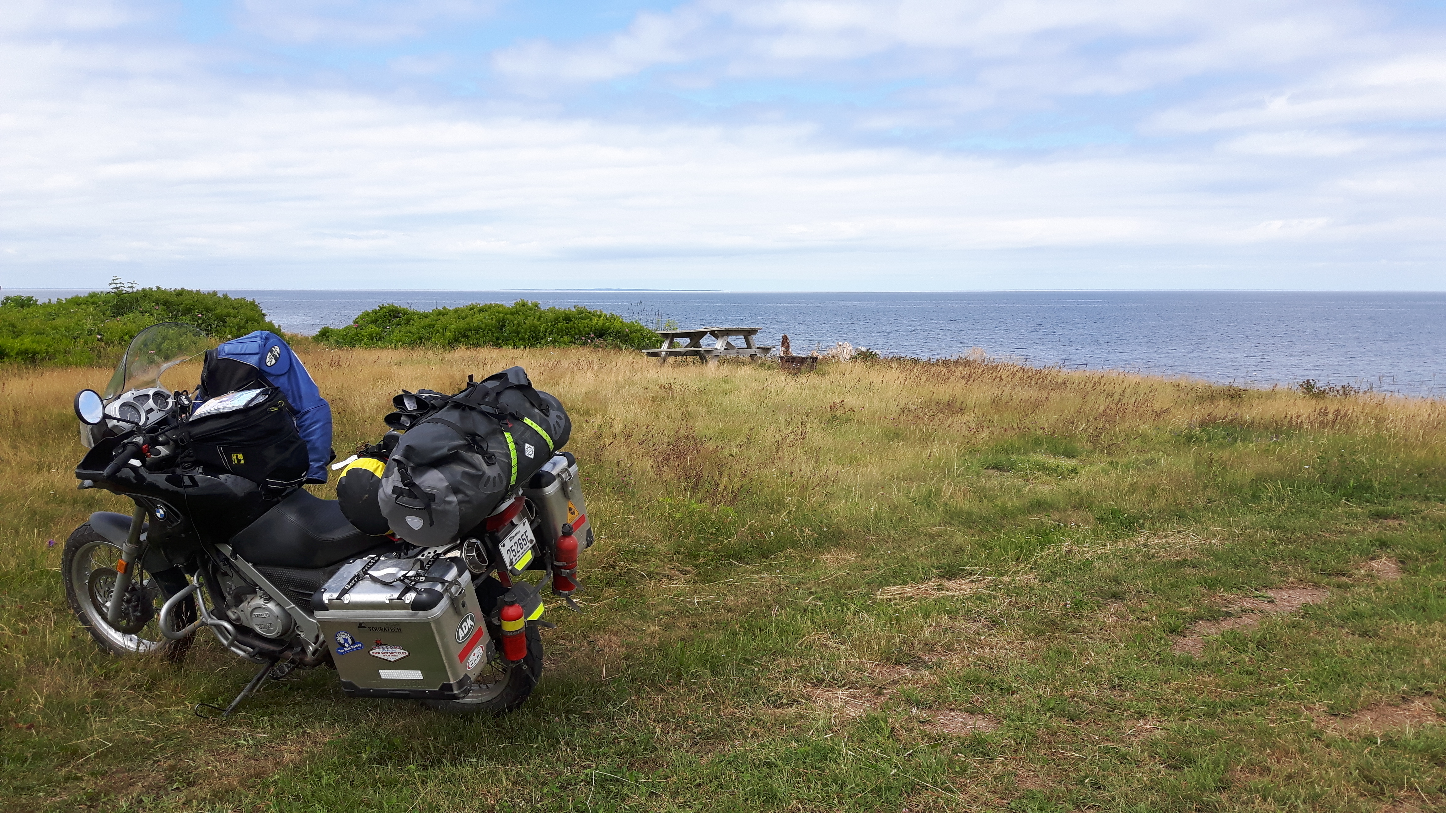
 I love this campground! My wife and I stayed here when we vacationed in Cape Breton two years ago, and she found it, so I can’t take any credit. It’s a very well run campground with wooded sites, clean washrooms, friendly service, a heated pool (nice after a long day of riding), free showers and, a personal favourite of mine, a campers’ lounge. I have to admit, I didn’t take to the lounge right away; it has a TV and seemed like what one tries to escape by camping. But this time round I was forced to sit there to charge my phone, and found it a pleasant place to write or read, especially on the evening it rained. I decided to stay an extra night at Baddeck.