“April is the cruelest month,” T. S. Eliot wrote as the opening line of his iconic poem “The Wasteland” (1922). Clearly, he had never experienced a Canadian March. As I write this on March 25th, we are 10 days into the new riding season, yet no one is riding. It’s 2C (36F) and the sky is a slab of grey slate pissing cold rain that turns to ice in patches on the treacherous sidewalks. Brown, dirty snow still sits at the sides of the roads and in patches on lawns, slowly melting over weeks to expose winter garbage and dog shit lying underneath, and the grass, when it finally pokes through, isn’t really grass but mud and last year’s soggy, decaying leaves. Eliot’s poem captures postwar disillusionment and his nervous disorder, but it might equally describe the mood of Canadian bikers in late March.
Nevertheless, we continue to plan and prepare for the season to come in a kind of blind faith. Yesterday I did a practice pack of my gear. I’m trying a new gear set-up and have the ambitious plan of eliminating my tank bag, tail duffle bag, and hydration knapsack. I want to ride this year without the extra weight either on the bike or my back. To do that, I had to be as ruthless as Ezra Pound was to Eliot’s manuscript.
Gear
I replaced my tent and mattress with a hammock and bug net. I’ll be touring midsummer so I’m going without a hammock underquilt. I also swapped my MSR Dragonfly stove and 2L Billy pot for an Odoland isobutane stove and pot, but I’ve added to my kit a Bushbox twig stove. I’m not sure which will become my primary stove, but the idea is to use the twig stove when dry wood is readily available and the isobutane when it’s not. And as a back-up to the back-up, just for its simplicity and ease, I’ve also picked up a Trangia alcohol burner. This fits nicely inside the Bushbox and can burn isopropyl alcohol, available at any pharmacy. Can you tell I’m nervous about giving up my Dragonfly?
My camping mates will be happy to know that I finally retired my toy hardware store hatchet and bought a Gränsfors Bruk Wildlife Hatchet. I don’t know why I suffered as long as I did. I’ll be using this around camp to prepare firewood and split firewood into twigs for the Bushbox. I’ll be travelling solo so edited out of my kit the second plate, cup, and cutlery, resulting in my cookware now being considerably smaller and lighter.
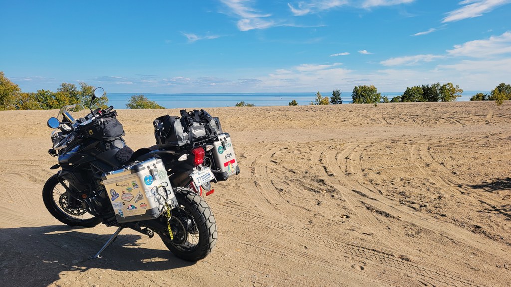
When I did The Timber Trail at the very end of last season, I found my Wolfman Expedition tank bag too big and heavy, making the Tiger more top-heavy at slow speed than it already is. It also worked better on the 650GS with the fuel cap on the side of the bike and not under the bag. It would have been possible to move the essentials to my hydration knapsack, but I want to eliminate it too. Water is heavy and the knapsack restricts airflow through a jacket. Mine also interferes with my neck brace. (If it goes under the brace, the brace sits too high; if it goes over the brace, the brace digs into my shoulders from the extra weight.) Instead, I’m going to try a fanny bag with only a few essentials from the tank bag: aux port to USB adapter, some electrical cords, a Leatherman Wave, tire pressure gauge, 8mm socket and micro-ratchet for my pre-load adjuster, and my monocular. I think fanny bags are nerdy, especially if worn in the front (i.e. the scrotum bag), and I wouldn’t be caught dead in one anywhere but on the trail, but one might be the answer to staying cool and unencumbered on the bike. If they find me dead somewhere on a trail this summer, at least my reasons for wearing one are now known.
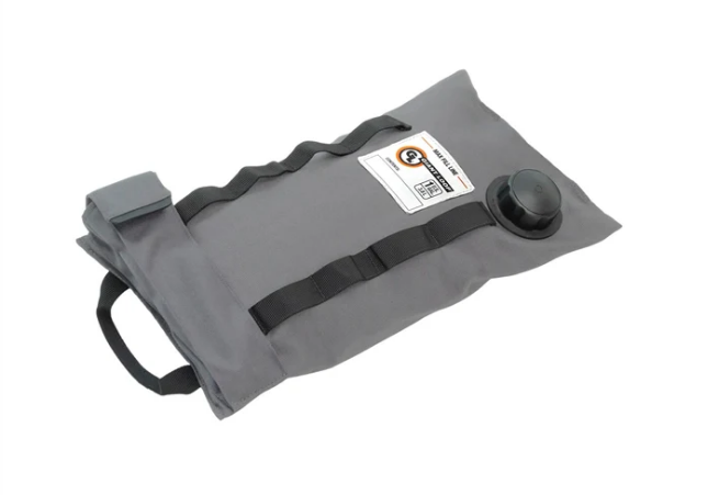
As for water, since I won’t be needing to bring a fuel bottle for the Dragonfly stove, my bottle holster is free. I’ve moved it from the back of a pannier to the front left side and will try the Simple Modern Insulated Tumbler with Straw and Lid for sips when I can. It’s only 28 mL so I’ll also be carrying an MSR 4L Dromedary to refill it as needed. Marilyn and I took the latter through Newfoundland but never used it much, so I was ready to retire it from my kit, but I’ll be doing some pretty remote riding midsummer so will strap the Dromedary onto the bike along with a 1G Giant Loop Armdillo bag to extend my range to around 400 km (~250 miles).
Giant Loop Armadillo Bag
After the practice pack last night, I can confidently say that almost everything fits into my Enduristan Monsoon Evo bags. I’ve added two Enduristan Fender Bags onto my panniers, into each fits perfectly a 10×10 Aquafest Safari Tarp. (I’ll be taking two—one for over the hammock, one for shelter.) My tools and tubes, as always, will go in two Giant Loop Possible Pouches that I strap to the crash bars at the front of the bike. I say “almost” because I will still have to have a small Enduristan tail bag on the rack at the back for my rain jacket, windbreaker, and down vest—my layering system to deal with temperature changes. I can live with that.
Finally, I’ve added to my gear to prepare for the risks of off-roading. I have a Knox compression suit and recently purchased the chest protector upgrade that doesn’t come standard with the shirt.
Knox Venture ShirtChest protector upgrade
I swapped out Level 1 armour for Level 2. I also recently replaced my ageing Arai Signet-Q helmet with a Contour-X. I know, I know: why didn’t I get an XD-5 or similar adventure helmet? Well, I already have an adventure helmet, the LS2 Pioneer, and this will be my touring helmet. The peak causes wind noise and I was looking for the most comfortable, quietest, safest helmet on the market, and the Contour-X fits me like a glove.
Route
I’m sorry, my American friends, but I’ve decided that I can’t do this summer my planned ride of The Blue Ridge Parkway south and the BDR’s coming back. This will be the 3rd time I’ve postponed this ride, and I don’t do it lightly. I was looking forward to exploring the Appalachian Mountains and challenging myself on the MABDR and especially NEBDR, but after much deliberation, I’ve decided to join my fellow Canadians and stay north of the border this summer, that is, the “artificially drawn border.”
What makes this decision especially difficult is that I have always found Americans extremely friendly and helpful, and I recognize the difference between Americans and their government. But lately we Canadians have been hearing of visitors having their phones confiscated at the border and searched, and some Canadians detained, and even some anti-Canadian sentiment from certain states that shall remain unnamed, so I don’t feel entirely safe to visit while tensions are this high. I’ll be travelling solo in remote regions so am especially vulnerable. It’s really unfortunate that it’s come to this and I hope our good relationship can be restored quickly so I can complete that bucket list ride.
Instead, I’ve decided to do some of the Trans Quebec Trail. This is a system of trails throughout Quebec. Initially I was going to do a section of the TCAT (Trans Canada Adventure Trail) called The Forest that runs from Baie Comeau, Quebec, to Kenora, Ontario, but that gps track isn’t always kept up to date. My Calabogie Misadventure ride a few years ago was largely a result of the track not being kept current; my riding buddy and I didn’t know that a bridge was out and were forced back out onto a gnarly hydro line. The big benefit of the TQT is that there is an accompanying app that is user-submitted; if there’s a problem on the track, one can immediately report it with the press of a button. The app also shows campgrounds, gas, groceries, attractions and more, so I feel I can ride with a lot less stress and simply explore, as I like to do, finding the essentials when needed. Thanks to Marc Chartrand and his team for putting this route and app together.
I plan to pick up the track south of Montreal and follow it east to Rimouski and beyond, perhaps into the Gaspé interior. Then I’ll cross the St. Lawrence River (uh, by ferry) from Matane to Baie Comeau and come back by the north shore, up through northern Quebec with some of the most remote riding I’ve ever done. It loops over Lac Saint Jean, where Marilyn and I visited last fall, but on dirt roads this time. Apparently about 90% of the route is dirt and gravel. You can see the entire trail and photos at the STQT Facebook page. I don’t know how long this will take me and I don’t have a definite schedule, but that’s the kind of adventure riding I like. With the app and riding solo, I can play it by ear and simply explore at my own pace. Teachers’ benefits.
Training
To prepare for the off-road element of this tour, I’ve decided to do some more instruction this summer. When I got my licence in 2016, I did some classes to get a Level 1 foundation, but it’s been several years since and I’m ready to improve on those skills. I’m going to look into the Level 2 class with Académie Ridaventure. Their Level 2 class covers such things as water crossings, clearing obstacles (logs, large rocks), and brake slides. I think it’s always good to develop your skills, and I feel I’ve plateaued recently.
I hope to do a semi-private Level 2 class.
“Ah spring!”
There’s another poem I know about spring. Unlike Eliot’s 434-line masterpiece, this one contains two words: “Ah spring!” I know it by heart. It’s been a brutal winter with record snowfall in Montreal and frigid temperatures for months. No January thaw this year. But we’ve finally arrived at the cusp of spring and the riding season.
If there’s one positive of the off-season, it’s the opportunity to “reculer pour mieux sauter,” as D.H. Lawrence said, step back to jump forward. It’s a time to dream and plan for adventures to come. I’m ready; the bike is ready. It may not be the cross-country tour I did in 2021, but in many ways it feels like this tour will be my most ambitious and the one I’ve been working towards since I began riding in 2015. It’s the kind of ADV remote touring I wanted to do on the cross-Canada tour but didn’t have the time. I discovered then that this country is so large that you have to explore it one province at a time, and I guess I’ll start with the one I’ve called home now for 35 years.
What are your plans for the season? What changes have you made to your bike and kit to prepare? Drop a comment below. Whether you are an armchair adventurer or a seasoned traveller, despite what Nature presents us today, it really is a special time of year. Keep the faith, my motorcycle friends: we’re almost there.
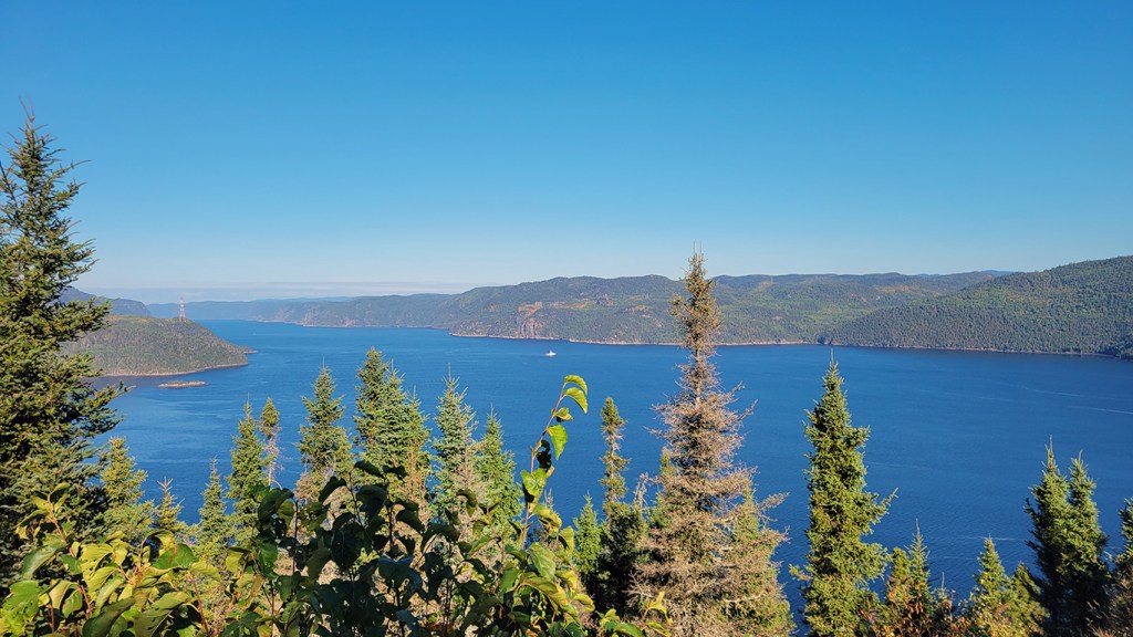
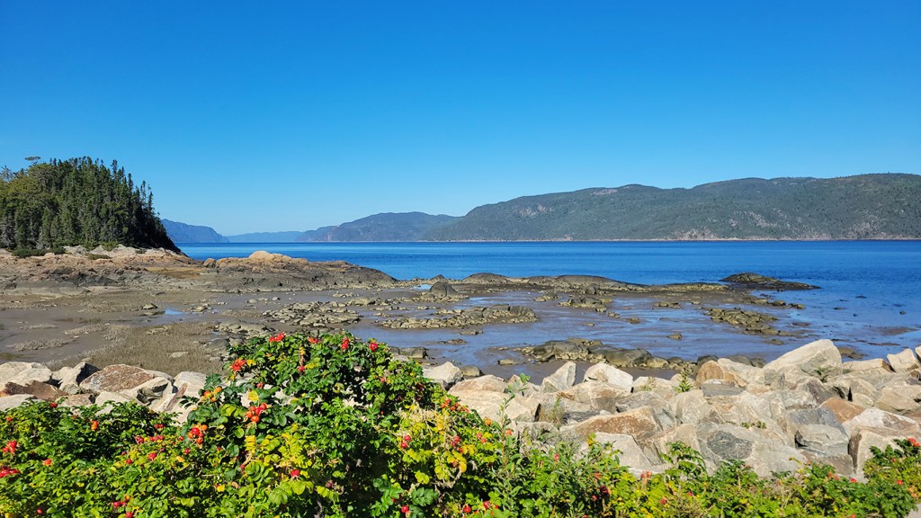
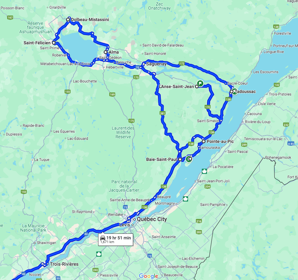
Maybe second only to Gaspé, the Saguenay fjord is the ride to do in Quebec. It’s therefore surprising that I’d never gotten around to riding it until this past fall. From Montreal, you need about four days for this tour. Marilyn and I went over our anniversary weekend in late September when the leaves were beginning to turn colour and it was the best time to visit.
It was getting a bit cold for camping, so we decided to leave the tent at home and get rooms at B&B’s, which in these parts are called gites. This trip would take us not only up the Saguenay fjord but also across the top of Lac Saint-Jean and through the beautiful Charlevoix region, known for its popularity with Quebec’s most famous painters. What Algonquin Park is to The Group of Seven, Charlevoix is to Clarence Gagnon, René Richard, Jean-Paul Lemieux, Marc-Aurèle Fortin, Bruno Côté and Claude Le Sauteur, among others. In fact, Charlevoix is so beautiful it was also visited by A. Y. Jackson and Arthur Lismer of The Group of Seven. When Marilyn first visited Quebec from Alberta in 2007, I knew where to take her. (I’m still wondering if she fell in love with me or La Belle Province first.)
The only issue with Saguenay as a destination from Montreal is that you have about 3 1/2 hours of gross highway riding to do before it starts to get interesting around Beaupré, just east of Quebec City. And to make matters worse, within the first 10 minutes of hitting the highway, I knew I had the wrong windscreen on. I have a touring screen and a standard screen, and I’d been experimenting with different set-ups (they are both adjustable) prior to leaving, looking for a solution to the wind noise on the bike. I’ll be writing something about that elusive search for The Holy Grail in an upcoming post, but suffice to say here that the standard screen doesn’t work for touring. Marilyn and I couldn’t even hear each other in our comms because the wind noise at highway speed was so bad. Damn! I’d prepared the bike by changing the tires from a 50/50 (Anakee Wild) to a 70/30 (Shinko 705) but should have swapped the windscreen too.
There are several options for touring the Saguenay fjord. Many people head north on the 155 at Trois Rivière up through La Tuque all the way to Lac Saint-Jean and then down the Saguenay River on either the 170 (east side) or the 172 (west side). Others go all the way to Tadoussac, and either cross on the ferry and ride up the river on the 172 or don’t cross and ride up the 170. If you do that, you have a few options for how to come down: the 169 from Alma, the 175 from the town of Saguenay, or the 381 that cuts through the interior. Basically, all roads in this region lead to Lac Saint-Jean, and you have your option of no less than five to choose from on how to get there and back.
We had already driven up the 155 as far as La Tuque a few years ago when we camped at La Mauricie National Park so didn’t want to repeat that, even if it would be on the bike this time. We had a recommendation of an excellent B&B in L’Anse Saint-Jean on the 170 so decided to make that our destination for the first day. And I had a recommendation from someone at the Overland North gathering I attended in Calabogie to not miss the 381, which is smaller and twistier than the other roads. We also wanted to see Tadoussac, so connecting these dots meant riding part-way up the 170 on our first day, then doubling back the next morning to Tadoussac, riding the 172 up to Lac Saint-Jean, and taking the fun 381 back down. It wasn’t the most efficient route, but when does efficiency matter when you’re on a bike?
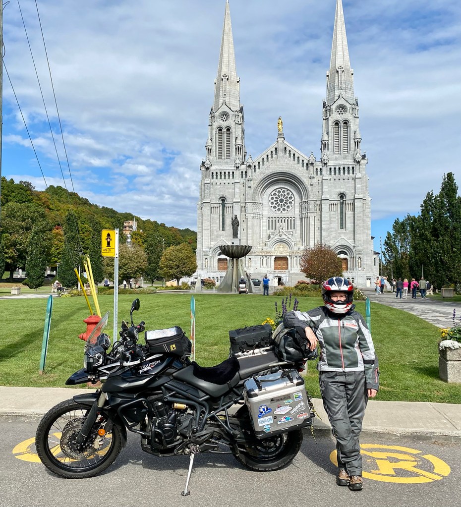
We blasted past Quebec City and didn’t stop until Sainte-Anne-de-Beaupré, where there is a famous cathedral. When the Pope recently visited Canada, he did a mass there, so if it’s suitable for the Pope, we figured it’s worthy of our presence as well. But we were on a tight schedule and it would have required a significant time commitment to go inside, so we opted instead just to make it a quick rest stop. (We’ve gone inside before and, trust me, it’s beautiful.) We still had a ways to go and had a dinner reservation at our inn in L’Anse Saint-Jean.
Our true sanctuary is nature and we were eager to get up into the hills of Charlevoix. Shortly after leaving Beaupré, Highway 138 begins to climb, and the geography suddenly takes on a completely different vibe. It’s hilly, pastoral, and there’s open road overlooking the St. Lawrence River with historic houses dotting the roadside.
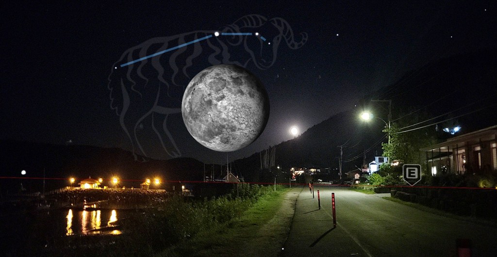
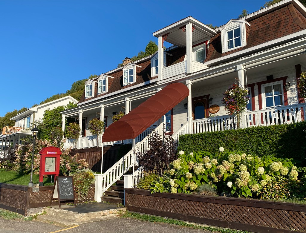
The recommendation from our club captain was a good one! While I didn’t do those rides, my club has stayed a few times at La Fjordeliase and it’s become a favourite. After an exquisite dinner (the scallops are not to be missed), we went for a walk along the shoreline. L’Anse Saint-Jean is magical, and there was a full moon that night!
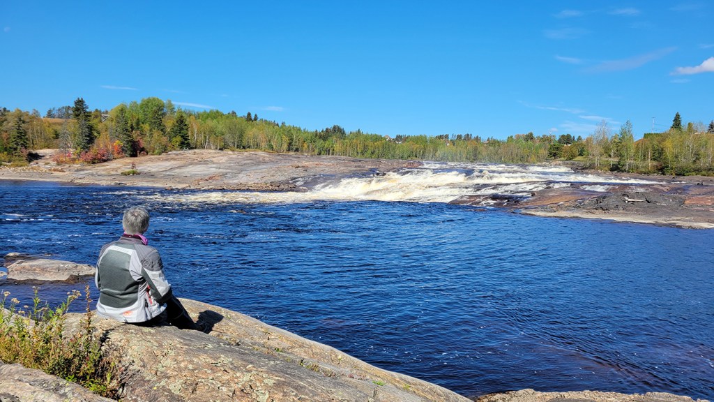
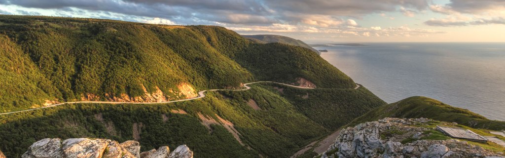
The next morning we hiked the trail behind our inn up to a lookout. It’s about a 2 km hike but all uphill with some steep sections. We were definitely feeling our age but happy we’re still able to do such a hike as the view at the top was worth the effort. (See banner photo above.)
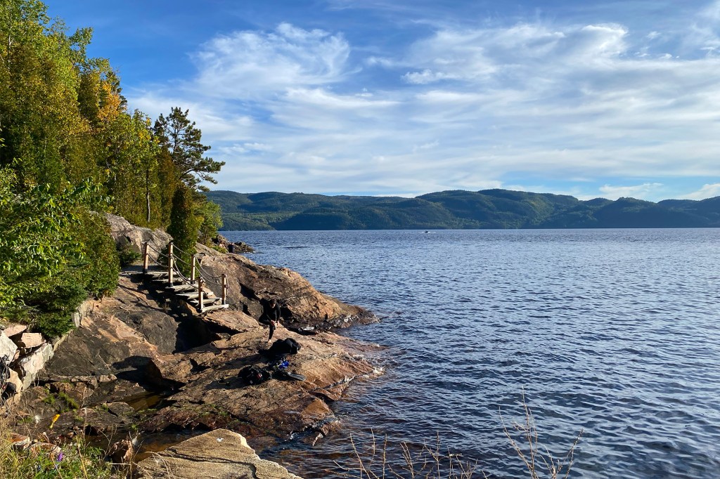
Back at the inn, we took in the shoreline and the view of the fjord one last time, packed up the bike, and headed off, down the 170 toward the 138 again. We didn’t get far before we saw a sign for Petit-Saguenay and a small road heading toward the river. One of the disappointments, I must say, with the tour is the lack of access to the Saguenay River. The major roads are inland and you don’t actually see the river very much. (By contrast, the 155 mentioned above hugs the shore of the Shawinigan River all the way to La Tuque and is more scenic.) But rue du Quai, splitting off from the 170 at the town of Petit-Saguenay, provides a rare opportunity to get down to the river so we took it. I’d heard it’s a special spot, where the Saguenay and Petit-Sageunay rivers meet. Indeed, this inlet provides the longest unobstructed view upriver of the fjord, according to a placard on the wharf.
Looking upriver at Petit-Saguenay
Back on the 170, we were cruising and taking in the views, and I guess I wasn’t checking my mirrors very often because I was suddenly startled out of my saddle by a sport bike passing me at twice my speed. And another, and another, and on it went, a stream of maybe a dozen sport bikes out for their Saturday morning rip. I guess the police presence in these parts is pretty thin and there’s no track that I’m aware of so if you have a sport bike, these are the roads you use as a track. They were passing other vehicles on the two-lane road like there was no tomorrow, which there wouldn’t be for any who make a mistake. No wonder they have to pay $2000 a year to register their bikes here in Quebec compared to the “paltry” $800 I pay to register my adventure bike. Later we saw them gathered beside the road down at the 138 in Saint-Siméon, clearly taking a breather before turning around and doing it all over again.
We took the free short ferry and arrived in Tadoussac. I’d passed through Tadoussac a few times before but didn’t remember it being so touristy, which is not my cup of tea. You know you’re in a tourist town when you have to pay for parking, and we rode around quite a while looking for where to leave the bike while streams of tourists blindly criss-crossed the road in front of us. Finally, we found a spot in front of a microbrewery pub that was a little off the main street and had a terrace with a view of the gulf. Nice!
Our next stop after lunch was The Dunes. You will find them just east of Tadoussac. It’s an unexpected area of sandy hills overlooking the river. I wanted to play in the sand but the bike was fully loaded and undersprung, and I was feeling the weight the entire trip as the bike had a tendency to wallow at slow speed. (I changed the spring and serviced the shock once back in Montreal.) Marilyn was digging the place because you can see the different depths of the water from this vantage point, and she took a bunch of photos while I stayed with the bike. I would get my fun on the dirt road shortcut that lead us back to the 138 while Marilyn grumbled into the comms that we should have doubled back on the asphalt.
The Dunes, overlooking the St. Lawrence River just east of Tadoussac.
Soon we were heading north on the 172. It’s a fun road, and yeah, the cops are few and far between in this region, but I had speed control riding pillion so had to be good. Since we couldn’t hear each other very well in the comms due to the wind noise, Marilyn and I had developed a system whereby if she wanted me to slow down, she’d tap my left shoulder, and if she wanted me to stop, she’d tap my right. This form of backseat driving worked reasonably well, but unfortunately sometimes the D3O shoulder armour in my jacket worked a little better.
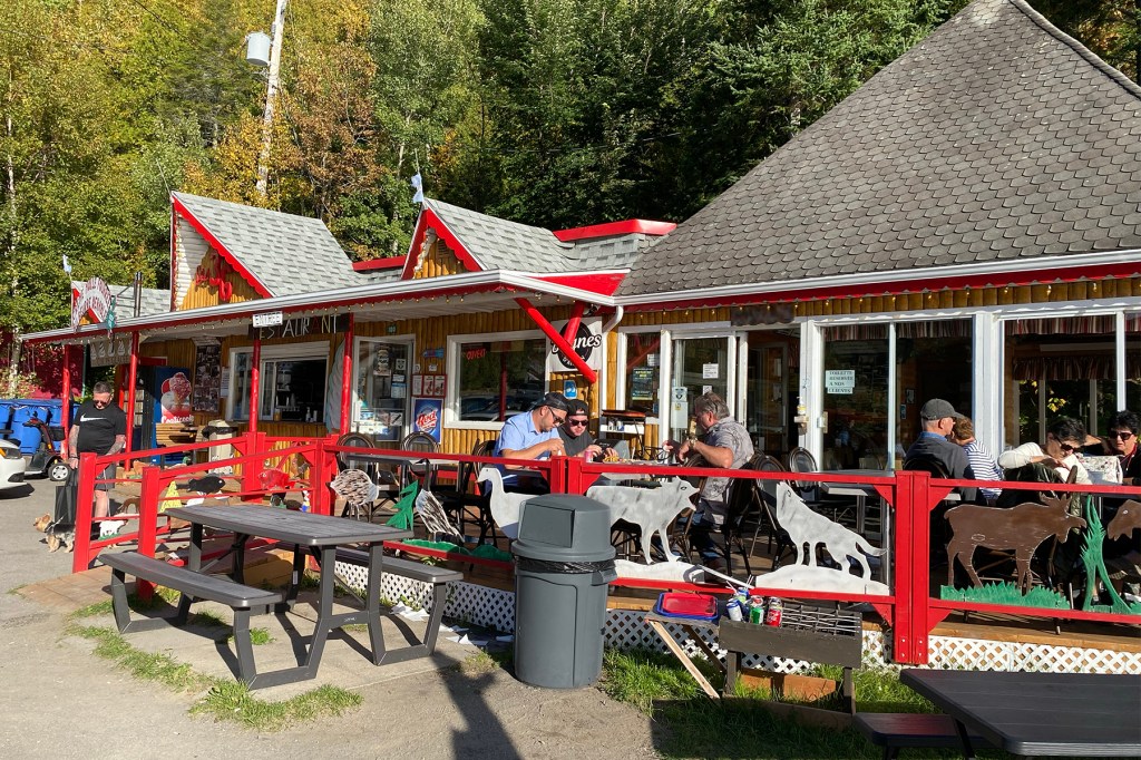
Marilyn had done a little research prior to leaving (somebody has to) and said there was a good rest stop at Sainte-Rose-du-Nord, a pretty little town that has a quay and offers a good view of the river. What L’Anse Saint-Jean provides on the west side of the Saguenay, Sainte-Rose-du-Nord does on the east—access to the river and a view of the fjord. We pulled in mid-afternoon in search of coffee.
Ste-Rose shorelineSte-Rose shops and diner
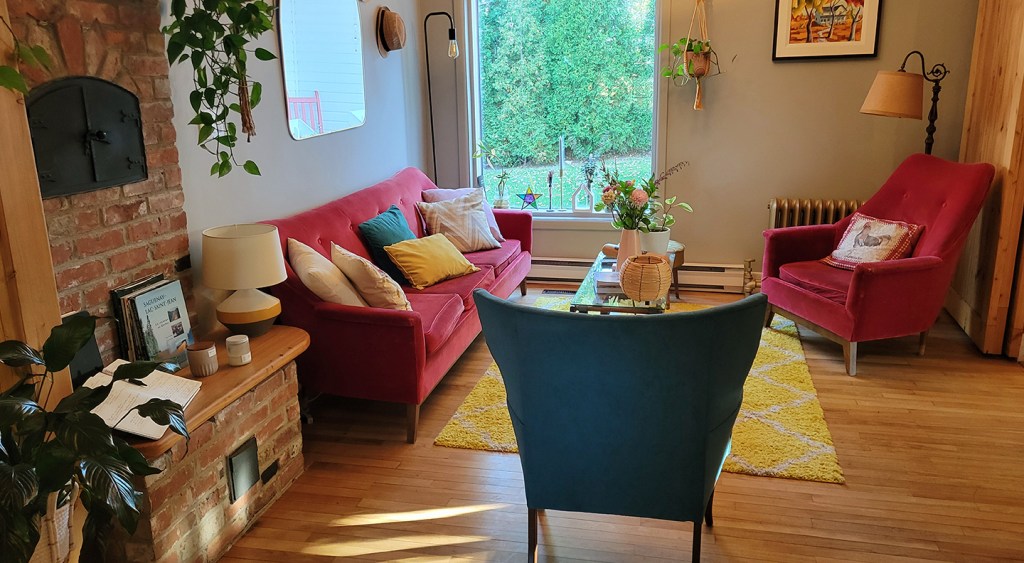
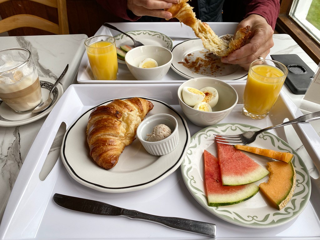
As many of you know, I’m not big on planning a tour before I go. I like the element of spontaneity and the ability to change plans on the fly. However, for this trip, since we were staying at B&B’s, I did take some time before leaving to find some sweet ones. We really, really, enjoyed all three of our gites on this tour. I love staying in an old historic house rather than a modern motel, and I love meeting the owner, finding out about the history of the building and the area, meeting other guests, practising my French, and enjoying the simple but tasteful breakfasts the hosts provide.
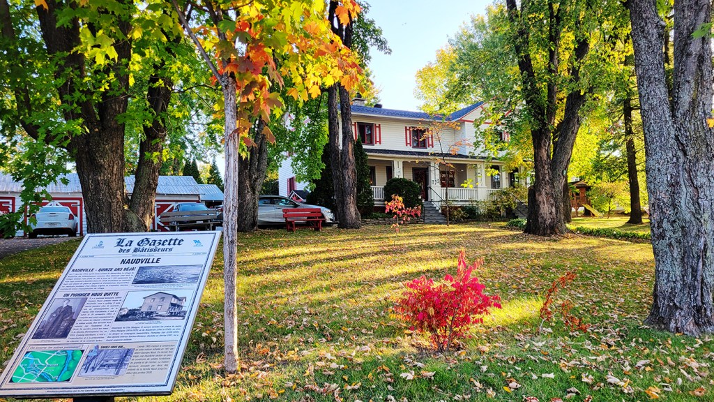
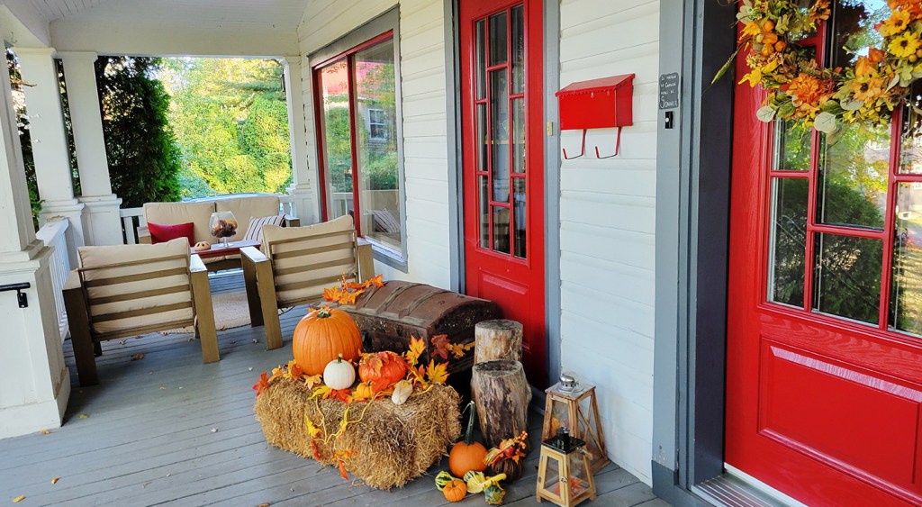
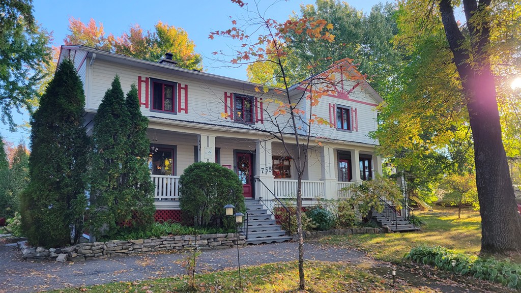
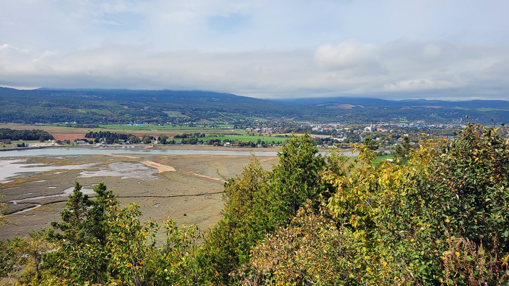
Our house in Alma, the Gite Almatoit, is home to a family and there were black and white photos of the house in winter and the kids playing in the garden. We were told that although the children must take a bus to school, snow days are (unfortunately for the kids) quite rare. After breakfast, I took a stroll around the property and learned from a sign on the lawn that the house was built in 1927 and is named La Maison Naud, after its original owner. Children of the Naud family lived in it until the early 2000s. It was the fall equinox, and our host had prepared this nice display on the front porch to celebrate the season. I’m too anti-social to be a B&B host, but I appreciate people who have decided to go into the hospitality business in order to make it work where they want to live. Maybe for them—I suspect for most—they enjoy the work so it’s a win-win.
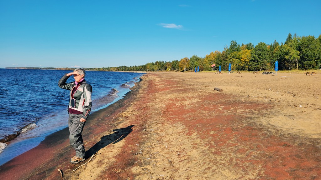
The next day took us over the top of Lac Saint-Jean. We headed north on the 169 and pulled off at Pointe-Taillon “National” Park to see the beach and lake. I’m putting national in quotation marks because I’m not a Quebec nationalist and I disagree with Quebec’s nomenclature for its parks, which in any other province would be called provincial parks. You can’t have it both ways: receive billions of dollars in equalization payments from the rest of Canada and then call yourself an independent nation. Or maybe you can, if you are Quebec. As a Quebecer, I feel uncomfortable with this hypocrisy, especially when that nationalism is based on ethnicity, not language, which anyone who has lived here for any length of time will attest.
I’m thinking of Quebec politics now as I write this, and I was thinking of them then as we sat in a Tim Horton’s coffee shop in the heart of separatist Quebec, north of Lac Saint-Jean. It’s pretty much unilingual in these parts, so if you don’t know French, you’ll have to use the point and grunt method to order your donut. My French isn’t great but I can get by, but for all the talk of language in this province you’d think it was the most important issue facing Quebecers. It’s not. Just today I read that one of the major health service providers in the Montreal area has entered creditor protection. Marilyn and I are currently without a doctor, and I’ve been waiting for an MRI for months to diagnose a lump that I discovered last June on my collar bone. This is the state of healthcare in Quebec, and don’t even get me started on the state of education. (I’ve been a teacher since graduating in 1994.) It’s time that the Quebec government stop stoking the fires of nationalism and get its house in order by prioritizing issues like healthcare, education, infrastructure, and social services that have a direct impact on the quality of life for most Quebecers.
I’ve railed against Quebec politics elsewhere in this blog so won’t repeat myself, except to say that Marilyn and I will be leaving the province when I retire in a few years. We have mixed feelings about this because we’ve developed some very close friends here, but speaking for myself, I no longer want to pay another tax dollar to a government that sees me as a second class citizen because I’m not French (note that I didn’t say “speak French,” because I do, however poorly), that doesn’t hold and promote values I can be proud of, and that has its priorities mixed up. It’s time that Quebec as a nation either sh*ts or gets off the pot, to put it crudely. If it’s going to pass legislation that goes against the Canadian Charter of Rights and Freedoms and can only be enacted by using the Notwithstanding Clause, it’s time to leave Canada and stop taking handouts. In 2025-26, Quebec will receive $29.3B in equalization payments, more than all the other provinces and territories combined. Vivre le Québec libre!
Parc national de la Pointe-Taillon on the shore of Lac Saint-Jean
Back at the Tim’s, I had that feeling I got once before, when my son and I stopped in a small town in northern Quebec for dinner after canoe camping. As I listened to the French conversations around me, I wondered what it would be like to be unilingual French, how narrow your window onto the world would be, and how your views and opinions would be shaped exclusively by French media. I understand the fear of losing your language and culture; as a Canadian, I face this everyday living beside The United States which threatens to devour the subtleties of Canadian English and our unique culture. But I’m convinced that forced monolingualism is not the answer for French Quebecers. And besides, as stated by famous Canadian lawyer Julius Grey in a recent talk at my college, no language that is taught in mandatory public education has ever disappeared. If freedom really is in the interest of the Quebec government, it should begin with linguistic freedom. Languages open doors to other cultures, other ideas, and broaden one’s horizons. I wouldn’t be living in Quebec for the past 34 years if I hadn’t done a summer immersion program in Quebec back in 1989 to develop my French. But as I write this, the Legault government is working to restrict access to education in English, leaving the vast majority of Quebecers linguistically and culturally isolated, not to mention vulnerable to media manipulation.
Blueberry fields north of Lac Saint-JeanRest stop at Chutes des Pères off the 169 in Dolbeau-Mistassini
We looped the lake and came back into the town of Saguenay, then picked up the 381 south, the preferred route for motorcyclists. It cuts through dense bush between mountain ranges, separating on the west the Laurentides Wildlife Reserve and on the east Parc national des Hautes-Gorges-de-la-Rivière-Malbaie. There was a lot of tapping on my left shoulder on that ride, all the way into Baie-Saint-Paul.
Baie-Saint-Paul at the foot of the 381
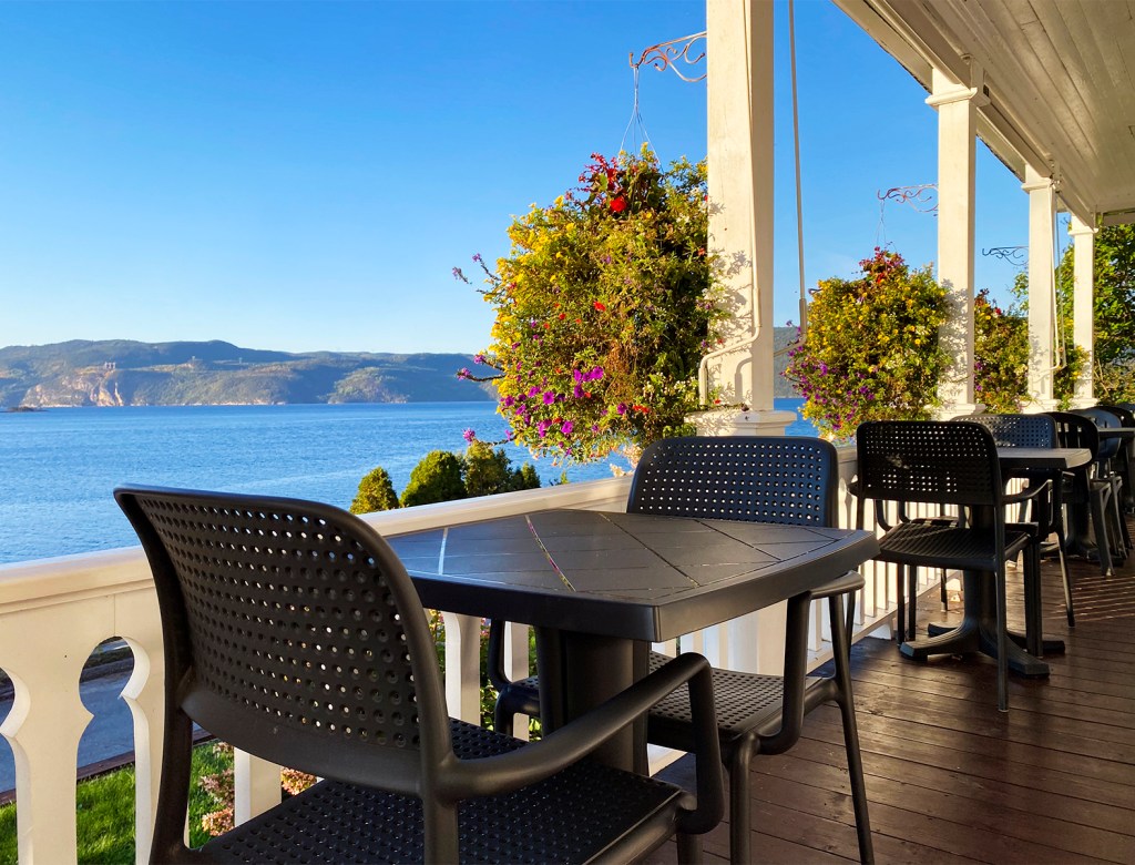
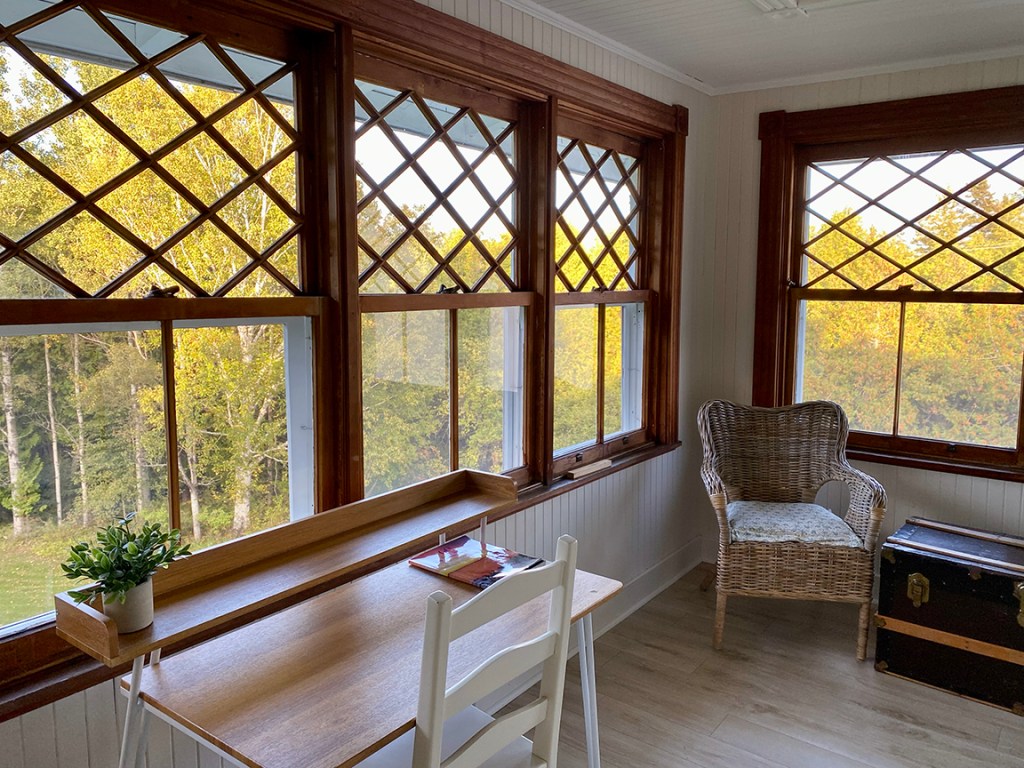
For our third and final night, we had a reservation at Auberge Les Sources in Pointe-au-Pic, just west of La Malbaie. I would say it was my favourite of the three, but they were all my favourite. The room itself was special with a lovely sunroom off of the main room where we could sit and listen to our little bluetooth speaker and journal and drink port. Yes port. Only we enjoyed it a little too much and somebody had to go fetch dinner. Thankfully, we were a stone’s throw from the Fairmont Le Manoir Richelieu which had take out St. Hubert chicken. It wasn’t the swankiest dinner of our trip, but it hit the spot under the circumstances.
After dinner, we decided to walk off the chicken by taking a stroll down to the hotel that overlooks the river. It really is a spectacular building, furnished exquisitely inside with original artwork (including a piece from one of Marilyn’s favourite painters, Michael Smith) and historical photographs and artifacts. The Fairmont hotels are a sort of relic from another era, and this one clearly is kept alive by the adjoining casino, accessible from the hotel by a tunnel. I’m rather morally ambivalent about gambling, but I guess in this instance I’m okay with other people spending their money this way if it’s going to prevent an historic building from being turned into condos. We peered through the glass doors into the carnival lights, bells, and glitter of gambling while a couple of bruisers stood guard outside, ensuring only hotel guests could lose their money.
Outside, fog had rolled in. We strolled along the boardwalk overlooking the river, and in the mysterious lighting of the outdoor lamps, with a foghorn sounding in the distance, you could easily imagine being another person 100 years ago.
Our final day would be more of the gross highway riding to get home, but before leaving our beloved Charlevoix, we indulged ourselves by stopping in at Saint-Joseph-de-la-Rive, a quaint village at the base of Les Éboulements, right on the river. The view as you descend is pretty good, and there’s an interesting little artisanal paper store there called Papeterie Saint Gilles, which still makes paper by hand, pressing petals of local wildflowers into the sheets.
The infamous descent from Les Éboulements.
This hill is so steep that several years ago a tour bus lost its brakes and crashed off the embankment. I spared Marilyn that story.
Our original plan was to cross on the ferry from here to Île-aux-Coudres and do a quick loop of the island I’d heard so much about. I’ll go to great lengths to find a good boulangerie. But it was off season and we figured a lot would be closed and we still had the return leg to Montreal to do, so we stayed on the mainland and strolled along another boardwalk, taking a last look at the rolling hills and tide flats of Charlevoix.
Saint-Joseph-de-la-Rive
Finally, it was time to climb reluctantly onto the bike and start heading home. The tour had been everything we’d hoped it would be. We weren’t able to do a holiday over the past summer, but this little excursion made up for it and cured our travel bug before the bike went into storage for the winter.
The Saguenay fjord has dramatic geography and the roads are windy and fun. Prices are reasonable and everyone we met was friendly and welcoming. Wherever I travel, whether in The United States, across Canada, or into the heart of pure laine Quebec, the people I meet rarely match assumptions based on what I’ve heard in the media. Perhaps that’s the best thing about travel: learning first-hand that people everywhere are essentially the same. I’m glad that I finally did this tour, if only to discover, with my own weak French, that the only thing separating English and French Canadians is language.
In celebration of Canada Day 2024, here are my 10 favourite roads to ride in Canada.
Canada is a huge country with over a million kilometres of roads. I can’t say I’ve ridden most of them, but I have ridden to both the east and west coasts and almost to the northern one, so I’ve done a good survey of the country. Here are my favourite roads in Canada, going from east to west.
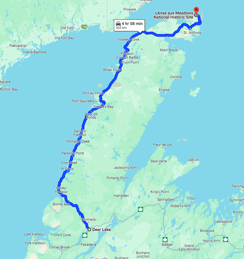
Highway 430 (Newfoundland)
Also known as The Viking Trail, this highway begins at Deer Lake, where it splits off from the Trans Canada Highway and heads west and then north. It hugs the western shore of Newfoundland, offering hours and hours of spectacular ocean views and some of the most impressive geology in the country. Be sure to stop in Gros Morne National Park and hike The Tablelands Trail with its unusual orange rock, and camp at one of three campgrounds right on the beach. A highlight for riding is the section through Rocky Harbour, a mountainous region with changes in elevation and twists and turns and scenic lookouts that rival the iconic Cabot Trail in Cape Breton. Further north, the 430 levels out and follows the shoreline. You’ll feel the air temperature change rapidly when the wind blows off the ocean, so have a windbreaker on hand. Another highlight is Point-au-Choix, a national historic site where moose, caribou, and other wildlife can often be seen. If you make it all the way up to the northern tip of the highway, you’ll be rewarded with views of icebergs drifting southward from Greenland and L’anse Aux Meadows, the historic site of the first settlement of Europeans from which the trail takes its name.
Western Brook Pond
Highway 4 (Nova Scotia)
You may be surprised that I didn’t choose The Cabot Trail as my favourite road in Nova Scotia. It’s a fun ride, no doubt, but for really getting a sense of interior Nova Scotia, I prefer Highway 4. Apparently it was the original Trans Canada Highway traversing the province and you can see that in the way it criss-crosses its replacement. You can also hear its history in some of the towns along the way. Travelling east, you pick it up just outside Oxford before it hooks south through Wentworth Valley, then east through Truro and Bible Hill, New Glasgow, and Antigonish before crossing onto Cape Breton, where it hugs the south shoreline of Bras d’Or Lake all the way to Sydney and, finally, Grace Bay at the shore of the Atlantic Ocean. It’s as long as its history and every bit as varied and interesting. It doesn’t contain the dramatic switchbacks of The Cabot Trail, but weaves its quiet way through rolling hills, countryside, lakes, and villages, never far from civilization but as if in another era. The two or three times I’ve ridden it, I enjoyed it so much I forgot to take a photo, so you’ll just have to get out there yourself to see why it’s one of my favourite roads.
Highway 132 (Quebec)
The 132 is Quebec’s longest and oldest highway. It begins in the west at the US border south of Montreal and follows the south shore of the St. Lawrence River all the way around the Gaspé peninsula. It’s best to pick it up at Rivière-du-Loup east of Quebec City, where it becomes picturesque with old clapboard houses and churches dating back to the origins of Quebec and, indeed, North America. East of Rimouski, the road narrows and mountains rise up on your right so that for hundreds of miles you are riding a narrow ribbon of asphalt strung between the Gulf on one side and dramatic cliffs on the other. And when the road turns inland to traverse the mountain range, the riding gets even better. Be sure to make a stop at Forillion National Park and the iconic Roche Percé (pierced rock), a biker mecca. But don’t stop there; keep riding around the peninsula to see sandy beaches as you pass through quaint fishing villages. When you reach the New Brunswick border, you can cut back across inland on the 299 for some technical riding.
Highway 2 (Ontario)
The first ride I ever did, the day after I got my licence, was along Highway 2 from the Quebec border to Kingston. It is another shoreline road, first in the east with the St. Lawerence River and opening up to Lake Ontario west of Brockville. It is also one of Canada’s oldest roads with a ton of history to explore, particularly Loyalist history. Be sure to check out the Lost Villages Museum, containing replicas of buildings flooded when the Long Sault dam was built, and the Long Sault Parkway, known as the Florida Keys of the north. (It’s actually a series of islands created by the flooding and strung together by bridges.) Windmill Point still contains the original windmill that was the focal point of the 1838 uprising, when Americans invaded across the river in a failed attempt to overthrow the fledging government. Just down the street in Prescott is Fort Wellington, an important early military location, and in Brockville you can walk the first train tunnel in Canada. And while we are on the road of firsts, once you get to Kingston, you can tour the first penitentiary and, a little further, the original milestone marking Highway 2 as the first asphalt highway in Canada. Riding Highway 2 is like riding back in time to the birth of Canada.
The Blue Church, 1845.
Highway 17, from Sault Ste. Marie to Thunder Bay (Ontario)
Highway 17 in the northwest of Ontario is far enough away from the urban sprawl of the GTA (Greater Toronto Area) to feel remote and pristine. Soon after leaving the Sault, you enter Lake Superior Provincial Park with several campgrounds, but regardless of whether you’re camping or not, be sure to pull off at Agawa Bay for the sandy beach and Agawa Rock containing ancient Ojibwe pictographs. When you leave the park travelling west, keep your eye out for the Wawa goose, and then settle in to miles and miles of excellent rolling tarmac with spectacular views of the The Great Sea. Although only two lanes, there are passing lanes on many hills so you can get past that RV and stretch your bike’s legs. At the end of the day, there’s Pukaskwa National Park to rest your head, get down to the shore, or hike inland to The White River Suspension Bridge. If you want a sense of northern Ontario, Highway 17 is it.
Highway 18 (Saskatchewan)
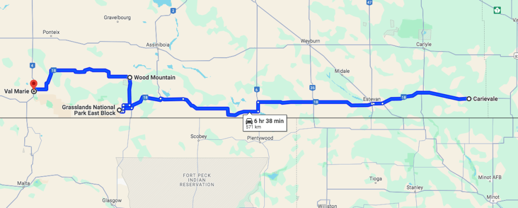
Think Saskatchewan is flat and boring? Think again. Highway 18 along the southern border strings together quaint towns, abandoned homes, historic grain elevators, rolling hills, and unblemished prairie. I rode Highway 18 west into Grasslands National Park East Block. It’s a fantastic national park with a very distinctive style of its own. Instead of the usual towering pines and lake views, Grasslands is in open prairie, and you can imagine what it would have been like to cross this formidable region by wagon in the 19th Century. Be sure to ride the single-lane loop along the top of the badlands, and the next morning, why not, continue on the 18 across the park to Val Marie. When I did it, I had the pleasure of watching four majestic elk cross the road in front of me and, one by one, as if in slow motion, leap the boundary fence before heading off across the open countryside. Grasslands NP and Highway 18 put you in touch with the prairie soil and grass and big sky like no other place I know.
Badlands at sunset, Grasslands NP
Highway 31 and 31A (British Columbia)
The 31 hugs Kootenay Lake from Balfour up to Kaslo, with the lake on one side and mountains on the other. Not bad. But it gets even better when you turn west and head along the 31A from Kaslo to New Denver. This road is listed in several “best of” articles and I’m going to include it in mine too because it’s pretty special. I don’t know how it compares to Tail of the Dragon for corners within a certain distance, but it has many, and one thing it has going for it that Tail does not is incredible scenery. You don’t really want to ride it fast or you’ll miss the view. There are towering mountains on either side and, for the eastern part at least, it follows the bubbling emerald green Kaslo River. At the end, although it needs no prize, is the quaint and secluded town of New Denver. I think I might just retire out there—if only to ride that road whenever I want.
Pausing on the 31A between Kaslo and New Denver
Highway 4 (British Columbia)
If you have to cross Vancouver Island, you have to take Highway 4. Good thing it’s a gem of a road, rising and falling through mountainous terrain with Cathedral Grove as a rest stop and the Pacific Ocean as the destination. As you approach Ucluelet, the road twists up into the mountains and you might find yourself in fog before it drops down again to the ocean. Once there, you’ll find Pacific Rim National Park, a magical place with long sandy beaches, crashing surf, and nothing between you and Asia but 19,000 kilometres of water.
The towering Douglas Firs of Cathedral Grove
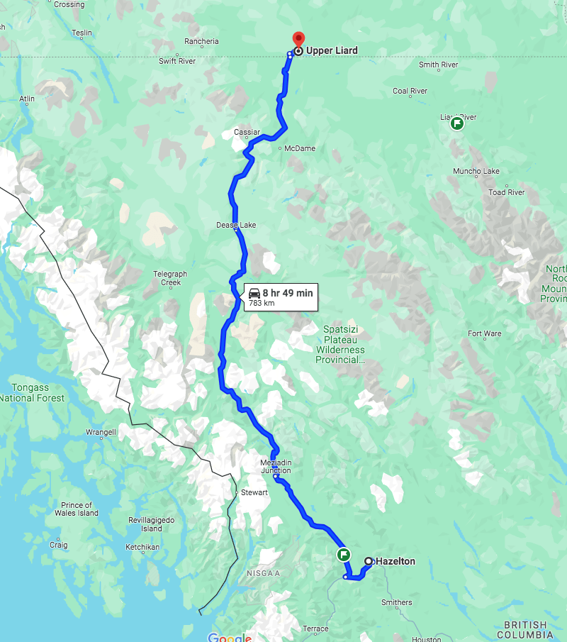
Highway 37 (Northern British Columbia)
Technically further west than Highway 4 and Tofino is Highway 37, also know as The Stewart-Cassiar Highway. If you are going into Yukon, it’s one of only two roads going that far north, and I’ll go on record as saying it is preferable for riding to The Alaska Highway. Just north of Smithers and west of Hazelton, you turn right at Kitwanga and head north, 750 kilometres of twisting smooth two-lane blacktop with scenic views of rivers and lakes at the sides of the road and northern Rocky Mountains as backdrop to your ride. It’s pretty remote up there and you will ride for hours without seeing another vehicle, so be sure to have lots of gas and tools at hand, just in case. This is bear country, and you will see many on the road or at the sides, eating berries in the ditch. There might even be some grizzlies in these parts, but the remoteness, your exposure to the elements, and the lingering threat of danger is part of the energy and excitement of Highway 37. This is a road that pushes you out of your comfort zone and into the realm of risk and adventure.
The Dempster Highway (Yukon)
Not enough risk and adventure for you? There’s one highway that trumps all others in both. It’s the Dempster Highway, 886 kilometres of gravel that will eat your tires if not puncture them. When I was up there, I saw a camper rolled over at the side of the road and figured it was due to a puncture because the tire tracks went sideways. But unlike the Trans-Taiga in northern Quebec, you don’t ride this road for bragging rights. You do it for the astounding, majestic, magnificent views like no other in the country. That’s because you are above the tree-line for sections of the Dempster and the wide open vistas of subarctic tundra are worth every kilometre. If you just want a taste, head up about 80 kilometres to Tombstone Territorial Park, but bring bear spray and be sure to string your food. If you want to venture further, you’ll need to go at least 400 kilometres to get to Eagle Plains and the next fuel station, so depending on your bike, you might need to carry extra fuel. One other major consideration: don’t attempt this road on anything but knobby tires; it’s covered in calcium chloride and when it rains the road becomes so slippery you will be forced to wait for it to dry before you can get back down to Dawson City. All warnings aside, this is my favourite road in Canada if only for the geography it offers and the sense of remoteness.
North of Tombstone Territorial Park
I know I’ve missed a few provinces and a territory, but I’m blaming that on Covid. When I went across Canada the summer of ’21, I wasn’t allowed to stop in Manitoba, and the border to The Northwest Territories was closed. I also didn’t spend much time exploring Alberta but stayed mostly with friends and family in Calgary.
So what roads have I missed? Which of these have your ridden? Let me know your thoughts. I’m two years away from retiring and there’s a lot more of this beautiful country I want to see, so please drop a comment below and I’ll put it on my bucket list.
Here in Montreal, Canada Day is mired in the usual nationalist politics and anti-colonial sentiment, and I think that’s a shame. Surely it’s not the right time to highlight differences or mistakes made in our past, but to celebrate the many collective freedoms and opportunities the country offers as well as to recognize its complex history and natural beauty. All things considered, and certainly compared to many other countries around the world, it really is a pretty great country to live in, and an amazing one to ride. Happy Canada Day. Now tomorrow get out there and ride.
My friend Ray and I went looking for adventure and got more than we bargained for.
When I got back from Newfoundland, it was the end of July and I was already starting to think about teaching. More accurately, I was beginning to dream about teaching. (My school begins mid-August, unlike most universities that begin after Labour Day.) I get these dreams toward the end of summer. In them it’s the first day of the semester and I’m not ready—my outlines are still at the printers, my textbooks aren’t in, I’m running late and can’t find something I need in the office, and when I arrive to class, a senior respected colleague is sitting at the back, having decided to audit my course. That kind of thing. I thought I was the only person who got them, but apparently they’re so common among teachers that they’re called Teacher Dreams. Anyway, I was already getting them so decided I’d put off that second planned trip to The States and the BDRs until the following summer and use what little time there was left in my summer vacation period to do shorter trips.
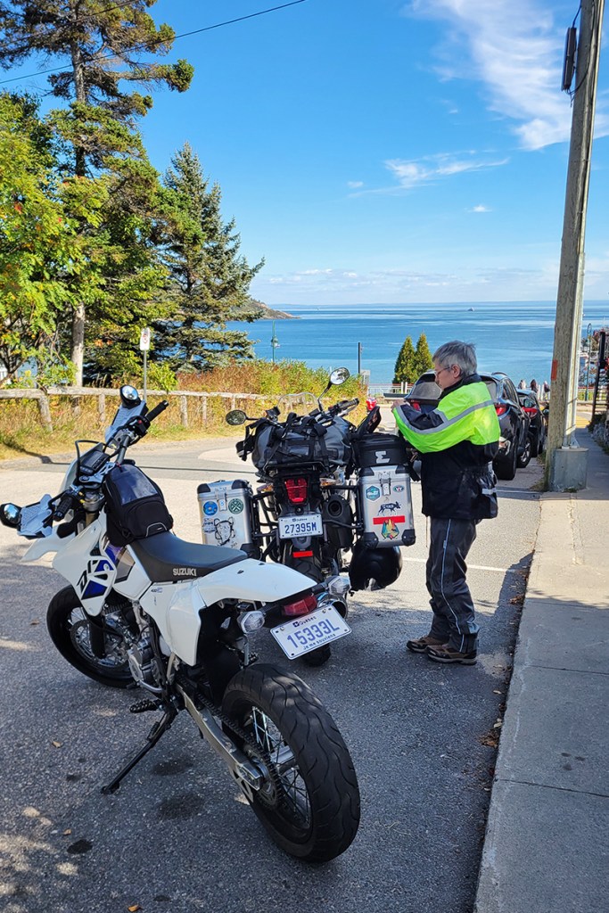
I asked my buddy Ray if he’d join me in doing a local overnight adventure ride. Ray likes the big gleaming classic bikes and rides an Indian Chief Vintage, but we won’t fault him for that. He’s also got a 2003 KLR in army green and joins me on off-road adventures when he’s feeling especially masochistic. We’ve had some adventures in the past, usually involving a hydro line, water, mud, and something semi-legal, so I think he was a bit reluctant. But I assured him I’d find something mellow this time, and like the good sport he is, he agreed, so I started researching the ride. The idea was for a relaxed dirt and gravel ride that had some nice scenery in the mix.
My first choice was The Bytown Adventure Loop and went as far as to pitch it to my editor at my paying gig, northernontario.travel. It’s always nice to ride, even better when you get paid to do it. The Bytown Loop was announced a few years ago to great fanfare, including a whole YouTube video to present it, and it looked pretty perfect for our purposes—big-bike friendly, close to home, with food and accommodations available should we want to avoid camping and cooking. Easy peezy. The only problem is that I couldn’t find the GPS files anywhere. You can see my query on the YouTube page, with no response. Same when I asked the channel owner directly. Hmm . . . seems like a lot of work went to waste at the final stages of development or there’s something I don’t know.
A little more sleuthing brought me to GravelTravel and he has lots of files available for a small fee, including the TCAT, and another that caught my eye, the Ottawa Valley Overland Route. It seemed similar to The Bytown Loop so I checked it out on YouTube. The videos I saw looked pretty mellow—apparently a large section of it is on abandoned railway line, which is usually flat, straight, and easy. Forums did not reveal anything concerning. In fact, I saw one post asking if it could be done in a non-modified AWD car, so I thought we’d give it a go. It would mean camping and cooking, but to be honest, I prefer that to venturing into town. I bought the files, reserved a campsite at Granite Lake, about halfway through the loop, and bought Lanark County trail passes for Ray and me.
The route is listed as 2-3 days. We were going to do it in 2, which was a bit ambitious since it would take us 1.5 hours to get to Merrickville, where we would pick up the route. To make matters worse, no sooner had we begun when we had a delay. We had done some service on Ray’s bike earlier in the summer and as we rode toward the Ontario border I began to doubt that we had re-oiled his K & N air filter. I remember washing it, and setting it out to dry . . . but not oiling it. You really don’t want to run those filters dry at risk of damaging your engine, so when we reached Alexandria, we pulled into a Tim Horton’s and discovered that yes, it was dry. Thankfully, the ubiquitous and life-saving Canadian Tire there had a K & N maintenance kit so we oiled the filter and let it sit while we had our coffees. It was a small delay, but on a tight schedule, every unplanned stop costs you dearly later on.
Arriving in Merrickville in time for lunch at Bob’s Fresh Cut Fries.
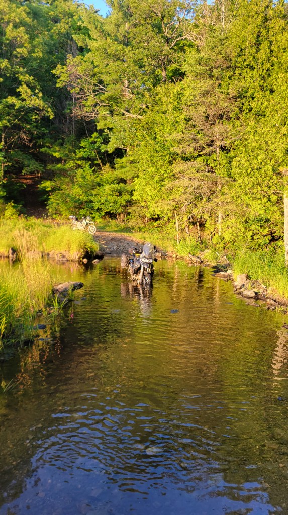
Merrickville is a charming historic village with more heritage buildings for its size than any other town in Ontario. I’ve written about it as a favourite destination for bikers here, but in this case we were just passing through. Soon after lunch, we picked up the OVOR track and, to my great surprise, almost immediately hit mud.
I didn’t have the tires for mud. I still had on Dunlop Trailmax Mission tires from my tour, so I stopped to assess the situation. I was also thinking of Ray, to whom I had promised an easy ride. I waded in and it wasn’t deep, just a bit slippery. I looked at the map and it appeared to be a short section. Now in this situation, Clinton Smout advises to let your buddy go first, but since I’d got us here, I figured I was the test probe. Ray got out his phone to catch any action.
On the Rideau Trail north of Merrickville.
“It’s not bad”? Soon I’d be eating my words when my tires caked up. Some of this easy trail wasn’t so easy.
The Tiger doesn’t have much low-end torque and I have to keep the revs way up whenever off-roading or it stalls. Soon after this ride I did my valves and all the exhaust valves were tight. I’m hoping that opening them up will help with the stalling. A little further on we turned left onto some two track, crossed a swamp, and popped back out onto gravel.
Once back on the road, it was smooth going again up into Carlton Place, another pretty town that was on my Top 5 Ottawa Area Destinations list.
You can see me glance at the hydro line as we crossed beneath. Premonitions of things to come?
We filled up in Almonte before heading down into the bush south of Ottawa. The highlight of the day was riding the Lanark County Trail System south of Ottawa.
California Road in Lanark County.
I was loving this and could have done it all day! The Tiger is in its element here and the Tailmax Mission tires are fine for this stuff; the back end slides out but consistently. We stopped for a photo out over White Lake during the golden hour and the ride was now everything we were hoping it would be. We had a little ways to go to get to our campsite and were looking forward to the steaks I had packed in one of my panniers.
Sadly, the fun would come to an end too soon. We crossed a hydro line, then rode the line for a few hundred metres before exiting onto another gravel road. Unfortunately, what we didn’t know is that the bridge crossing the river that feeds into Duncs Lake was under construction and was out. We got off our bikes and surveyed; sometimes you can find a way through even if it’s closed (the semi-legal stuff I alluded to earlier). In this case, that wasn’t possible at all, and we happened upon a workman finishing up his day and he confirmed what we already knew: end of the road. (What was especially frustrating is that they were building a new road called, appropriately, The New Road, and it was smooth sailing on the other side. We looked at our map and figured we were about 2 kilometres from Highway 511 and the best bet was to return to the hydro line and follow it out to the road.
Hydro lines. When you’re stuck in the bush, they’re a lifeline to civilization, a man-made geometrical order imposed on the chaos of wilderness. But they can also lure you into that chaos, the fisherman’s line drawing you into dark waters. And speaking of water, what I’ve found is that they almost inevitably involve some of it at the low points as the terrain rises and falls. A ride along the primitive access trail of a hydro line is a rocky descent to a water crossing to a steep rocky hill climb to a moment of respite before another descent, and on, for hundreds, thousands of miles if you want, from dams to urban centres, traversing great swaths of Canadian boreal forest.
We got through that without incident but by now it was getting late, we were getting tired, and our off-road skills were suffering as a result. I offer these two videos for your amusement, at our expense.
Ray took his own tumble and decided, while down there in the tall grass, to take a little nap.
In the first video, you can hear concern in my voice. I was worried that we would come upon a crossing that was just too deep to cross and that would block us from the highway. At this point, I was getting some serious arm pump and had pretty much given up on making it to Granite Lake and our planned campsite. We’d figure out where we were going to spend the night once out of the bush.
But we never made it that far. At one water crossing, I got hung up on some rocks and dumped the bike. I hit the kill switch before it dunked but the bike wouldn’t start once righted. After trying for a while, I left it sitting there while deciding what to do.
Eventually, we ended up just pushing the bike out by hand and it was surprisingly easy. But it wouldn’t start, no matter how many times I cranked it. Thankfully, Ray got across without incident. I have to say, the KLR really showed its capabilities on this ride. Where I was struggling on the Tiger, Ray was getting over stuff using the tractor factor of the KLR.
I figured the Tiger was hydrolocked, but to get to the spark plugs on this machine you have to remove a lot of plastics and lift the gas tank. I didn’t want to start that work with 30 minutes of light remaining, so we made the decision to camp on the hydro line. I left my bike where it was, Ray rode his up to a clearing on the line, and we set up our tents there. I fired up my stove and cooked us the steaks. We had a little something from the liquor store in Alexandria, and I had a pipe and Ray had a cigar. It wasn’t exactly the campsite at Granite Lake I had imagined, but we made the best of a bad situation.
Still smiling, despite the bugs and our situation. Not smiling.
That night in my tent I had a restless sleep, worried that I might not have packed the spark plug socket. I wasn’t sure because it’s such an involved process to access the plugs that I might have concluded I’d never be lifting the tank trailside. But thankfully I had, and after morning coffee and porridge, we started tearing apart the Tiger.
In this photo, you can see a section of hose coming out of the bottom of the tank. That is a hose I carry for emergency syphoning should someone run out of gas. We found that when we lifted the tank, gas flowed out of the overflow drain. I’ve had that tank lifted before and it’s never done that. It was a clue that I should have paid more attention to.
We took out the plugs and they looked dry. We turned the engine over and no water came out of the plug holes. Next we thought that maybe the air filter was soaked and choking the engine. Unfortunately, Triumph put a weird 7mm hex screw on the airbox and I didn’t have that socket on me. I pride myself on being prepared but I came up short on this occasion.
We decided that I would ride Ray’s KLR out and up to the Canadian Tire in Renfrew. Why me? Ray said I had more experience off-roading and would have a better chance of getting out. There was some really gnarly terrain and a pretty significant water crossing, but I made it out, again, impressed by the KLR’s capabilities off road.
Shortly after I started heading up toward Calabogie, the skies opened up and it started to rain cats and dogs.
Wishing I’d zipped up my vents earlier.
It was weird weather. In Renfrew it was dry with blue skies. Little did I know it was still coming down hard back on the trail. Canadian Tire had the 7mm deep socket, and while in town I picked up lunch and water and gassed up Ray’s bike. I was planning for the worst case scenario.
As I rode south on the 511 toward the trailhead, I rode back into the torrential rain. It was bad! In fact, unbeknownst to us, this extreme weather was causing major flooding in nearby Ottawa and back home our wives were concerned. I got to the trailhead and started heading back in, but before I reached the bike, who did I see walking out but Ray. He was soaked to the skin and looked pretty miserable. Our “easy ride” had turned into 24 hours of hell, stuck in the bush in extreme weather. I was never going to live this down.
Ray had determined that the trail was now impassable and that I might be waiting for him at the highway. I guess he doesn’t know me as well as I thought. No extreme weather was going to prevent me from getting back to my bike. But he looked cold and miserable and it was teeming, so we agreed to abandon the troubleshooting and get a room in Calabogie. There was nothing more to do but turn around and splash Ray, who couldn’t get any wetter, then double him out to the highway.
“Hop on. This part is pretty tame.” Camera shuts off by itself at the worst time. Sorry about that.
Unfortunately, he had started walking without his helmet, so I doubled back, tidied our gear, grabbed his helmet and jacket, and returned to ride us up to the Calabogie Motel.
It was sunny in Calabogie but probably still raining 20 kilometres south on the trail. I didn’t feel very good about leaving my bike on the trail overnight but tried to put it out of mind. We went for dinner at The Redneck Bistro.
The next day we were up and out early, eager to get the airbox open and hopefully solve our problems. I’d been communicating with my buddy Riley from The Awesome Players, who has more experience with bikes than me. He too was confident that when we got it open, we’d find a soggy filter and after drying everything out the bike would fire right up again.
The trail was still waterlogged and I was worried about doing the deep crossing again. We didn’t need two hydrolocked bikes. But the KLR is a beast, and I told it so.
Things went a little sideways on me there but we got safely across. I left his bike at the top before the gnarly stuff, then walked down to the bike. With great anticipation and suspense, I got out the new 7mm socket and opened the airbox . . .
It was dry, bone dry. I was deflated. Ray had been walking in from the road and soon arrived. We continued our troubleshooting but were running out of ideas. We tested the plugs and there was spark. We took out the filter and the Unifilter prefilter. We checked all the fuses. The one for the auxiliary socket was blown and we thought we’d solved it then, but after replacing it, the bike still wouldn’t start. We looked down inside the throttle bodies for water. We inserted twisted paper into the throttle bodies and it came up dry. We put a drop of fuel from my stove bottle into each throttle body and still it did not fire! Not even a cough.
As a last resort, I walked up to where there was reception and called Riley to see if he could think of anything I hadn’t. He asked if I could hear the fuel pump cycle on with ignition. I did. He said he’d consulted with Player Ivan and it didn’t make sense: we had fuel, we had air, we had spark—the bike should run! We were all stumped, and with it already getting on the afternoon, I decided to throw in the towel. I didn’t want to spend another night on the hydro line and knew there were limits to what I could ask of Ray. Riley offered to trailer me back to Montreal if I got the bike out of the bush. So we took Ray’s bike again and rode back into Calabogie where I found someone who does trail rescue. It cost me a pretty penny but I was out of options.
Throwing in the towel.
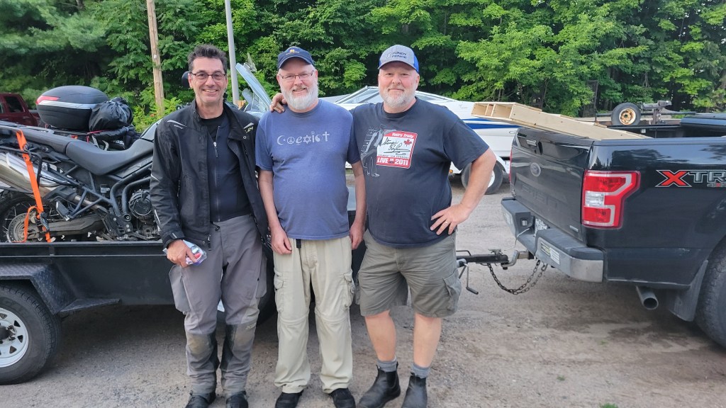
Back in Calabogie, Riley and his brother arrived and we loaded both bikes onto their trailer and headed for home.
With Riley (right) and his brother Kelly. I owe these guys one large favour! photo credit: Ray Bourgeois
I will admit I was feeling more than a little deflated on the drive back to Montreal. It reminded me of when the water pump went on the 650GS while at Dirt Daze and, for a moment, I considered selling it for something more reliable. Perhaps Riley knew what I was thinking and told me about Super Dave’s mint 1200GS he got for a song.
And I was disappointed in myself. How could I ride into remote areas if I couldn’t be sure to get myself out? It felt like, after all my preparation over the preceding years to learn about bike mechanics in order to do that kind of riding, I’d been tested and had failed. I also felt bad for Ray, who had suffered hypothermia and water-damaged his phone. When I got back to Montreal, I stuck the bike in the shed and couldn’t bring myself to touch it for a few days.
When we are at our lowest, it’s our friends who lift us back up, people like Riley who drove out from Montreal to fetch me, and my buddy Mike who came by to shake me out of my doldrums and help troubleshoot the bike. He noticed almost right away the presence of water around the fuel line in the way the fuel was beading on parts, and we decided to drain the tank. I make home-brew beer and had an empty carboy to use. This is what we found in the tank.
Gas on top, water on bottom. Several litres of dirty water in the gas tank!
Gas and water are insoluble and water is heavier than gas. This is a 23 litre carboy so I estimate that there was at least 3 or 4 litres of water in the bottom of the tank, and since the fuel pump draws from the bottom, the bike wasn’t getting any fuel. No wonder it wouldn’t start!
How did the water get in the tank? The fill cap seal is good, so it didn’t get in there. The bike was running fine up until it wasn’t, so I didn’t get bad fuel in Almonte. No, the only theory that makes sense is this: at the river crossing, the engine and tank were hot. When I dunked the bike, the tank cooled rapidly, creating a vacuum, and water was siphoned up through either the tank overflow or breather tube that was hanging in the water. It would only take a bit of water to foul the injectors and prevent firing, but with this much water in the tank, now I think the bike was drinking water the entire time it was in the river.
I’ve posted this theory on ADVRider to see if anyone else has experienced it and no one said they had, but I did find some threads on ATV forums supporting it. There’s supposed to be a check valve that prevents water or sand entering and also serves as the tip-over sensor. It’s a simple ball bearing valve, but I haven’t been able to locate it on the Tiger. The solution, I think, is to reroute the tubes to a higher point. This is what the ATV guys have done. You don’t want to just cut the tubes because you don’t want fuel draining onto a hot engine, so I’m thinking I will run them back along the frame toward the rear of the bike and have them drain somewhere safely behind the engine.
I’d be very interested to hear what others think about this. I’m surprised more bikes don’t have this problem, which makes me wonder if it’s particular to the Tiger or my bike. I’ve seen guys completely submerge their bikes and they don’t get any water in the tank, so what goes? If you have any ideas, drop a comment below. I’ll be getting out to the shed in the coming weeks to do a bunch of work on the bike in preparation for the season, and I understand there are some water crossings on the MABDR.
Anyway, Mike and I removed the fuel pump and squeezed as much water out of the filter as we could, then let it dry and reassembled. We purged the fuel rail and I changed the spark plugs. With clean fuel, the bike reluctantly started, first on two cylinders, then three. I added some Seafoam to a tank of gas and gave it the Italian tune-up all the way to Cornwall and back. Now it’s running great again. I also put in some cheap oil for a few hundred kilometres, then drained and refilled with the good stuff, just in case some water got in the oil. The bike is running fine now, especially since doing the valves. I feel better for having an explanation for what happened and am no longer thinking of selling it.
Some people say that the essence of adventure riding is adversity. We watch Itchy Boots riding through Nigeria and Cameroon with their bad roads, bad gas (if you can find it), security check points and security risks and are impressed by her courage. On the other hand, there are lots of people in my club who just want to ride and skip the adversity. I remember Ray once said at a club event that “riding with Kevin makes you feel alive,” and I’m reminded of what D. H. Lawrence once said along the same lines, something like, “Only once you’ve accepted death can you truly live.” I’m paraphrasing, but I think I know what he’s on about: if you don’t face risk, you are only existing, not living. I don’t go seeking danger—I love life too much—but neither do I let “what ifs” stop me from living the life I want to live.
Memento mori. When I’m old and feeble and no longer able to ride a motorcycle, I’m sure I’ll be thinking wistfully of Ray’s and my Ottawa Valley Extreme Weather Misadventure.
Pin marks where my bike crapped out. You can see the trail along the hydro line. It ducks into the forest and exits onto the 511 just south of the line. The big water crossing is just left of the circular lake.
We continue our tour of the east coast through the iconic Gaspésie region.
When I first started teaching, I taught ESL (English as a Second Language) to adults at a French college. For one mid-term oral exam, to evaluate my students’ use of the past tense, I asked them to tell me about a previous holiday they had taken. Almost all of them talked about Gaspé. It was even more popular than Disney World, a distant second favourite, so I figured it must be good.
Gaspé. The name to an anglophone suggests breath-taking, and it is, but in fact, according to one account, the name comes from the Mi’kmaq word Gespeg, meaning Land’s End. That would make sense since the region is the tip of the southern shore of the Gulf of St. Lawrence. I had toured it decades ago in a car but never on a motorcycle, and Marilyn had never been there at all, so instead of bombing along the Trans Can to Newfoundland, we decided to take a few extra days to get there by following the coast around the peninsula and making a quick loop of PEI before heading to Sydney and the ferry terminal.
The challenge, as always in Canada, were the distances we had to cover and finding the right balance between covering distance and enjoying the places we were riding through. We wanted to spend as much time as possible in Newfoundland since neither of us had been there before, yet Marilyn had less than three weeks vacation. We allotted ourselves five days to get to Baddeck, Nova Scotia, with our ferry crossing reserved for noon on July 6th. In the end, this was a challenging schedule of approximately 500 kilometres a day with camping and cooking in the daily mix.
Our planned ride from Reford Gardens to Petit-Gaspé Campground in Forillon National Park was only four hours long, but my love of pastries and coffee, not to mention Marilyn’s love of flowers, already had us off schedule. We indulged ourselves with a snack at the Gardens’ café and left early afternoon; our schedule was so tight that it really didn’t allow for even these kinds of delays. The price was that looming sense of urgency throughout the afternoon as we continued east along the 132.
The 132 is like this for miles and miles. Sorry about the bug deflector.
Despite that, the coastal ride was everything we were hoping it would be. The 132 hugs the shoreline for hundreds of kilometres along the peninsula. After Matane, it gets spectacular, with mountains on the other side of the road rising sharply up, especially around Sainte-Anne-des-Monts, where in my previous visit I’d watched hang-gliders leap from the towering cliffs out over the gulf. The best riding in the region is when the 132 drifts inland and rises through a mountain range, with twists and turns, constant changes in elevation, and hairpin turns that reminded me of the some of the mountain ranges in The Rocky Mountains we’d ridden out west. Yes, it was that good. There are parts where the guard rail is small and the drop-off great, and when we pulled into a gas station in Grand-Vallée and I turned off the bike, Marilyn said “That was thrilling!” There’s nothing like the proximity of death to bring a woman closer.
Route 132 gets quite hilly and twisty when it strays inland from the coast.
More hills and thrills on the 132. Messed up that right-hander. Keep in mind I’m fully loaded and with a pillion so wasn’t pushing it. Love the sound of that Triumph triple!
Because we were behind schedule, we decided to grab dinner on the road instead of cook it at camp. A hamburger and chicken burger with fries and salad from essentially a chip truck set us back $45 and had me remembering the inflated prices of the region from the last time I visited. Yes, the tourist season is short, and the locals reap what they can when the going’s good. We’d also been warned that sometimes the “local seafood” comes out of a box.
I wasn’t smiling after paying the bill.
We tried to put that price tag behind us and chalked it up to the cost of travel. It meant that when we arrived at the campground, there was time after setting up camp to go for an evening stroll out to the ocean and catch the sunset.
We walked down with our morning coffees too.
Our second night of camping was a lot better than our first! We love National Parks and had purchased Discovery Passes for the trip. National parks are always immaculately maintained with clean facilities and hot showers! The Petit-Gaspé’s park seemed to have a brand new building with a campers’ lounge including a hot stove. Even though it was July, they had it lit, which was nice because we could lay out some clothing to dry.
A sneak peak into the women’s washroom. Clean and modern washrooms at Canadian National Parks.
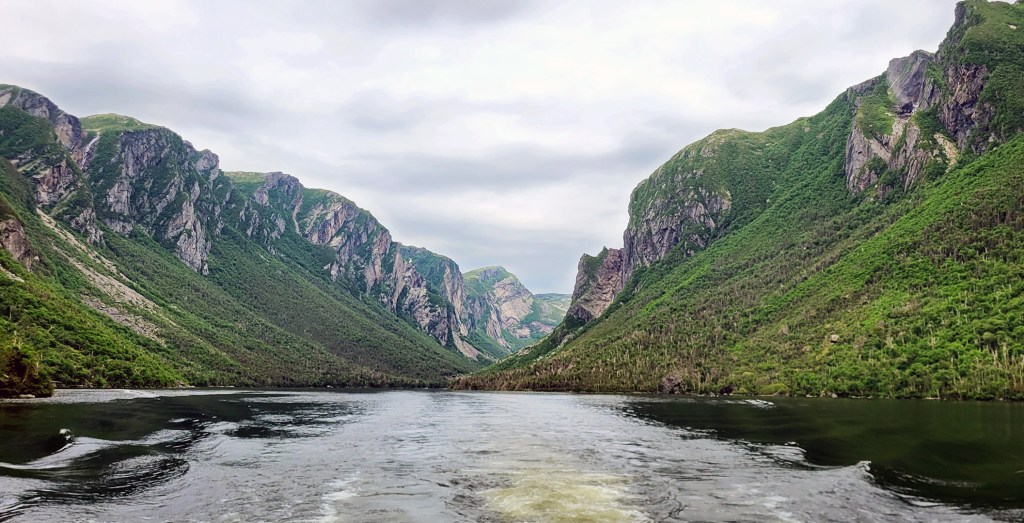
The next day took us through into Percé and past the famous pierced rock. Unfortunately, there was so much fog we couldn’t get a good look at it. The fog, however, made for some dramatic photos from the lookout at Cap Mont Joli. (See banner photo above.)
While waiting to see if the fog would lift, we killed time with one of my favourite pastimes.
We couldn’t afford to stay long in Percé. After picking up my pannier sticker, we continued on. The coastline now heading back west is sandy beaches with a smattering of homes along the road. Marilyn was surprised that the area is so populated, but geography determines a lot, and here fishing boats can safely land compared to the rocky shore of the gulf coastline. Instead of the adrenaline of the twisty, undulating road earlier, I was happy to cruise the Baie-de-Chaleurs, past the small fishing villages of Grand-Rivière, Chandler, Port-Daniel, Paspébiac, and Bonaventure. By the time we reached New Carlisle and New Richmond, the place-names indicated we were approaching New Brunswick.
Heading west along the Baie-de-Chaleurs. Now sandy beaches instead of rocky coastline.
When you ride these popular routes, you often bump into the same people repeatedly as they ride the same route. We passed three women on Harleys parked at the side of the road, and then they must have passed us at some point, and you do this leap-frogging for sometimes several days. In this case, we finally met them at a Tim Horton’s somewhere in New Brunswick. They are members of Motor Maids and were headed to Cape Breton to ride The Cabot Trail before heading to Massachusetts for the club’s annual convention. By the time we bumped into them again, days later, at the Nova Scotia Tourist Info Centre, they were four, and we saw them again on The Sunrise Trail. The last time we saw them was in Cape Breton. This time we were parked, figuring out what we would do for dinner, when we saw them cruise past, heading for their hotel in Baddeck, living the dream.
We crossed the bridge into New Brunswick at Cambellton and picked up Highway 11 which took us to Highway 8, then turned right, and headed straight south, inland on an open multi-lane highway, as fast as we dared, keeping our eyes out for cops and moose. (Thankfully, much of the highway through the drive-through province is fenced.) We knew this would be a long day. We didn’t have a reservation anywhere for this night but thought we’d push on as close to the PEI bridge as humanly possible before stopping. It was hot, and we’d been on the road since early morning. Finally in Miramichi, NB, as we crossed the river, Marilyn said enough was enough, and I know better than to go against the wishes of my better half.
We stopped at the tourist info in Miramichi to ask about accommodations and restaurants. I noticed that it has both Scottish and Irish Festivals on separate weekends in August and calls itself The Irish Capital of Canada. It was clear that we were no longer in Quebec.
Marilyn and I begin our east coast tour on Canada Day, 2023.
New bike, new tour.
Have you ever noticed how, just before setting off on a major holiday, strange things start happening to obstruct you? Things start breaking or go missing, or the dog gets sick, or you get audited, or the secretary for the specialist you’ve been trying to see for months phones to offer you an appointment next week. Well, according to Swiss psychologist Carl Jung, that’s your unconscious saying “Not so fast! Where do you think you’re going? Get back here, young man!” (or woman, as the case may be).
Jung’s theory is that the unconscious likes the status quo. It doesn’t like change, negative or positive. You’ve survived life so far, it deduces, so more of the same must be good, safe. This applies to all aspects of life, including planned and unplanned positive change, like going on a major holiday or experiencing a leap of personal growth. It’s as if you have to push through the obstacles the psyche in all its guile throws up in front of you before you can reap the rewards of progress.
We’d been planning this trip for close to two years. The original plan was to go summer of 2022, but with the addition of a new dog to our family, we postponed a year to allow him to settle (Obstacle #1). I’d been thinking about the trip through the dark months of the previous winter and had been planning the route, modifying the bike, and boosting my fitness to be fully prepared. Now with less than a week before departure day, all hell was breaking loose, right on time and as expected.
For one, a family member had a major medical event that left us wondering if we could go at all (Obstacle #2). Then I received a call from the car dealership: the vehicle we were expecting to take delivery of in August arrived early. Could we come complete the paperwork and pick it up before July 1? (Obstacle #3) The day prior to our leaving, when I was supposed to be full-on packing, CTV News phoned asking for an interview about an op-ed article I’d published (Obstacle #4). In the meantime, an article for my paying gig, northernontario.travel, about a club ride I did to Prince Edward County was due. (Obstacle #5) That ride was our shakedown ride during which I discovered that we were significantly under SAG, so I had to get the rear shock off and to Stadium Suspensions in Beloeil to be re-sprung (Obstacle #6). I also changed the oil, coolant, brake fluid, and rear brake pads, and tweaked a bunch of little things. I was busy.
Finally, however, on Saturday, July 1st, we were packed and ready to roll. All adversity had been overcome. The departure date, Canada Day, was symbolic and the same as it was in 2021 when I set off to discover western Canada. This eastern tour of the Maritimes and Newfoundland would be the companion trip to that one. We said good-bye to our furry friend, climbed on the bike, noted the odometer reading, and pulled away from the house.
The first task when living in Montreal is always to get out of the city. This is not always easy, but leaving after the morning rush hour on a national holiday meant a relatively quick exit. We crossed over the Champlain Bridge to the south shore and continued on Highway 20, the Trans Canada Highway, until east of Quebec City before dropping onto Route 132, the highway that would take us right the way around the Gaspé Peninsula.
First glimpse of la mer
Highway 132 is an incredible road. It’s the longest highway in Quebec, stretching from New York State in the west to the New Brunswick border in the east, and it’s one of Quebec’s oldest highways, passing through many historic towns and villages that date back to the 17th Century or earlier, when Europeans began to arrive. It’s also arguably Quebec’s most scenic highway, hugging for long sections the shoreline of the Gulf of Saint Lawrence on one side with mountains rising sharply up on the other.
When I first came to Quebec as a student on an immersion program, I lived in La Pocatière, in the Kamouraska region. No wonder I fell in love with Quebec and decided to move here. Kamouraska is one of the province’s major tourist regions. The Gulf of Saint Lawrence has opened up enough for inns (or gites, as they’re known here) to advertise “sur la mer” (on the sea), which is a bit self-aggrandizing because it’s still the river but, okay, brackish with a small tide. But the river starts to smell like the sea and look like the sea and you can imagine it being the sea, even swim in it, if you want. We decided instead to get some lunch at one of our favourite spots. The lobster bisque is worth all 400 kilometres and the $17.
When Marilyn and I toured out west, the compromise was that we did no camping; she would ride pillion as long as there was a bed waiting for her at the end of the day. Fortunately, we had friends and family across Alberta and British Columbia that welcomed us into their homes, and we took a hotel room when needed. But the remoteness of some of the regions of this trip would require some camping. How do you experience Gros Morne National Park without camping?
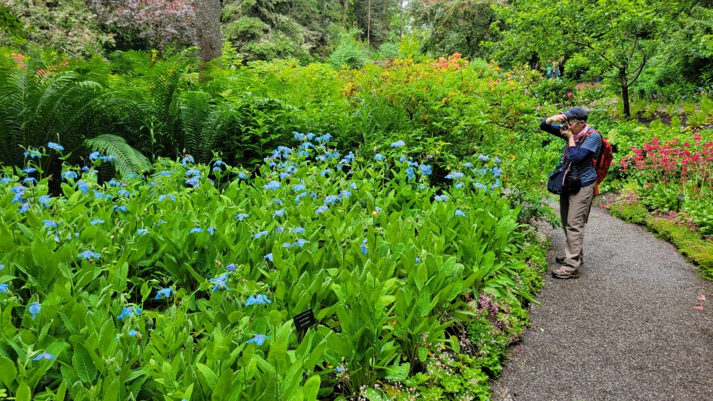
With that in mind, I planned strategically. Our destination for Night 1 was close to Reford Gardens – Jardins de Métis, where we would spend the next morning before continuing along the 132. The Reford Gardens is another famous garden like Butchart Gardens we visited in Victoria. Similarly, it was a labour of love by one woman, in this case Elsie Reford. By enlisting the help of local farmers and fishing guides, she was able to turn a spruce forest into a lavish garden which included the very rare Tibetan Blue Poppies. If you have to ask your wife to do anything really unpleasant, like camp in the rain, just remember the diplomatic power of flowers.
The first night was the toughest. To ensure we would have time to see the gardens, I reserved a site at Parc Régional de la rivière Mitis [sic. that’s not a typo; I don’t know why there are two spellings], barely a stone’s throw from the gardens’ entrance. I saw when making the reservation that these are walk-in sites, but only about 230 meters from the parking lot, so how bad could it be, right? Well, the sites are on a trail network and the trail was muddy and hilly. When we arrived, it started to rain, and it kept raining, all night and through breakfast the next morning. Marilyn, who is a light sleeper, heard the neighbouring campers’ music and conversation, the Canada Day fireworks at 10, the neighbouring campers’ sex, the heavy rain and thunder and, through it all, my light snoring. She got about one hour of sleep. Oh yeah, and then there were the bugs.
Not a happy camper.
As if to punctuate the state of affairs, the next morning, while I was preparing the coffee, animal excrement of some kind slid out of the tree above and landed with a splat! on the water bladder. It was going to be that kind of a day.
What the hell?
But after a porridge breakfast and a top-up of coffee, the rain stopped and the sun came out. Yes, the absence of pain is pleasure, and the sun that day was all the more enjoyable, especially while at the gardens.
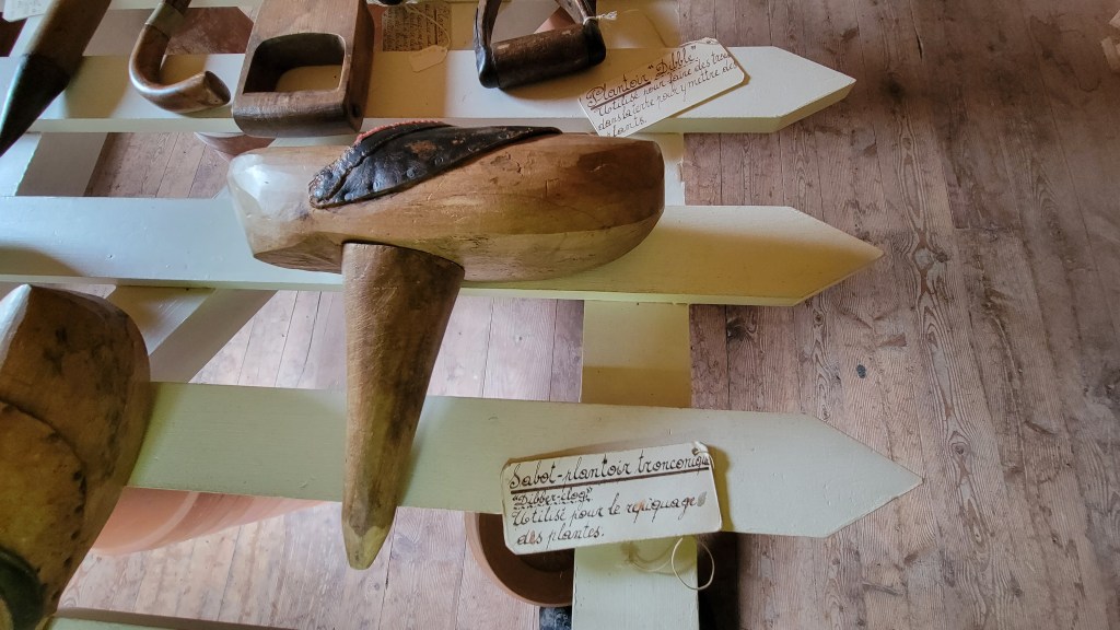
Dibbler ClogOld gardening toolsMarilyn in her element
It was all uphill from here. We had survived the worst of it with our marriage intact. After a quick snack at the cafe in the gardens, we were back on the bike and headed for Forillon National Park on the tip of the Gaspé Peninsula.
We are bound for Newfoundland. If you want to follow along, click Follow.
The second tour of the coming season will be down memory lane.
Jumping waves on the Outer Banks, NC, circa 1970.
When I was a boy, my parents used to take us down to Cape Hatteras on the Outer Banks of North Carolina for our family vacations. I was the physical barrier separating my two older sisters in the backseat of our Pontiac Strato-Chief. My dad had installed seat belts in our favourite colours according to this arrangement: red, blue, green. Or was it green, blue, red? I can’t remember, but I remember quite a lot about those vacations. They were among my happiest memories growing up, despite the backseat shenanigans.
Not my dad’s Strato-Chief but similar.
We went with another family, and apparently those vacations left an impression on them too, for one of the children named her future child after me. En route, we camped at Shenandoah National Park in the Blue Ridge Mountains. I still remember the nature hikes led by a ranger (who taught us to recognize a particular birdsong by its resemblance to “Drink your teeeeeea!”), the nighttime slide shows at the amphitheatre, walking back to our campsite afterwards, the fog so low you could bounce your flashlight off the underside of a cloud, and the rainstorms. The rainstorms! To this day, I love a good rainstorm from inside a good tent.
Since getting my licence in 2016, I’ve wanted to return and ride the Blue Ridge Parkway, and this summer I finally will.
We would drive much of the Blue Ridge Parkway before spending a day in Williamsburg, then head over to the coast and camp along the Outer Banks. The campground was so close to the ocean you only had to walk along a boardwalk over the dunes to the beach. I wasn’t a strong swimmer and the sea always frightened me, but I enjoyed playing along the shoreline. One year, we went to The Wright Brothers Memorial at Kitty Hawk, and I think my first ever book was a staple-bound biography of The Wright Brothers I purchased from the gift shop there with the few dollars we were given for “spending money.” That seed of interest later sprouted into a dream of being a pilot when I grew up, and although my career ultimately went in a different direction, it has combined with another interest of mine—poetry—to produce a collection of poems that explores the theme of flight. I might not be a pilot, but I can imagine being one; the opening section is in the voice of Wilbur Wright.
A postcard of this famous photo of the first flight sat on my desk and served as inspiration.
The last time I went down there I was 14. My sisters by this point were already doing their own thing and didn’t go, so I had the backseat all to myself and Supertramp playing on my cassette recorder. During one rest stop on the Blue Ridge Parkway, we came out just in time to watch three motorcyclists start up their bikes and roar off down the parkway. One was a woman on a BMW. I’d never heard of that manufacturer but my dad clearly had. “Did you see that young woman take off on that BMW?” he remarked to my mom.
Perhaps another seed was planted on that holiday because, since getting my licence in 2016, I’ve wanted to return and ride the Blue Ridge Parkway, and this summer I finally will on my Triumph Tiger 800 named Jet.
The trip so far is pretty sketchy, but that’s generally how I like to tour when I’m on my own. In the earlier trip planned for this coming summer, my wife and I are going to visit Newfoundland, and much of that trip has been scheduled. For this one, however, all I know so far is that I’ll ride The Blue Ridge Parkway and Skyline Drive at some point, camping at Shenandoah National Park. I also know that I’ll ride some dirt in the MABDR and NEBDR (Mid-Atlantic and North East Backcountry Discovery Routes respectively). The MABDR and Blue Ridge Parkway plus Skyline Drive cover similar geography, so it makes sense to do one down and one back. One is asphalt, the other primarily dirt.
I’m thinking I’d also like to get out to the Outer Banks and ride them too if I have the time. They are less than a day’s ride from the Blue Ridge Mountains. Lea of Got2Go recently rode them and titled her YouTube video “The BEST road trip of the USA East Coast?”
Got2Go Rides the Outer Banks
At the time of this writing, there are lots of unknowns. Will I be touring solo or with a few friends? I’m good either way, but it would be nice to ride the technical sections of at least the NEBDR with a few buddies, and I’ve put a few feelers out. If I get some takers, will they do the whole tour with me or only one or both of the BDRs? If they can only do the dirt with me, I might change the order of things and ride the BDRs down and the asphalt back, to accommodate them.
I also don’t have a precise route mapped out yet from the Canadian border to the top of Skyline Drive. I’ve got Google Maps, Kurviger, and Rever open in separate tabs of my browser with the “Avoid Highways” option selected and am studying their suggested routes. Depending on which router I’m looking at, it’s between 1000 and 1100 kilometres from my house to where the scenic drives begin. This is prime Civil War geography through Pennsylvania and I’ll be tempted to stop often at historic landmarks.
Will I ride Tail of the Dragon while I’m down there? I’ve heard from several people that it’s not worth it and, in fact, is a little dangerous with superbike and sports car idiots treating it like a track instead of a public road. There are apparently many roads in that area just as good or better and less populated. Do you have any suggestions? Let me know.
So there’s a lot still to decide about this one but one thing I do know is that I’ll be leaving sometime in the fourth week of July and will have a little under three weeks before I have to be back for work mid-August. That’s not a lot of time but my parents did it in three weeks, if memory serves me well, and they had three kids in tow.
I know a lot will have changed and I can’t expect everything to be as I nostalgically remember it. You can’t go back in time or relive your childhood, nor would I want to. But I suspect the mountains and the ocean won’t have changed much since I saw them last, and that’s what I’m going there to see. And this time, instead of being stuck between two sisters in the back seat of a car, I’ll be riding my Tiger 800XC, putting it through the full range of its abilities as I carve new memories through the Appalachian, Blue Ridge, and Great Smokey Mountain ranges.
As I write this, we’re having yet another major snowfall in Montreal. It’s been a particularly snowy winter and after a few mild days, some of us got lured into thinking spring is just around the corner. But as I sit looking out the window of my 2nd-storey study, it’s hard to imagine that the Montreal Motorcycle Show is next weekend and we can legally be back on the road in less than a month.
My favourite way to avoid shoveling: write a blog post!
Still, I must continue making travel plans in a kind of blind faith in the power of nature. If I put on my cheap Dollar Store shades, all that white outside becomes a shade of green, and I can almost imagine it being June and setting off. With this trip, there are some reservations that have to be made, like booking the ferry on and off Newfoundland, so I have started to map out a rough outline of our planned exploration of the Canadian east coast. This will be the book-end tour of the west coast trip of 2021.
Learn from your mistakes
I’m trying to keep in mind what I learnt from that last one, specifically, sometimes less is more. That’s what I keep telling my students, anyway, who think they are clarifying their thesis statements by adding clause after clause. The last trip was spent too much on the Superslab in my need to cover distance in the time I had. I don’t want to make the same mistake so am trying to be realistic in what we can see in the time we have away from the dog and our jobs. Marilyn, the domestic accountant, likes to remind me about our budget too.
My first route planned included The Cabot Trail. It seems sacrilegious not to “do” The Cabot Trail if you are anywhere within 150 kilometres of it on a motorbike, and we will be passing through Cape Breton en route to Sydney, NS, where one catches the ferry to get to Newfoundland. But my practical wife reminded me that we have been to Nova Scotia several times and both ridden (at least, I did) and driven The Cabot Trail and maybe we should devote that time to Newfoundland and perhaps Prince Edward Island, which we haven’t visited. This is a classic case of idealism (i.e. “we can do it all”) versus realism (“we are only human”) so we’ll see in the coming months which ideology wins.
The Cabot Trail: an iconic ride
Gaspésie, PEI, Nova Scotia, Newfoundland
What we do agree on is that we’d like to ride the coast of the Gaspé Peninsula, or as they like to call it here in Québec, La Gaspésie. I’ve driven that before and it’s spectacular. Marilyn hasn’t seen the Roche Percé, and like the Butchart Gardens we visited on Vancouver Island, we will make a stop at the Reford Gardens in Matane, QC. Forillon National Park at the tip of the peninsula is pretty special too.
Another decision we have is whether or not to visit Prince Edward Island. Our Insight Guides book suggests a three-day 250-kilometre road trip that includes Charlottetown, Argyle Shore Provincial Park, Brackley Beach, and the West Point Lighthouse near Cedar Dunes Provincial Park. Hopefully, those provincial parks offer camping. Technically, I’ve been to PEI, but I was too young to remember much. If we can’t work it in this summer, we will definitely get out there next. Aside from NWT and Nunavut, PEI and Newfoundland are the only provinces or territories I haven’t visited, so I’m hoping we can devote a few days to get a taste of the island.
Should we take the day or night ferry to Newfoundland? There are pros and cons of each, as I see it. A day crossing might be time wasted, just looking out for 7+ hours over endless water. I know there might be the opportunity to do some whale watching, but I’m sure we’ll be doing some of that once on the island. A night crossing is more expensive if you buy a cabin and try to get some sleep. On the other hand, the cabin isn’t any more expensive than a motel room, which we’d have to get soon after landing from a day passage. I’m leaning toward a night crossing. I’ve never experienced sleeping on a boat like my parents did when they immigrated on the Queen Elizabeth II and I think it would be novel. If we cross during the day, we will camp at a favourite campground in Baddeck in order to get to the ferry in the morning; if we cross at night, there might be time to ride The Cabot Trail or stay at Meat Cove, which is an amazing campground off The Cabot Trail right at the eastern tip of Cape Breton Island.
If you’ve visited Newfoundland, what did you do and why? I’m open to advice. There is a growing sense of urgency to decide, especially if we want a cabin as they sell out early, so decisions have to be made soon.
Neither Marilyn nor I has visited Newfoundland before, so this is going to be a treat. Again, we can’t do it all, and we’ve decided to focus on the west coast. Gros Morne National Park is a bucket list item. Then we will continue up the coast on what’s called The Viking Trail because I like history and am interested in seeing the Viking settlement at L’Anse aux Meadows. Then we will cross the island to Saint John’s because, well, you can’t visit Newfoundland without strolling around Saint John’s, including “hydrating” at a pub on Water Street before climbing Signal Hill. I’ve heard and read about these places and look forward to exploring them in person.
Finally, we have to decide whether we have time to ride The Irish Loop, a 325 kilometre loop along the coastline south of Saint John’s. The name is intriguing since we both have some Irish blood. And anything along a shoreline is bound to please me on the bike. Our guidebook suggests 2-3 days for this, so it really depends on if we can fit it all in.
Maine, New Hampshire, Vermont
Currently, the plan is for Marilyn to fly out of Saint John’s back to Montreal like she did from Vancouver when we were out west, and I’ll continue on solo. And I’m pretty sure I’ll come back via The United States instead of my initial plan to return via Labrador and the north shore. Like the caribou during their migration, I’m detouring to avoid bugs. Besides, the riding through Maine and New Hampshire will be more interesting than through Labrador. I recently purchased a subscription to Rever, which classifies roads on a colour coding system, and there’s a cluster of G1 (Best) roads in the White Mountains of NH that is calling my name.
G1 Best roads to ride are in yellow. That cluster in the White Mountains looks interesting.
I might saunter my way back along the coast, checking out Bar Harbour and a few other places before cutting diagonally north-west through the White Mountains. Without the deadline of ferry crossings, this will be the unplanned, unscheduled segment of the trip, which is generally how I like to tour. Maybe I’ll stay an extra night in New Hampshire so I can ride those primo roads unladen with gear.
This trip is going to take me about three weeks—two weeks with Marilyn, and about a week solo to get back. After a short rest in which I’ll service the bike and change my tires to something more dirt-oriented, I’ll head off again, this time to ride some BDRs. It’s going to be a full and exciting summer on a new bike, and I’ll have lots to write about so click Follow if you want to follow along.
Is extreme remote riding simply gratuitous risk-taking?
Video credit: Troy R. Bennett
Recently a story was circulating about Eric Foster, a guy who crashed on the Trans-Taiga Highway. Perhaps you’ve seen it. He was riding solo and woke up eight hours later in a hospital in Montreal. It’s actually an old story from 2017 but was republished end of November and that’s when I saw it. It’s a pretty gripping story, as far as crash stories go. He was riding in perhaps the remotest area of North America when he crashed, breaking his back and a leg. Some trappers saw the smoke from his motorcycle on fire and came to his aid, but it took hours for first responders to get to him, and then hours to get him to a hospital. The story has a happy ending; he returns to the spot where he had the accident and finishes his trip, stopping to thank the trappers along the way who helped him.
I’d never heard of the Trans-Taiga, so the article got me looking. It’s a dirt road built by Hydro Quebec to service their dams, and it is indeed about as remote as you can get in Quebec. According to Wikipedia, it’s the “northernmost continuous road in Eastern North America,” snaking 582 kilometres (362 mi) through forest from James Bay Road to the Caniapiscau Reservoir. That’s right—that’s all there is at the end of a dangerous journey: a reservoir. Then you turn around and ride the same road back.
Why would someone want to do such a ride? Well, the answer is in the article. Eric Foster describes himself as “a challenge guy.” When asked why he wanted to ride the Trans-Taiga, he replied, “Just to say I did it,” then added, “I love a good challenge.” I’ve found myself saying the exact same words of that last sentence, and I’ve written about risk-taking in an earlier post when discussing my decision to try The Dempster, another dangerous highway. Quoting Jordan Peterson, I wrote at the time:
“When untrammeled—and encouraged—we prefer to live on the edge. There, we can still be both confident in our experience and confronting the chaos that helps us develop. We’re hard-wired, for that reason, to enjoy risk (some of us more than others). We feel invigorated and excited when we work to optimize our future performance, while playing in the present. Otherwise we lumber around, sloth-like, unconscious, unformed and careless. Overprotected, we will fail when something dangerous, unexpected and full of opportunity suddenly makes its appearance, as it inevitably will.”
12 Rules for Life
Research on the Trans-Taiga led me to looking at James Bay Road, a highway so remote that you have to sign in at a check point before riding it so officials can keep track of who’s up there. I watched a YouTube video of a group of guys who rode it to James Bay, including a few kilometres of the Trans-Taiga, “just to say they did.” And then the YouTube algorithm did its thing and showed me another series of videos of a father and son riding the Trans-Labrador Highway, which was right up my alley because I was considering riding it back from Newfoundland this summer after crossing to Blanc-Sablon.
Coincidentally, this series is also by Troy Bennett.
The Trans-Labrador Highway is one of those classic ADV rides you’ve apparently got to do to call yourself an ADV rider. It also snakes through some pretty remote territory, and until recently, was mostly gravel. (The final remaining section of dirt has recently been paved.) I watched the six-part series and the riders did have some adventure. They had a break-down and had to be saved by some locals, and they encountered some unseasonable weather and were held up for a few days by a late snow fall. There was some good bonding time, for sure, but in terms of the ride itself, it seemed like hours and hours of mind-numbing coniferous forest. No lakes, no mountains, no cliffs, no hill climbs, and as of last summer, no dirt.
Why would the Trans-Labrador be such a popular ADV ride? It has to be its remoteness, and if you live in the northeast of North America, the Trans-Lab is one of the few remaining truly remote roads.
If you’re looking for a challenge, remoteness will provide it. For one, there is the not-so-little issue of fuel; you have to be able to cover upwards of 400 kms between fuel stops, which can be done by carrying extra fuel in a Rotopax or another fuel container. With remoteness usually comes some challenging riding too since no one wants to pave a road that has limited use. And if it rains, that challenge increases significantly, especially on roads like The Dempster or The Dalton that are sprayed with calcium chloride as it makes the mud greasy. Then there’s the danger of wildlife, whether it be an aggressive grizzly bear or, worse, the black flies.
Stuck in otherwise pretty safe lives, we seek danger in answer to an ancient call somewhere in the reptilian brain that harkens back to another era when we lived close to death.
But the real challenge of riding remote is simply the lack of assistance should you have a mechanical or medical problem. I won’t say you are on your own because even on these remote highways there are still trucks passing periodically, but parts and medical assistance become scarce. This is where you have to be prepared: know how to fix your bike, carry spare parts, bring a first-aid kit, and have on you a satellite tracker like the Garmin inReach units that are connected to emergency services.
Is it worth it? Well, to each his or her own, but for me, the risk itself is not enough. In fact, I’ve been wondering if riding remote for its own sake is really just a way for some people to feel alive again. Stuck in otherwise pretty safe lives, we seek danger in answer to an ancient call somewhere in the reptilian brain that harkens back to another era when we lived close to death. Some people skydive. Others bungee jump. Some climb mountains. And some race The Isle of Man TT in search of what Guy Martin calls “The Buzz,” that adrenaline hit you get when you are on the edge of life and death.
But watching these videos has led me to rethink my upcoming tour. I don’t think I’ll be coming back from Newfoundland via The Trans-Lab. It’s not because I’m scared of remote riding, but in my world, there has to be some pay-off for the risk, and bragging rights just isn’t enough. When I rode up The Dempster, every kilometre was worth the risk for the magnificent views the highway provided. I’d never seen geography like that before and likely won’t until I get up there again.
Golden Sides Lookout just north of Tombstone Territorial Park, Yukon.
But the Trans-Lab, the James Bay Road, and the Trans-Taiga don’t offer much beyond hours and hours of forest. From what I can determine, there aren’t even places to pull off safely for a rest or to camp. These are roads built exclusively for trucks to get from Point A to Point B, cutting a single line through otherwise impenetrable bush. I’ll leave it to the black flies.
For a challenge, I’ve decided instead to ride this summer the NEBDR and MABDR (North East and Mid Atlantic Backcountry Discovery Routes respectively) down to The Blue Ridge Parkway, and while there, I’ll probably do Tail of the Dragon, although riding a curvy section of road at the limit of my skill and the bike is not my preferred mode of challenge these days. Rather, I’m looking forward to testing my metal on those Class 4 roads of the NEBDR. I’ll take a rocky hill climb over speed or gratuitous remoteness any day; it’s what drew me to ADV riding in the first place. Off-roading provides a challenge that is relatively safe. That might sound like an oxymoron, but you don’t have to risk your life to get “The Buzz.” Successfully completing a technical section of road or trail will give you a hit too, and if you don’t make it and drop the bike, well, you live to try another day. And along the way, there are some pretty great views, villages, and campgrounds.
What do you think? If you ride a motorcycle, you’re familiar with managing risk. Is remote riding your thing, and if so, why do you do it? If not, what kind of riding gives you The Buzz? And if you don’t ride, what do you do to step outside your comfort zone and feel alive? Drop a comment below; I’m always interested in hearing from readers.
In this final post in a series on gear, I discuss the navigation apps I use when touring.
Old-School Navigation. I still like to tour with a map on my tank bag.
“I learn by going where I have to go,” Theodore Roethke says in the refrain of his famous villanelle “The Waking.” That may be a good philosophy in life, but when motorcycle touring, it’s downright dangerous. There’s nothing worse than not knowing where you’re going and fumbling with a GPS in traffic while riding. Yeah, I’m all for exploration and adventure when you don’t have to be somewhere, but when the light is fading and you still don’t know where you are pitching camp, or when your fuel gauge is on one bar and you don’t know where the next gas station is, that’s a problem.
Charging
I learnt early in my touring experience that navigation is huge, maybe because I had so many problems keeping my phone charged. If the USB port detects moisture, the phone stops charging, and it doesn’t take long for a GPS app to drain your battery. And then there’s the cord. If your phone isn’t charging and the port isn’t wet, it’s probably the cord. They make them so cheap these days that the internal wires break. I once had to ride from the Cabot Trail over to the Best Buy in Sydney, NS, just to buy a new cord to get me home. What a pain!
So let me say at outset that if you don’t yet have wireless charging on your bike, you should. It’s a game changer. It avoids 90% of the issues you are going to face on tour. For years I worked around the charging problem by using the type of cord that has magnetic adapters. I siliconed the appropriate adapter into the port of my phone, then just attached the USB cord via the magnet to charge the battery. Rain didn’t affect the charging. The cord was still liable to break, but they are cheap and you can buy, like, a 4-pack on Amazon for $20 so can carry several.
The problem with this set-up is that the magnetic adapters are fine for charging, but most can’t transfer data, so now your phone is limited off the bike. Maybe you don’t want to silicone an adapter into your $1,100 iPhone 14. I worked around this by buying off eBay a cheap, used, military grade phone that I dedicated for bike navigation. It didn’t have a SIM card in it and was locked, but it didn’t matter: I used it in Flight Mode. That’s right, I don’t have a huge data plan and I ride in places that often don’t have cell service, so I download all my maps before leaving.
Navigation
The main app I use to navigate is OsmAnd+ because it is open source and includes free maps to be used offline. This is also great when I travel in The States because I don’t get hit with roaming charges. Last I looked, OsmAnd+ was about $20. I bought the Plus (paid) version because it imports GPX tracks, which I need for leading club rides, but the free version works perfectly well for navigation, if that’s all you need. OsmAnd also includes contour lines and hillshades layers. When I venture off-road, it’s nice to know how steep the mountain is going to be. There is also a Points of Interest (POI) layer so I can see gas stations, restaurants, healthcare, parking, and convenience stores and supermarkets on the map (configurable), and a Wikipedia layer, so I can see what significant landmarks I’m riding past or near. It’s a great little app, available for both Android and iOS.
OsmAnd Screenshots
I’ve tried maps.me, Gaia, Locus Map (Pro and Classic), Scenic, Eat Sleep Ride, and others, but I always come back to OsmAnd. It’s easy to use yet full-featured, a rare combination. It does what I need it to do and no more. Do I really need to know how far over I leaned the bike on my latest ride? Do I really need crash detection? Does my wife prefer to hear that I’ve crashed from an app or a person? But the main reason I like OsmAnd is for the free maps. I started using Locus Map Pro but maps are $1 per country. That sounds cheap—$1 for all of Canada—but for some reason they consider each state in the US a country, so that can add up fast. I still have these other apps on my phone as back-ups but I don’t really use them.
The other main app I use to navigate is Google Maps, now called just Maps. (I guess Google figures it’s so ubiquitous we no longer need the brand name.) Maps handles addresses better than any other app, thanks to Google’s AI. Need to know where a specific place is but you don’t know the address? Just Google it, then press the navigation arrow icon and it loads in Maps and guides you there. Easy peasy. As much as I like OsmAnd, you need a specific address for it to find your destination. (You can, however, press and hold on the map to choose a specific point of destination.)
You can use Maps also offline, but like OsmAnd, you have to download offline maps before leaving home. (The search feature, however, does require cell service.) In the upper right hand corner, press your identity icon, then select Offline Maps from the menu. Press “Select Your Own Map,” zoom and position the frame using two fingers to select the area you want, then press Download. I name each map so I can keep track of them. They will expire if left unused for a certain amount of time, but you can update them all quickly and easily every once in a while when you are in a Wi-Fi zone. I downloaded maps for all the provinces I planned to tour before heading across the country. I didn’t need the northern part of most provinces, but I grabbed everything where I thought I might be riding. This was important since I was often not in a region with cell service.
The only other navigation app I use is Waze, and I only ever use it around town, frankly. That’s because it shows where the cops are. Nice! (Not that I ever speed.)
Route Planning
For route planning, I use the web-based Kurviger. Forget BaseCamp. Kurviger is intuitive and full-featured. I choose the type of route (highway, straight, curvy, very curvy; one-way or round trip), the origin and destination, and Kurviger comes up with an interesting route. I then drop in shaping and waypoints to shape the route exactly how I want it, flipping back and forth between Kurviger and Maps in street view to check the quality of the road. (Drag the little yellow man, ur, person, icon onto the map to see a street view.) When I’ve got the route exactly how I want it, I export it to a gpx file. Kurviger can generate a QR code for the file or hyperlink to share, or send it directly to Scenic, if that’s your preferred navigation app. I usually email the gpx file to myself then open it on my phone, which knows to open gpx files in OsmAnd.
Screenshot of the web-based Kurviger route planning app.
I have Kurviger Pro on my phone as well, and it uses BRouter to do the routing. BRouter takes some setting up; like the offline maps in Googe Maps, you have to download in sections the areas you need first, but the upside is that you can use Kurviger Pro in the field. For example, say you’re riding with some friends and you’re looking for a good route to a specific place but nobody wants to pour over a map to make those decisions. Just open Kurviger Pro on your phone (it will load a map at your current location), press and hold on your destination, and it will generate a route—again, to the degree of curviness you want. You can even share the route with your friends.
Screenshot of Kurviger Pro. All roads lead to Lachute.
Non-Navigation Apps
There are some other apps I use, not for navigation, strictly speaking, although they can be used for that. If you’ve followed Itchy Boots as she makes her way across the Americas, you will have heard of iOverlander. Noraly uses it to find her accommodations. I’m rarely sleeping with a roof over my head when I tour, but iOverlander is equally useful for finding campgrounds and even wild camping locations (i.e. places on crown land where you can camp for free). The app is user-based, and users submit descriptions and photos of the sites they’ve stayed at. This is helpful because there are a lot of people boondocking with campers and vans, and their needs are different than those who are tenting. So a safe gravel parking lot might be good if you have an RV, but not so nice if you are tenting. I wish iOverlander made this distinction, perhaps using a different symbol for each type of wild camping.
iOverlander screenshot. Tent icons are campgrounds; crescent moon icons are wild camping spots.Clicking on the icon brings up a window with user-based descriptions and photos.
Last spring, a friend and I planned to camp at a state campground in Vermont, only when we got there it was closed. In fact, we were too early and all the state campgrounds were still closed for the off-season. (Doh!) So I opened iOverlander and it showed a wild camping spot a short distance away. We ended up at lovely site next to a river with a few other campers nearby for security and even a drop toilet to boot!
I also use weather and radar apps, of course, to monitor the weather. They are pretty straightforward so I won’t spend any time on them. But for the record, my preferred apps in this department are WeatherCAN and MyRadar. I like WeatherCAN because it’s generated by Environment Canada. I reluctantly open Weather Network only when I need a 14-day forecast, steeling myself for the clickbait.
The Best Riding App on my Phone
I’ve saved the best for last. There is one app that I have come to love, to love I say, so much so that it’s become almost indispensable. It’s an app like no other since it is an overlay on the Android system and replaces the usual interface. It’s called Drive Mode Dashboard, by Thork Racing.
This is what I see when I launch DMD. (This is Version 2.0.) Instead of my usual desktop and app icons and widgets, I see this. It’s fully configurable but this is how I’ve set mine up—with a set of most-commonly-used apps on the left and a compass, digital speedometer, and odometer on the right. There’s more info along the top, as you can see. Along the bottom are icons for a map, my full list of apps, settings, even a digital rally book. Pretty cool.
Rally Book Mode. Ready for the Dakar.
But where this app really comes to life is in conjunction with Carpe Iter Controller, a bluetooth controller that mounts to my handlebar. With this controller and DMD, I can navigate throughout my phone—open any app, open and control media in Spotify, change the volume in my helmet, the brightness of my screen, and more. Where I use it most is to zoom in and out and pan around in maps. I think I could even tune my ECU while riding if I wanted to. About the only thing it can’t do is stop Microsoft Office Update from reminding me to check for updates every time I open Word! (Can Bill Gates avoid this?)
Carpe-Iter ControllerThis was the install on the BMW. (Note the magnetic USB cord at right stuck on the mirror stem.)
I see Thork Racing have a new unit out now with three buttons and a toggle and it can connect directly to 12V. My 1st generation controller has a rechargeable battery that lasts about a week with full-time use. There wasn’t room on the Beemer’s handlebar to mount it vertically so I made up a bracket and mounted it horizontally on the mirror stem. I have it mounted vertically on the Tiger, and yes, you configure the orientation in the driver software so the toggle switch pans your maps accordingly. Needless to say, with this set-up, if my eyes are not always on the road, at least my hands are on the handlebars. The controller is a little pricey but it’s a very nice modification.
Final Words
Despite finally getting my phone set up to be my primary means of navigation, I ended up buying a used Garmin Montana 600 for the big trip. I was nervous after having so many tours tainted by navigation issues and wanted a reliable back-up. The Montana has a WAAS-enabled GPS receiver and HotFix® satellite prediction. No, that’s not a dating service but the latest technology to ensure your connection to satellites is never dropped. The Rugged Mount is waterproof and robust enough for off-roading, and while I’m not positive, I think the Montana has a more comprehensive off-road mapping system than the phone apps. The Google Car made all the way up to Tuktoyaktuk, apparently, but it can’t go on single track or some of the ATV trails I do.
When all electronic devices fail, I rely on that thing called a paper map. No batteries needed! My Wolfman tank bag has a nice big clear plastic sleeve on top for them. It’s easy to lose sight of the big picture, so to speak, after staring into a 6″ x 3″ screen all day. I’ve recently discovered Butler maps, made for motorcyclists, and they are not only water resistant but also contain routes suggested by other motorcyclists and a ton of other information on the flip-side. I bought the one for The Maritimes and it currently hangs in my upstairs hallway outside my study, as did the one of North America I used to plan my cross-Canada trip. So a paper map serves multiple purposes: it’s great in the field, but it also serves to navigate me through the dark winter months of the off-season.
Ready for my sticky dots.
What are your preferred navigation apps and devices? Are there some I haven’t mentioned? Drop a comment below. I always like to hear from readers.